
Showers and a few thunderstorms will continue to move north this evening into North Texas, Northeast Texas, the Brazos Valley, and East Texas. Some activity will produce heavy rainfall that will cause street flooding. The heaviest activity has exited the Austin and San Antonio metros – and we do not expect additional widespread heavy rain there tonight.
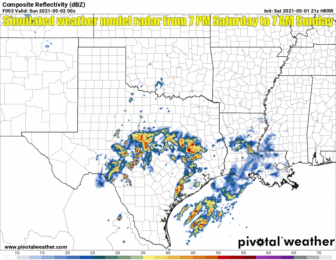
Simulated weather model radar from 7 PM tonight to 7 AM Sunday.
Unlike last night, we are not anticipating widespread heavy rain tonight. Low-water crossings in San Antonio and Austin may continue to experience high water several hours after rainfall ends. We don’t want anyone totaling out their vehicle tonight by driving into high water.
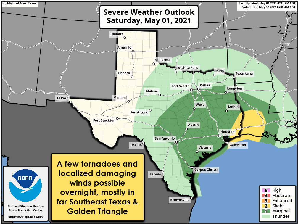
Severe weather outlook tonight and early Sunday morning
Our focus will shift from hydrological to severe thunderstorm potential later this evening. An unstable airmass will move inland from the Gulf of Mexico into the Golden Triangle and the Far East/Far Southeast Texas tonight. Low-level wind shear will be strong and supportive of rotating thunderstorms. The High-Resolution Rapid Refresh (HRRR) is showing a few severe storms tonight. A few tornadoes along with damaging straight-line winds are the primary concerns.
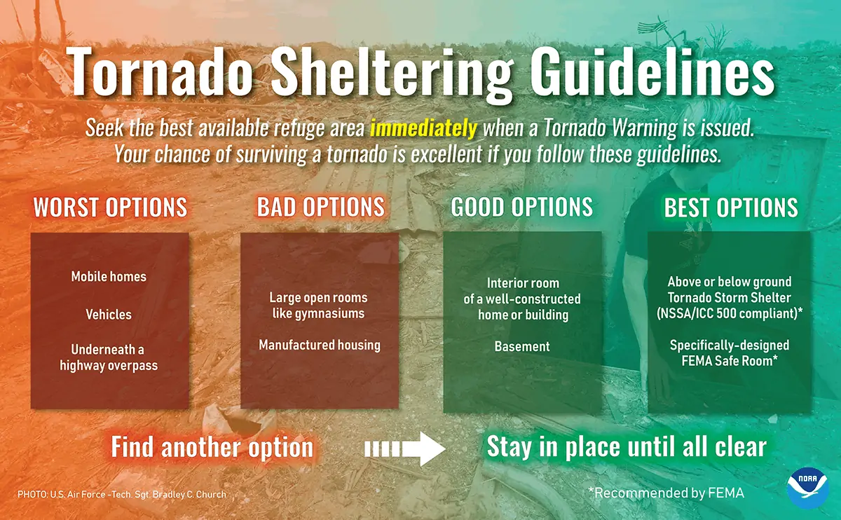
With the potential tornado threat occurring well after sunset, we encourage folks to have a way to receive weather warnings overnight. I do expect we’ll have at least one tornado warning in Far Southeast Texas and the Golden Triangle overnight. By overnight, I mean it could be around 2-4 AM. We’ll be around and will conduct live severe weather coverage on our YouTube channel if a tornado warning is issued.


0 Comments