
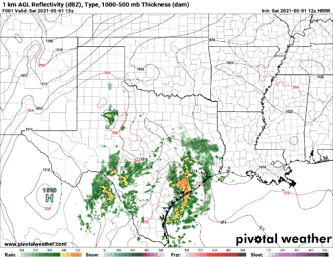
Just a quick update on additional rainfall expected this weekend. The focus for much of today’s rain and storm chances will be across part of Central Texas, the Coastal Bend, Southeast Texas and up into North Central Texas by later this evening. A few strong to severe storm will be possible, especially later this afternoon along and east of the I-35 corridor and into Southeast Texas and the Houston/Galveston metro area as we head into the overnight hours. Below is the current forecast radar loop taking us through about noon on Sunday. As always, keep in mind these radar forecasts are just that…a forecast only…and reality may look a little different.
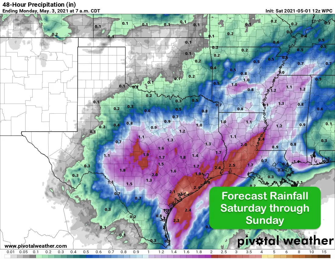
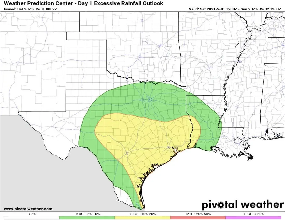
Anticipated rainfall over the next 24 hours will be most generous the further south you go, especially for folks in our Coastal Bend region into coastal Southeast Texas. This is additional rainfall on top of what has already fallen. Definitely some beneficial rainfall for areas which have seen the development of abnormally dry to severe drought conditions over the past couple of months. The Central Texas, Coastal Bend and Southeast Texas regions are also under a Slight Risk of Excessive Rainfall Outlook for today which will mean the possibility of more widespread flash flooding potential especially as stronger storms with heavy rainfall develop later today.
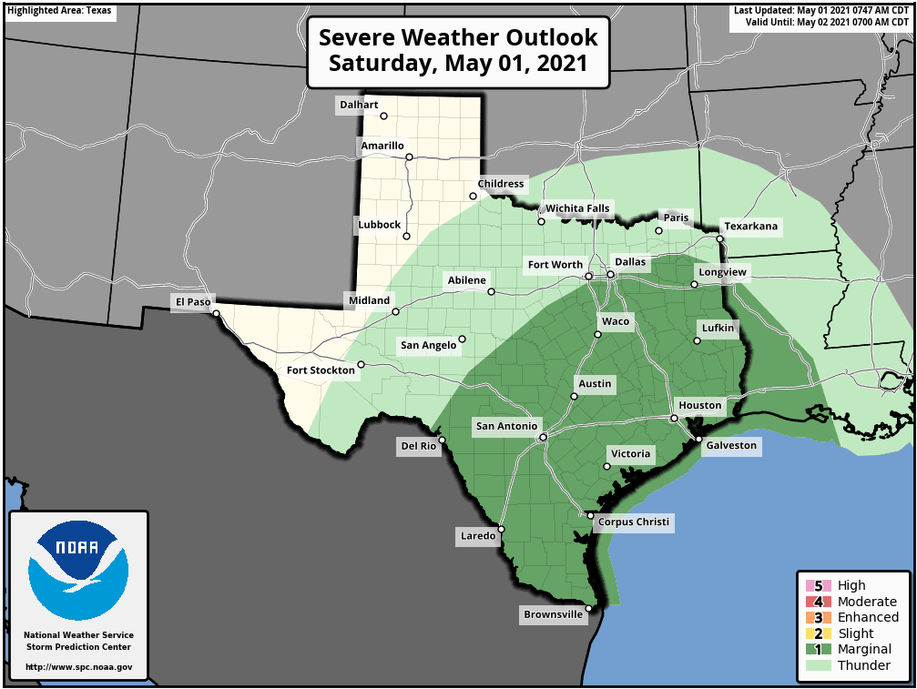
Severe weather chances today will extend from deep South Texas into Southeast Texas and up into Central Texas. The Storm Prediction Center has placed a Marginal Risk (level 1) for the development of a few strong to severe storms across the risk area later this afternoon and into the late evening and overnight hours. Widespread severe weather is not expected, but as we head into the afternoon and evening hours, we could see the development of a few scattered isolated storm cells with a large hail and damaging wind threat on top of localized heavy rainfall with flash flooding potential. If you plan on being out and about this evening and especially during the overnight hours, do your best to avoid driving in low lying areas prone to flooding.


0 Comments