
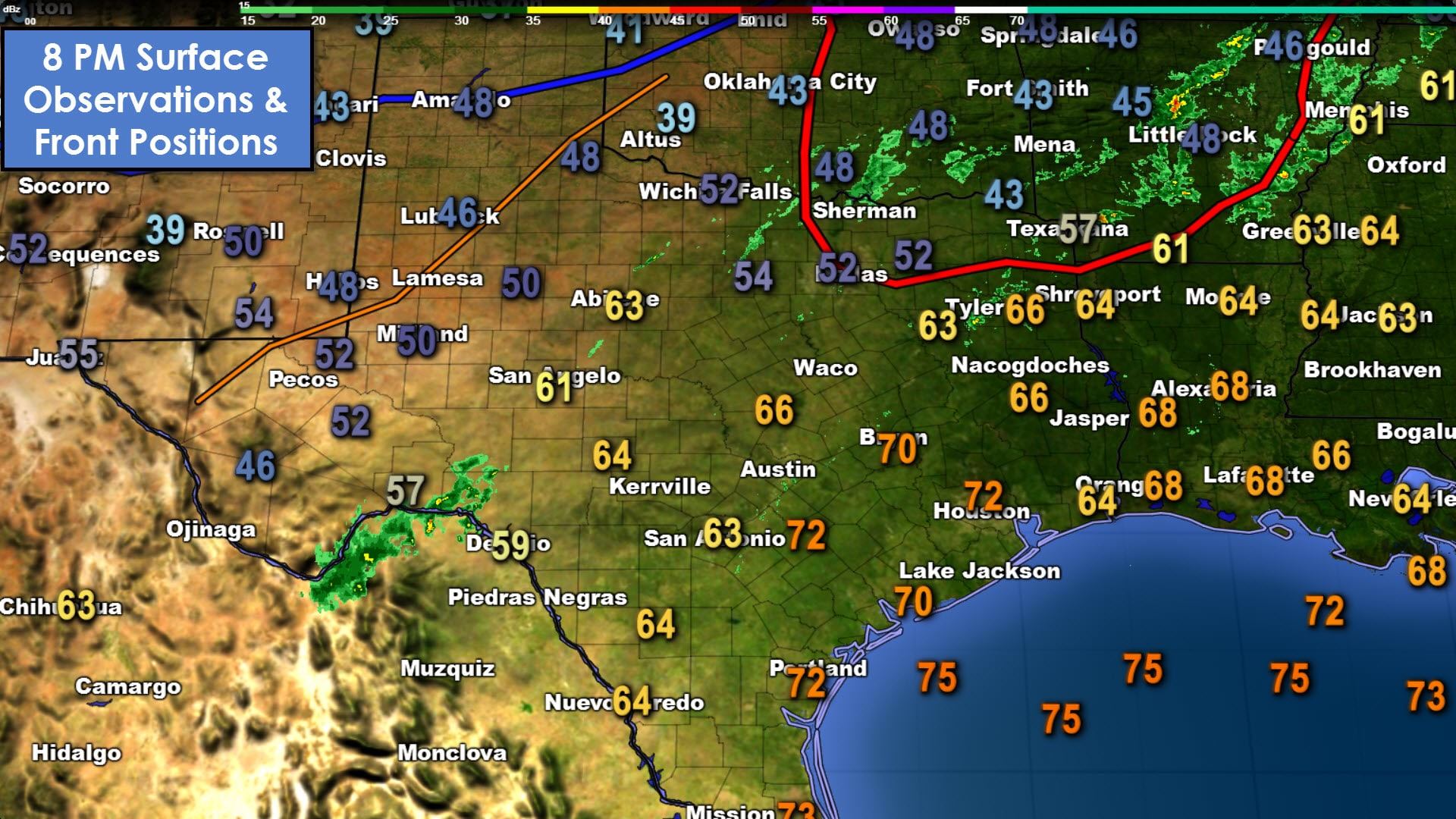
A warm front is lifting north this evening across North Texas and Northeast Texas. Fog has become dense in proximity to this front in North Texas, including the D/FW Metroplex. Dense fog is also occuring in Northeast Texas and parts of East Texas. Temperatures are still in the 60s and 70s across Central Texas, South Texas, into the coast and Southeast Texas. Dewpoint values are also noticeably higher. Closer to Interstate 20 in North Texas and Northeast Texas temperatures are in the lower 50s. These temperatures will slowly rise overnight as higher moisture values arrive. Meanwhile, a cool front is bringing a slight temperature drop to the Texas Panhandle this evening. Light showers will remain possible through the evening hours.
Animation
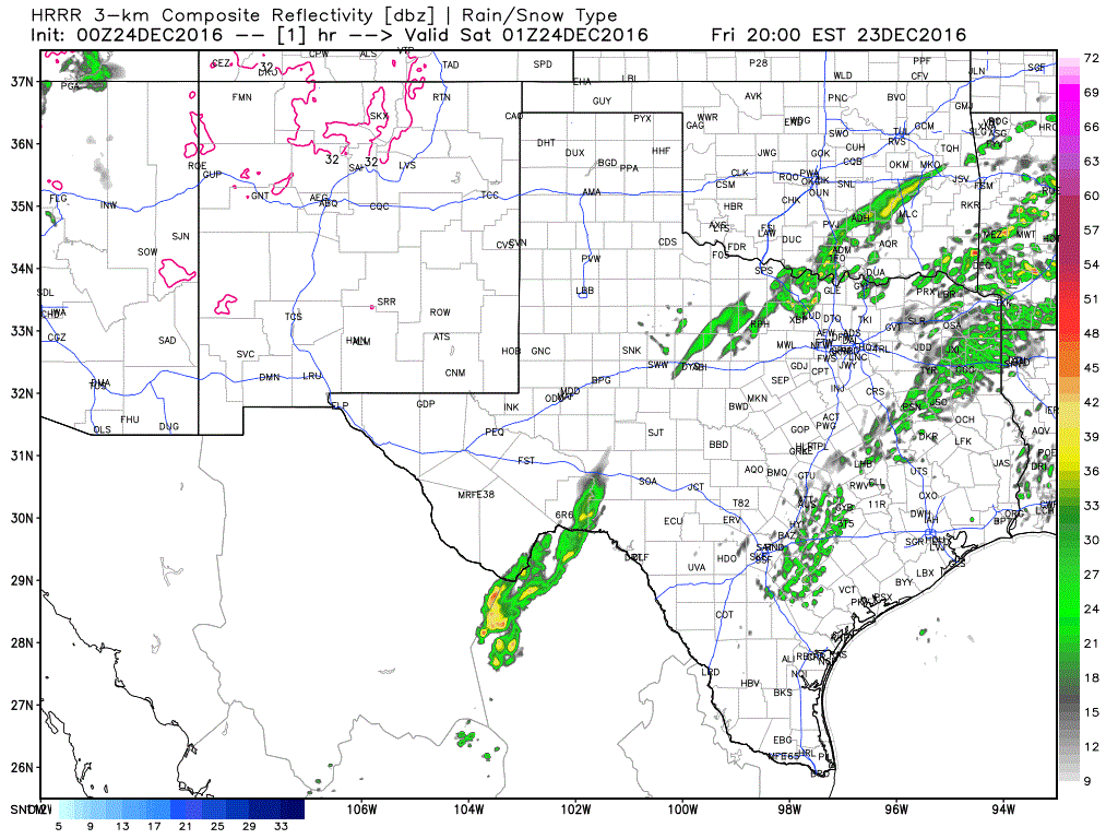
Weak upper level ascent combined with the warm air advection process will help a few storms develop around midnight in Central Texas, the Brazos Valley, and in East Texas. This activity will move off to the northeast during the morning hours Saturday. Severe storms are not expected, but don’t be surprised if you get woken up by some thunder. The animated graphic above shows the HRRR model’s radar projection through Saturday morning.
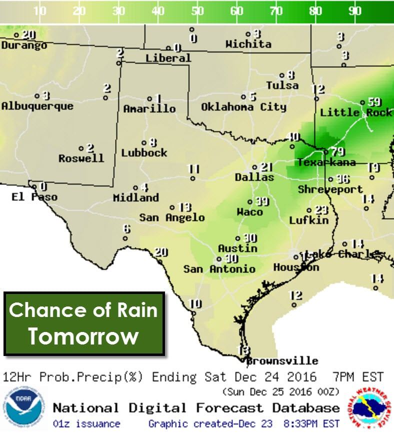
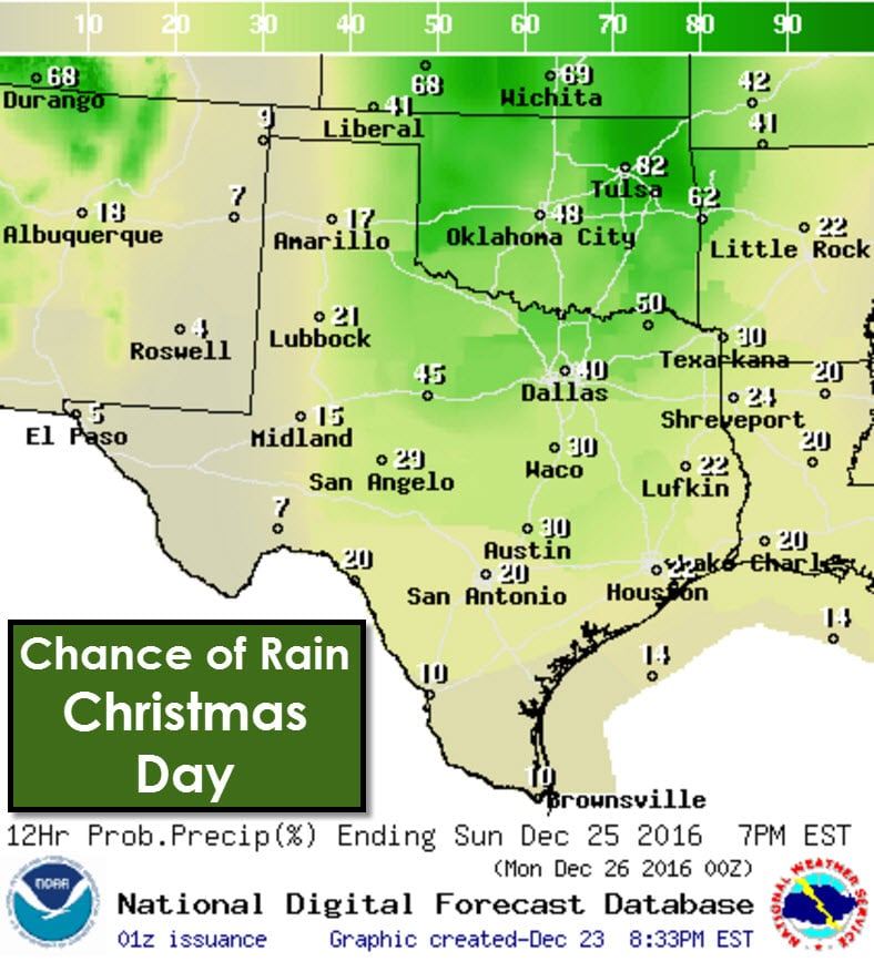
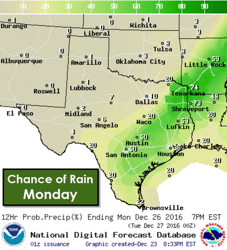
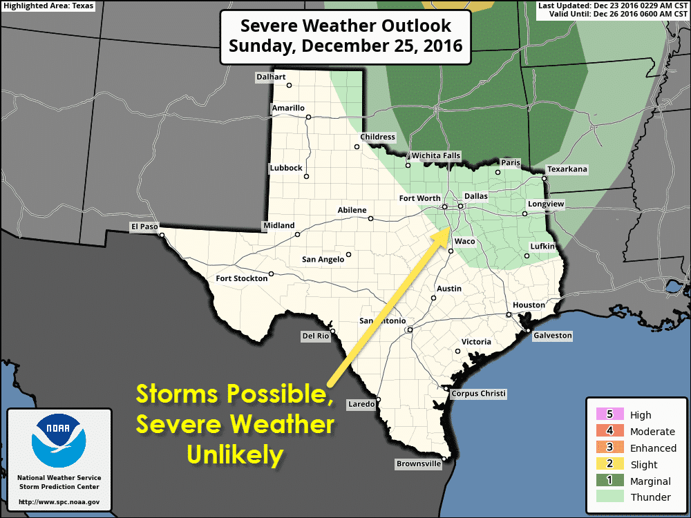
Scattered showers and a few storms will remain possible on Saturday and on Christmas Day (Sunday). Severe weather is not expected either day as a powerful storm system passes well to our north. The heaviest rain totals over the coming days will be in Northeast Texas where up to two inches of rain may fall. Projected rain amounts decrease with west/south extent. A few storms on Christmas Day may produce localized gusty winds up to 40 MPH. Again, severe storms are not expected in Texas. It would take some pretty substantial changes in the forecast for an increase in the overall severe weather risk in Texas. A few severe storms will be possible in Kansas and Nebraska with damaging wind gusts, closer in proximity to the strong storm system’s track. Spotty showers will remain possible into early next week as moisture lingers in place.
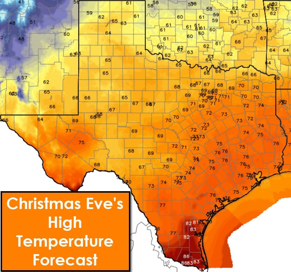
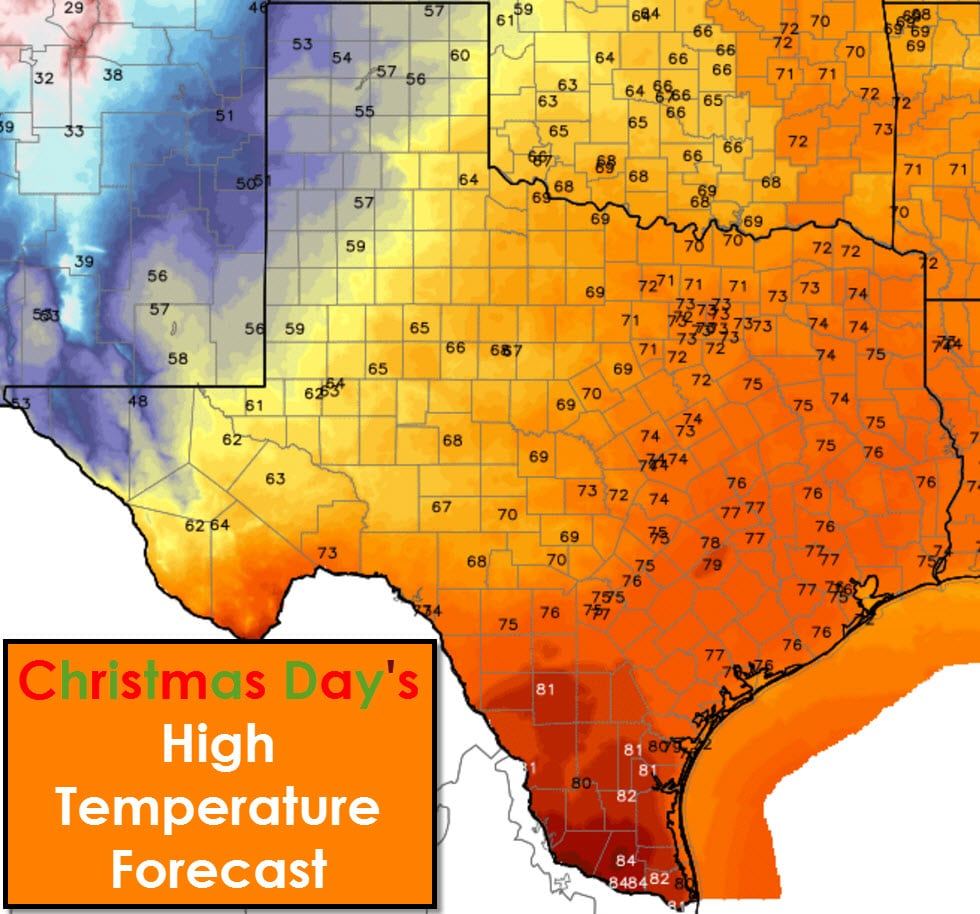
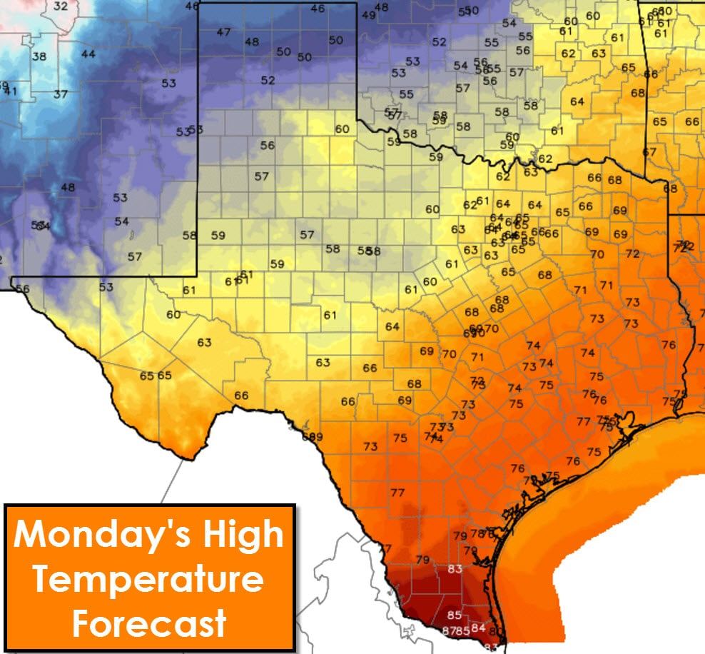
High temperatures on Christmas Eve and Christmas Day will be above-average. High temperatures on Christmas Eve will be in the 60s and 70s across Texas. Temperatures in the Rio Grande Valley will make it into the upper 80s tomorrow. Temperatures on Christmas Day will be a bit cooler in the Texas Panhandle into the Borderland with highs in the 50s. Otherwise it’ll be another warm day across Texas with 60s and 70s. 80s are expected in South Texas and the Rio Grande Valley.


0 Comments