
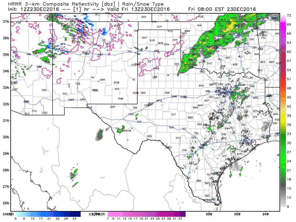
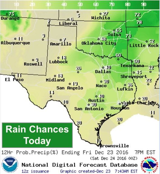
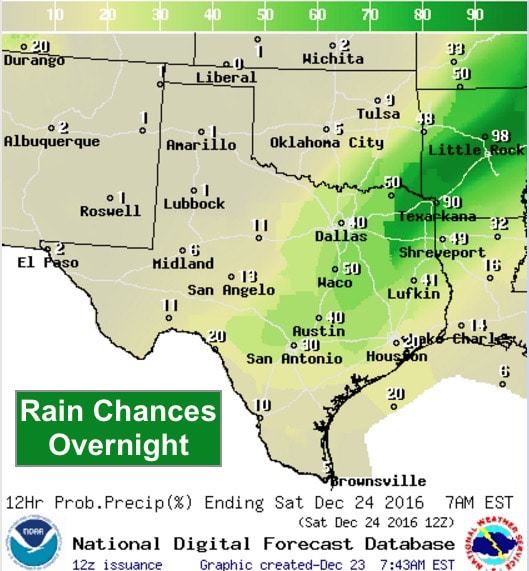
Mild but unsettled weather is in the forecast for the next couple of days as we head into the holiday weekend. While the threat of severe weather remains quite low, it will begin to feel more like early spring this weekend with the return of gulf moisture, abnormally warm temperatures and chances for on and off rain and showers across the eastern 2/3rds of the state, with dry and windy conditions expected across the panhandle and western half of the state. For today, cloudy and mild with chances for light sprinkles and fog this morning across coastal south Texas. This fog will hang in for most of the morning before improving after noon. For central, north and eastern Texas, cloudy with increasing spotty rain and drizzle throughout the day. Rain chances increase this afternoon and evening across north and northeast Texas with the approach of an upper level impulse.
Simulated Radar through 7pm
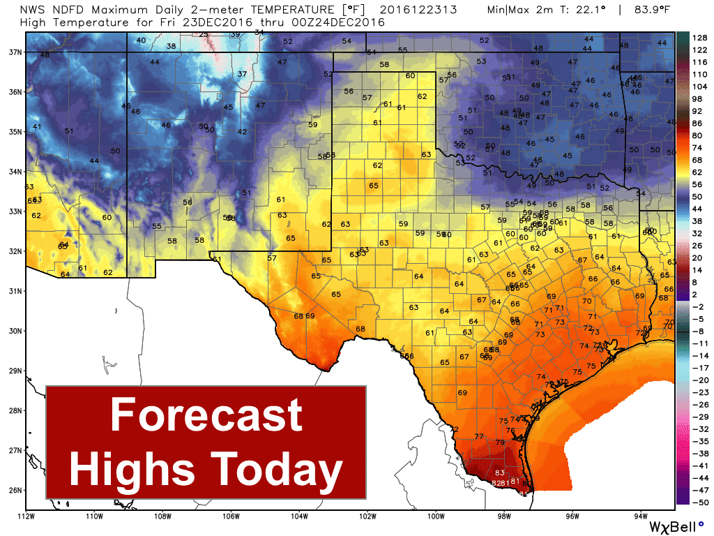
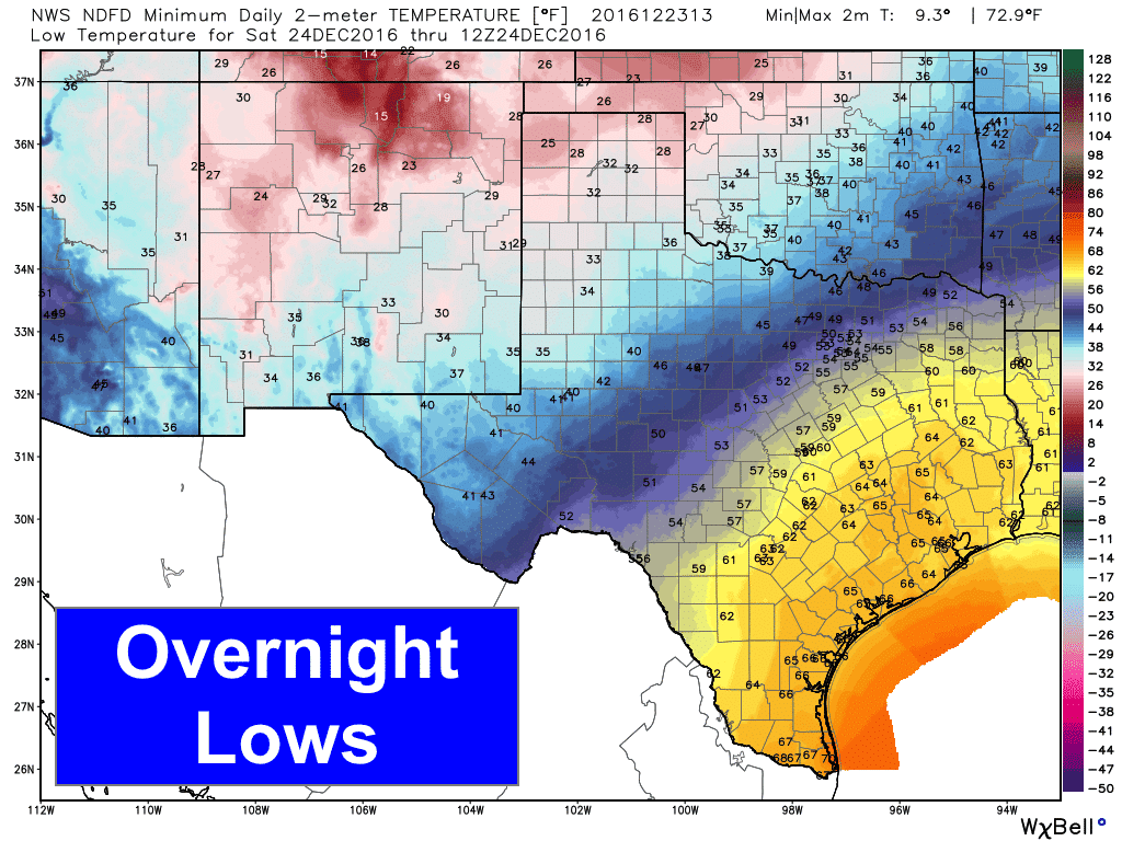
Highs today…quite warm for this time of the year, especially across south central/southeast Texas and the Texas panhandle region where both regions will see highs a good 10 degrees above average. Moisture will also begin to advect northward through the weekend, and by Sunday we’ll be quite muggy and humid for this time of the year. Cloud cover over the eastern 2/3rds of the state will remain in place for much of the weekend ahead, while the panhandle and western Texas will see much clearer skies and drier conditions. Lows tonight will also be a good 15 to 20+ degrees above seasonal averages across much of central and south central Texas. The panhandle and western Texas will be closer to normal due to drier air and less cloud cover to inhibit radiational cooling overnight.
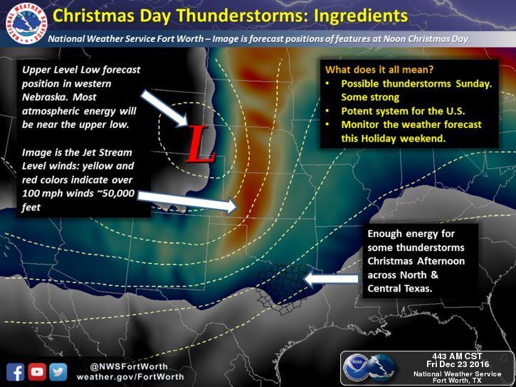
As we’ve been talking about the past couple of days, we continue to monitor the chances for Christmas Day storms across north central and northeast Texas. Thankfully, the threat of seeing any severe weather continues to decrease as the latest model data continues to push the strong upper level low well north of us keeping the best threat of severe storms up across Oklahoma, Kansas and Nebraska.
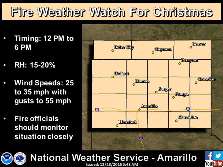
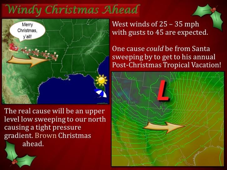
What will be a concern for our state on Christmas day will be very strong westerly winds across the panhandle region with gusts up to 55mph along with blowing dust and the threat of wildfires. Definitely not fun for travel across the region, not to mention outdoor decorations and other loose objects. Make sure everything’s put away or well-secured before Sunday!


0 Comments