
The first weather hazard we’re dealing with this morning continues to be the patchy dense fog along the Red River into parts of Northeast Texas. This fog will generally become less dense through the late morning hours, although it won’t go completely away. Low-level overcast will continue across the eastern half of Texas through Christmas Day as strong warm air advection continues to generate spotty showers and drizzle. Scattered showers and a few storms will be possible tonight through Christmas Night as a dryline/weak front moves east and eventually stalls. Over the next couple of days, through Tuesday of next week at least, we’ll see scattered rain showers continue in proximity of the front. The best chance of rain seems to be setting up in a corridor from Central Texas into Northeast Texas, although there will be shower chances on either side of that corridor and south to the coast. Rainfall amounts will range from half and inch up in Central Texas up to two inches in Northeast Texas through Tuesday. Flooding is not expected at this time.
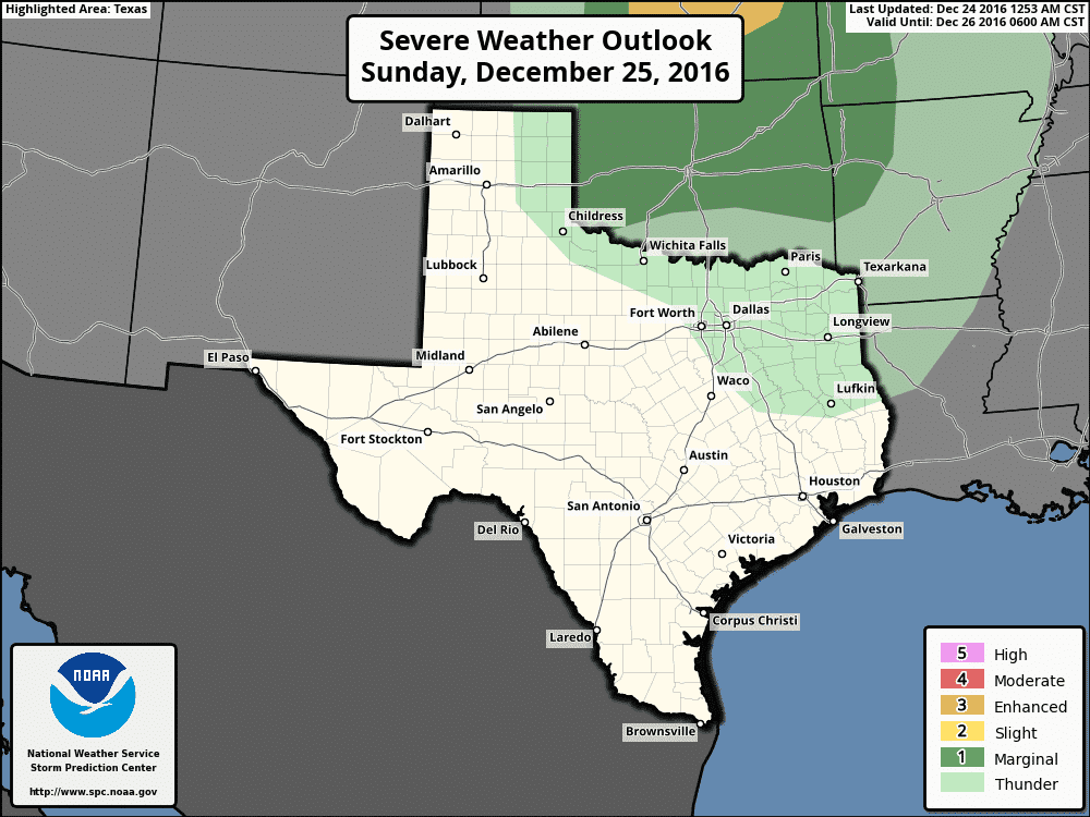
We continue to remain outside any severe weather risk on Christmas Day. The upper level storm system will pass well to our north and our atmosphere will only be marginally unstable. As such, severe weather is unlikely. A few gusty winds are possible from showers/storms tonight in the eastern Texas Panhandle and on Christmas Day in Texas, but I don’t expect any sort of severe weather problems.
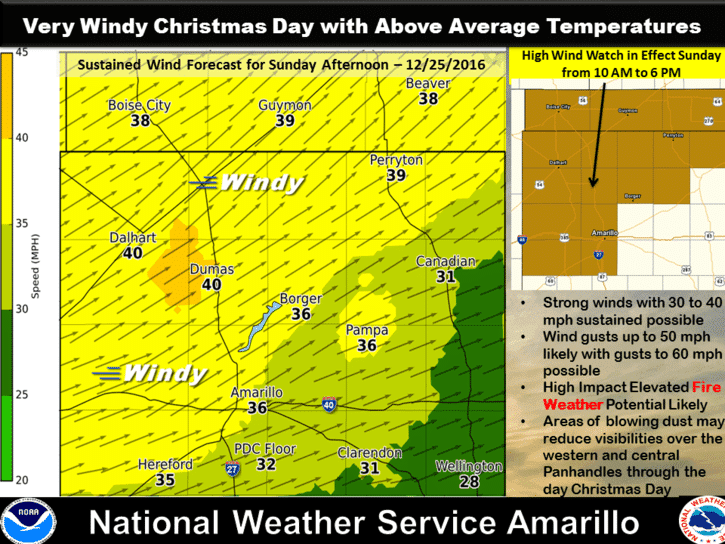
Strong winds and very high fire danger are expected in the Texas Panhandle on Christmas Day as the dryline/weak front surges to their east. Winds could be sustained at 40 MPH with gusts up to 60 MPH. Low relative humidity values will promote the rapid spread of any fires that develop. Blowing dust is a good bet as well. Winds will be gusty tonight into Christmas Day across the rest of Texas as well with gusts up to 30-35 MPH.
Temperatures over the next few days will remain above-average with highs ranging from the 50s up to the 80s. A muggy, humid airmass will continue to the south/east of our weak front. You’ll notice that humidity when stepping outdoors along with a dense low-level overcast and drizzle. These conditions will continue through Tuesday. Temperatures north and west of the front will be comparatively cooler, but nothing like the arctic outbreak we experienced last week.
0 Comments