
Late August has arrived, and it certainly feels like it across Texas. We’ve been rather fortunate this summer with multiple cool fronts and rainy days. The upper-level weather pattern responsible for those rain chances has also done a good job at keeping tropical mischief away from the Texas coast. Well, we’re in the summer doldrums, and we’re in late August now.
Alas, it would appear we may be rather busy next week in the tropical mischief department. That is normal, considering we’re at the peak of the Atlantic Hurricane Season. Before folks start getting hyped up, let me try and establish the voice of calm and reliability.
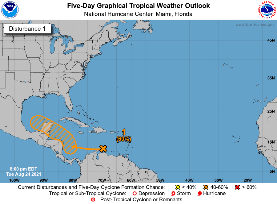
A broad area of low pressure is producing thunderstorms in the southwestern Caribbean Sea. In a few days, environmental conditions are expected to be favorable for further development. A tropical depression is likely to form late this week or over the weekend near the Yucatan Peninsula. It may form before it moves over the Yucatan, or it may wait to move into the southwestern Gulf of Mexico. Either way – once the system is over the warm waters of the Gulf, development appears likely.
No hype, realistic forecast information for 7 days out
What does that mean for folks in Texas? Well, we could be looking at a variety of scenarios. Let me clarify that there is little forecast certainty beyond ‘we think something will develop’. That part has become more likely. When and where development occurs is still somewhat questionable.
Once development occurs, we’ll be able to pin it on a map and question where the system goes from here.
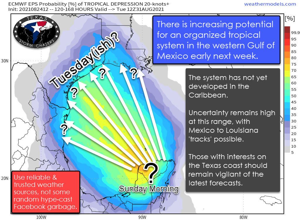
Long-range weather model ensembles, which are individual weather models initialized dozens of times over with slightly altered initiation parameters, are honing in on the western Gulf of Mexico. We’re not trying to pin down the strength of the potential system or a specific landfall point at this range.
Landfall locations in today’s data range from northern Mexico to Louisiana. Several solutions do result in a Texas landfall late Monday or on Tuesday. However, confidence that far out in a system that hasn’t even developed is very low. The timing will undoubtedly change between now and this weekend.
It is late August, and the Gulf of Mexico is hotter than an apple pie coming out of the oven. Everyone on the Gulf Coast knows it is wise to keep an eye on weather forecasts this time of year. The next week will not be an exception, although it takes more than warm ocean temperatures to generate tropical mischief.
If the system does move somewhere into Texas, we would have a plethora of hazards next week. Not diving into wind or storm surge, we’d be looking at a system moving slowly after it makes landfall. Heavy rain on a regional basis would be a concern, along with the possibility of tornadoes in the eastern semi-circle of the system.
Hurricane Preparedness
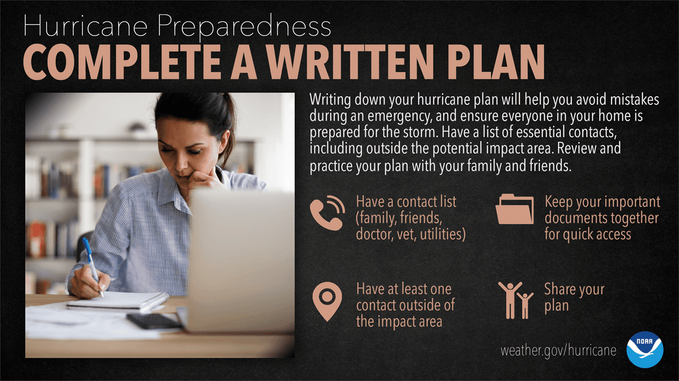
The time to prepare for a hurricane is NOW, while the weather is quiet. Once you’re under pressure, having a written plan will take the guesswork out of what you need to do to protect yourself and your family.
Know where you will ride out the storm and get your supplies ahead of time. You don’t want to be standing in long lines when a Hurricane Watch is issued. The supplies you need will probably be sold out by the time you reach the front of the line.
Being prepared now will mean the difference between your being a hurricane victim and a hurricane survivor.
ready.gov/make-a-plan


0 Comments