
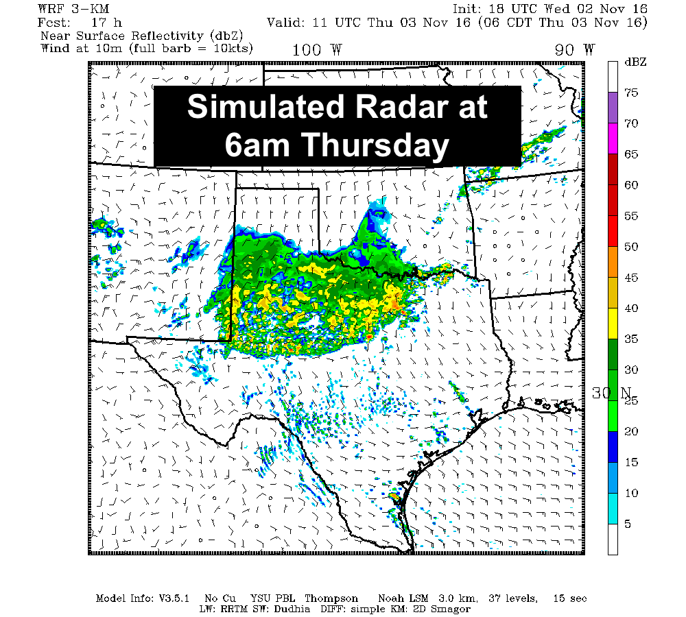
A cold front pushed through the panhandle region earlier today and is now making its way southeast across western north Texas. Widespread rain and a few severe storms developed out ahead of the front this afternoon and now we’re dealing with a squall line which has formed out between Vernon and Haskell. Main hazards with this line as it moves east/southeast at roughly 35 mph will be wind gusts around 50mph, penny size hail and frequent cloud to ground lightning. The potential for additional severe weather is diminishing with the loss of daytime heating, and the fact that the cold front is beginning to undercut the storms. This will help drive the line east/southeast overnight with impacts to the DFW metro area by early tomorrow morning. Just go ahead and plan on the potential for a messy Thursday morning commute and leave a bit early.
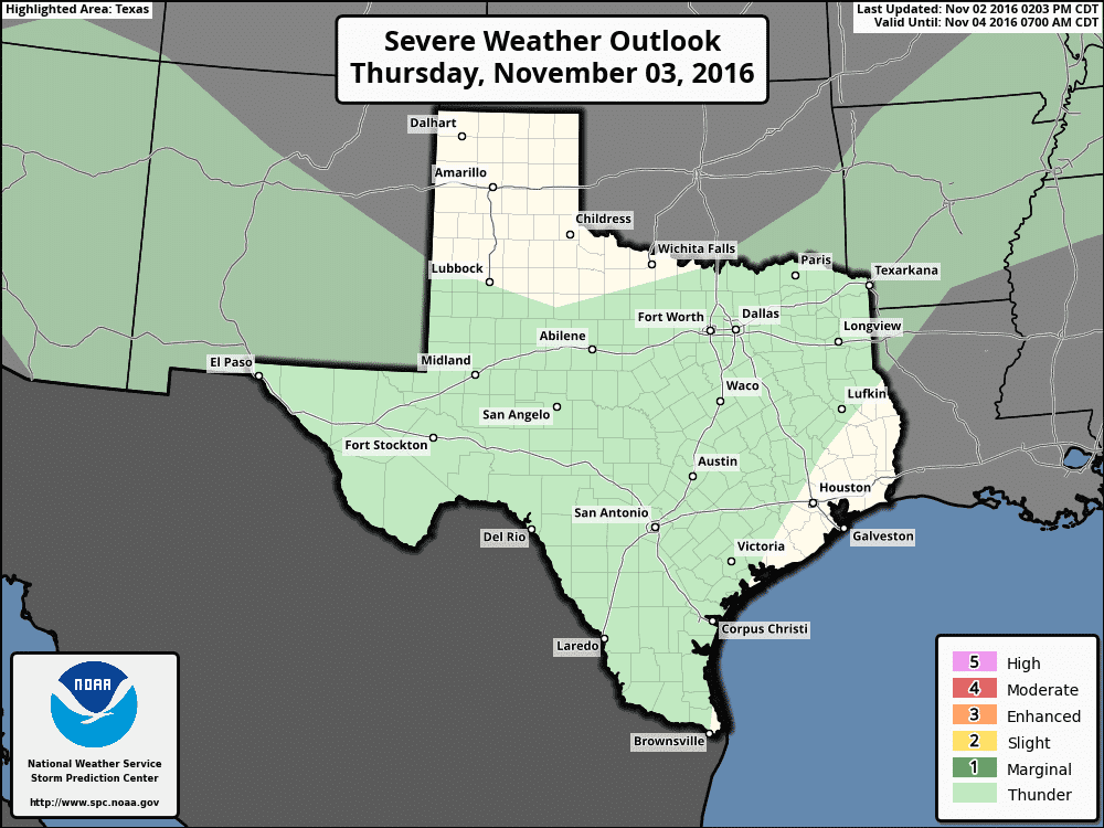
Rain chances tomorrow continue to look good and will favor areas mainly west of the I-35 corridor by tomorrow afternoon. A few storms across the Edwards Plateau region west of Austin could become strong to severe tomorrow afternoon during peak daytime heating, but outside of that region, the threat of seeing anything severe activity is very low. The latest model data is just beginning to roll in, so be sure to check back tomorrow morning for the latest updates on tomorrow’s rain and storm threats. 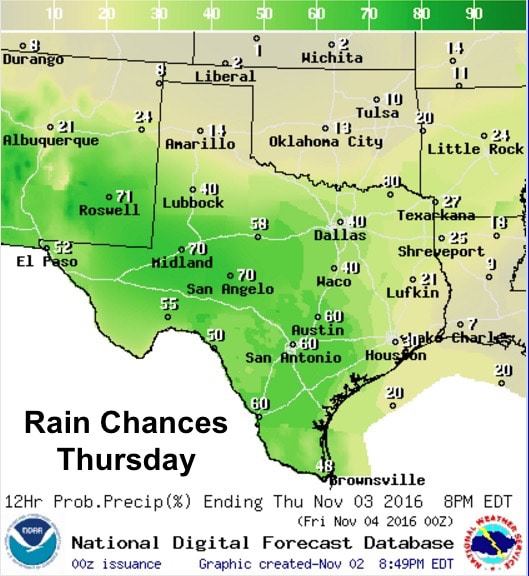


0 Comments