
Texas has had a blessed summer in the weather department. Outside of a landfalling hurricane, we don’t typically get to talk about widespread rains in mid-August. Yet, portions of the Concho Valley have received nearly ten inches of rain since Saturday night. That kind of rain causes short-term flooding issues but sure helps fill up lakes. We’ve seen a good smattering of showers and storms over the last few days – and more is on the way.
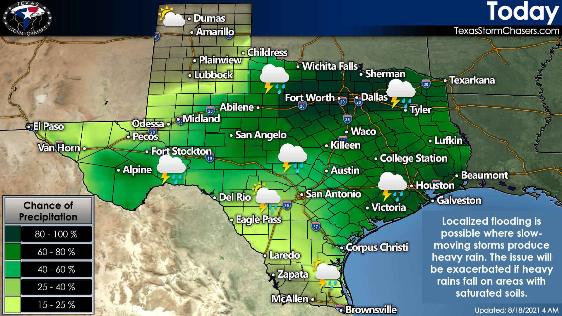
Today, scattered to numerous showers and thunderstorms from Alpine in Far Southwest Texas east through the Big Country, Concho Valley, Hill Country, into Arkansas and Louisiana. Like the past few days, it will not rain all day at any given location. Severe thunderstorms are not expected to be a widespread issue. Any stronger storms during the summer months can produce localized gusty winds and hefty rainfall. Localized flooding will be possible if a heavier storm sits on anyone too long or if we get more heavy rain on saturated soils.
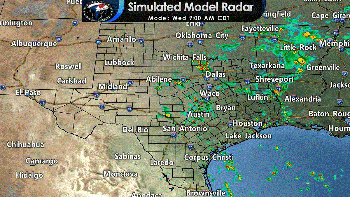
This morning’s run of the high-resolution rapid refresh (HRRR) shows our expectations quite well visually. Ongoing showers and storms this morning will continue into the afternoon. We’ll see a higher number of storms this afternoon as daytime heating helps to juice up the atmosphere. As usual, most popup storms will be able to drop a quick one to four inches of rain. Some folks may see a few drops; some may see a few too many. Those not receiving rain today can expect summertime weather with a rather unpleasant dose of humidity.
Thursday
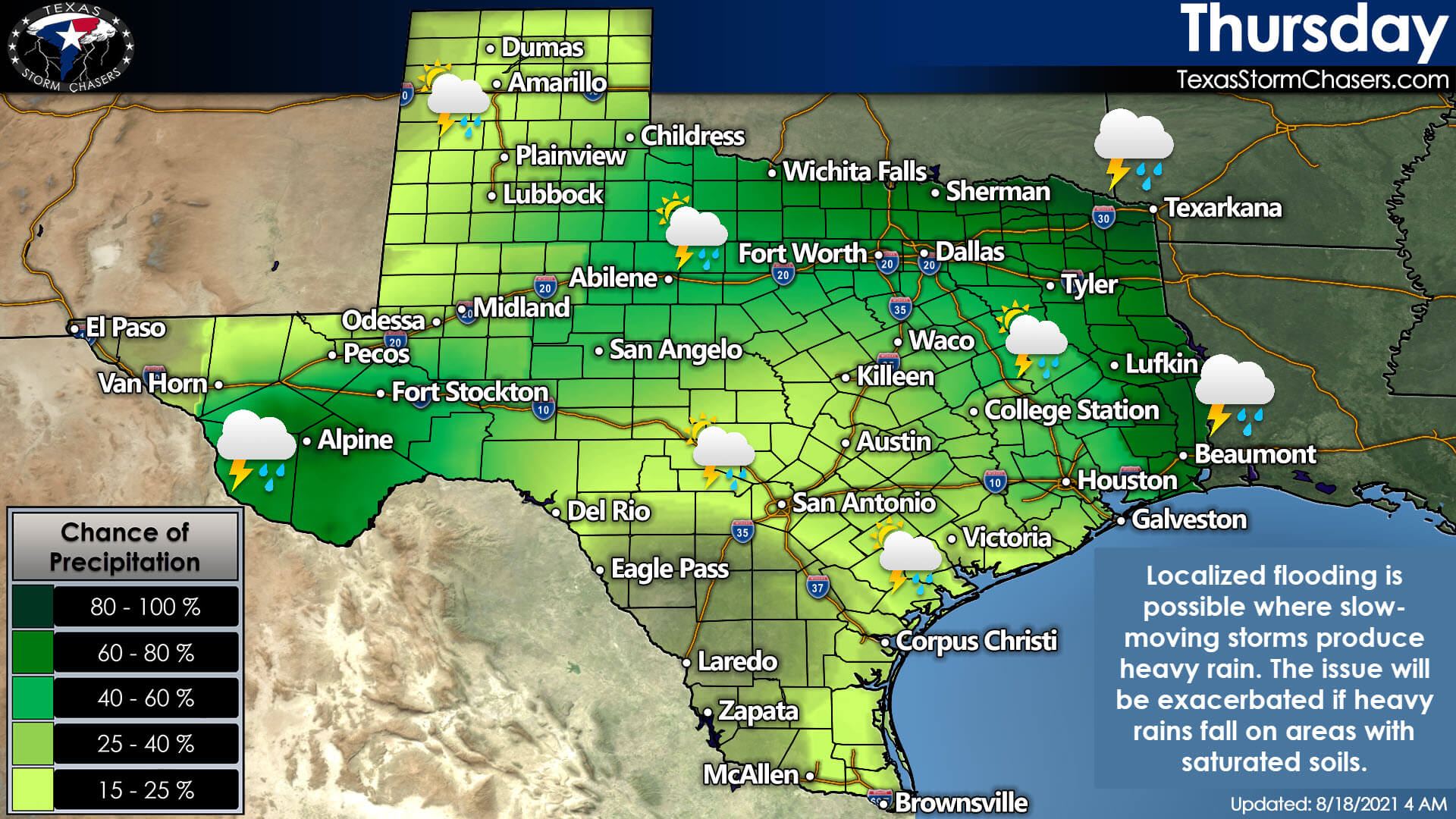
Thursday will mark the beginning of a shift back toward a typical summer-time weather pattern for us. We’ll still see scattered summer storms tomorrow. Rain chances will trend lower by the weekend and mainly concentrate toward the coast. In the absence of higher rain chances, temperatures will climb back up. Saturated soils mean humidity levels will remain elevated too, so heat index values will not be on the pleasant side this weekend or next week.
Tropical Storm Grace
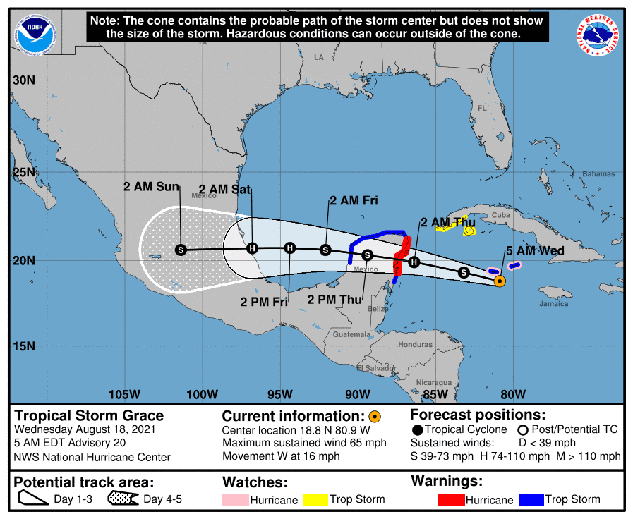
Tropical Storm Grace will become a hurricane later today. Tomorrow morning, it will continue moving west, with a landfall expected in the Yucatan Peninsula, south of Cancun. From there, it will move west into the Bay of Campeche Thursday night, with a landfall late Friday in mainland Mexico. Grace will remain well south of Texas. Grace’s only sensible impacts to Texas will be strong rip currents and increased tides on the coast.
Keep an eye on the sky with our interactive weather radar here on our website or in our free mobile app.


0 Comments