
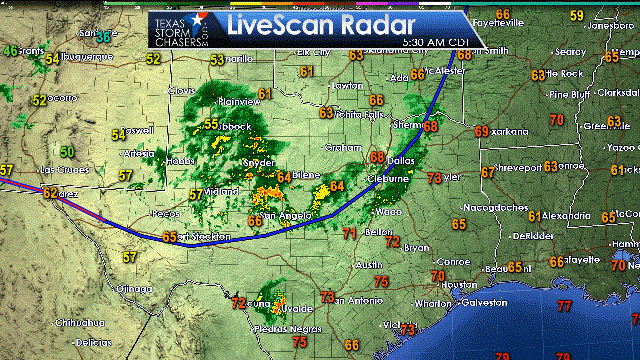
It certainly is nice to see the weather radar lit up this morning. Might it be too soon to say it looks like a Christmas tree? Perhaps, but we’re not that far off from the holiday season. The strong storms that moved through Northwest Texas, North Texas, and the Big Country overnight have weakened. They have pushed into portions of Eastern and Central Texas. Widespread light to moderate rain is falling across the Permian Basin, Concho Valley, Big Country, into West Texas and the southern Texas Panhandle. While the line of storms overnight was moving east most of the ongoing precipitation across western sections of Texas is moving from south to north. The cool front is shallow. Winds a few thousand feet above the surface are out of the south with plenty of moisture. That’s why we have the northward movement with this morning’s convection. A reminder that we do have a interactive weather radar on our website here.
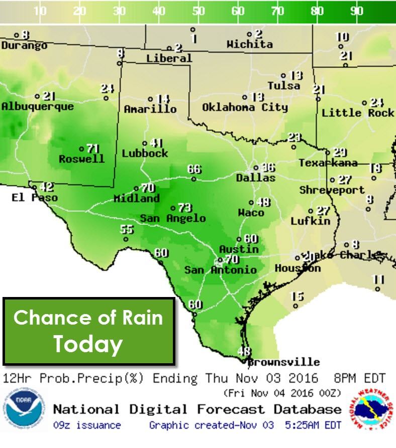
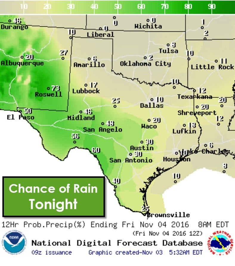
As we head into the afternoon into tonight we’ll see the best rain chances shift into the Borderland, Permian Basin, Concho Valley, and Southwest Texas. The cool front moving south this morning will stall out and become a stationary front later today. Severe thunderstorms aren’t expected today since most of the rain will be occuring in a stable surface airmass. Some thunderstorms are certainly possible, but will remain well below severe limits. Isolated to scattered storms will be possible in South Texas, the Rio Grande Valley, and to a lesser extend in Southeast Texas where temperatures and humidity will remain elevated.
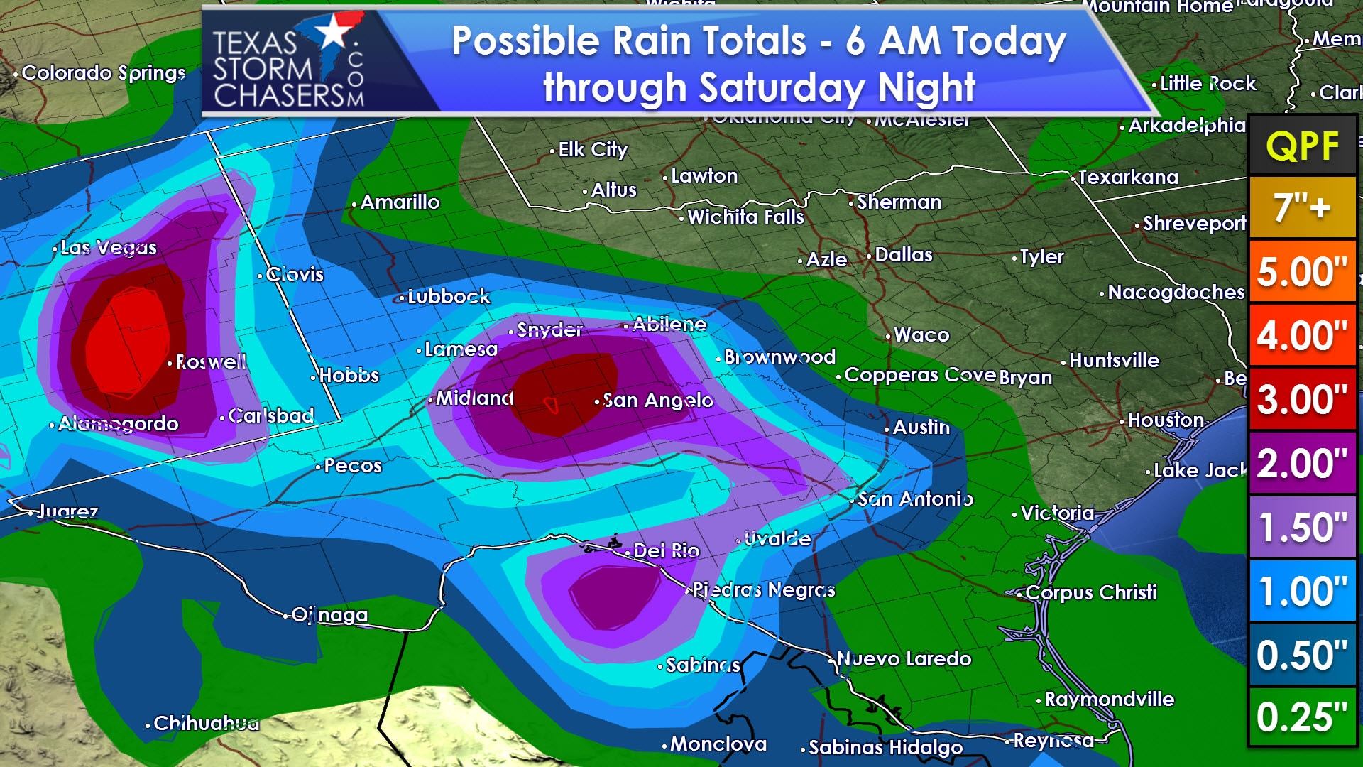
Rain chances on Friday and Saturday will remain elevated across the Borderland, Permian Basin, into West Texas and the Texas Panhandle. A few spots could see up to three inches of rain by Saturday evening. The recent dry weather and rainfall amounts not getting excessive should keep the flooding threat low. As usual if we see heavy rain start to ‘train’ or move over the same areas repeatedly the threat for localized flooding may develop. Severe thunderstorms are not anticipated.

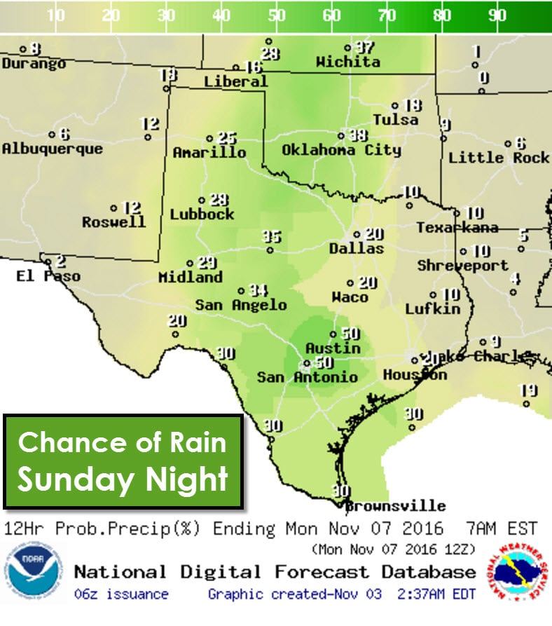
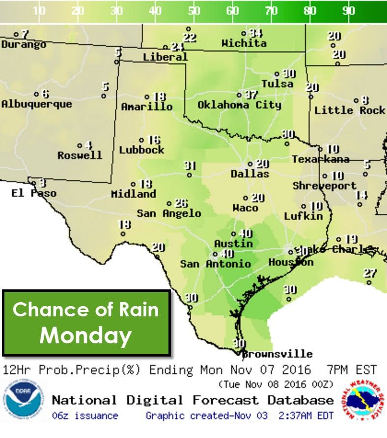
Another pierce of upper level energy will move close enough to Texas by Sunday to increase rain chances further east into Northwest Texas, the Big Country, Concho Valley, and Hill Country. There remains uncertainty on how quickly the upper level wave will progress. The best rain chances look to stay at least 50-100 miles west of Interstate 35 at this time. A third, potentially more impressive storm system could arrive on Monday. Uncertainty remains high but it looks like we’re going to stay in a active pattern into next week with rain chances and temperatures staying closer to seasonal averages.
Speaking of temperatures – let’s take a look at what we expect in the climate department over the next couple of days. Thanks to rain chances and our cool front temperatures across the northwest half of Texas will be much more comfortable today with highs in the 60s and 70s. Unfortunately temperatures across the southern/southeastern half of Texas will remain above average with 80s to right around 90 degrees possible in the Rio Grande Valley.As we continue into the weekend temperatures look to top out in the 60s, 70s, to middle 80s across Texas. While the southern sections of Texas will remain warm we should see temperatures come down several degrees compared to peak highs over the last week. Depending on the strength and track of next week’s storm system we may see temperatures drop even more. Until that point at least we will see high temperatures back in the 60s, 70s, to lower/middle 80s through early next week.


0 Comments