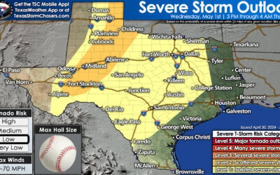
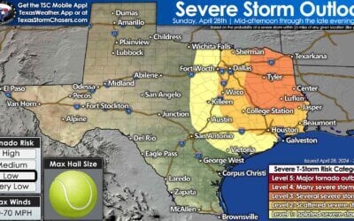
The Storm Prediction Center has upgraded portions of north central Texas to a Slight Risk of severe weather early tomorrow morning. The latest model data rolling in suggests that wind shear and instability will be enough to produce at least a couple of severe storms, possibly one or two supercells embedded within the squall line, early tomorrow morning. The area expected to see the greatest threat for severe weather will be across the counties immediately north of the Dallas/Ft. Worth metroplex up to the Red River counties and into south central and southeast Oklahoma. Low level wind shear may also be strong enough to produce a quick tornado spin up, although that threat still remains fairly low. Hail up to the size of quarters or slightly larger may also be possible within the more robust storms that develop. While we still do not see this becoming an area-wide major severe weather event tomorrow morning, all it takes is one or two severe storms to cause issues. We will continue to keep an eye on trends as they develop overnight and will have an update out early tomorrow morning, so please check back.

Timing still remains the same as before with a broken squall line of storms developing after midnight across western north Texas and moving east/southeast and into the DFW metro area between 4am and 6am.


0 Comments