
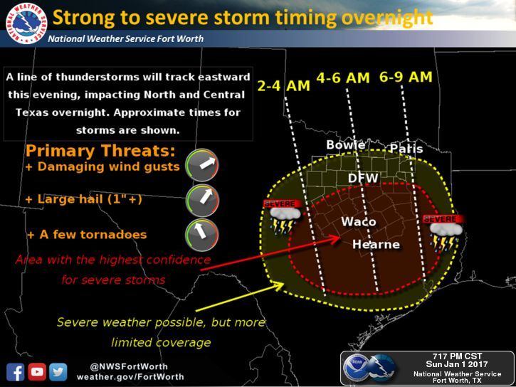
Not much has changed since our blog this morning concerning the threat of severe weather. The Storm Prediction Center continues to maintain a Slight Risk of strong to severe storms across much of the Hill Country, Central and South Central Texas overnight. Parts of North Central Texas are also included in the Slight Risk…mainly along and south of the I-20 corridor. The greatest threat with these storms overnight and tomorrow morning will be damaging winds and the possibility of large hail within the strongest storms. The tornado threat is low, but non-zero and would likely come in the form of a brief spin-up along the leading edge of the thunderstorm complex. The areas with the greatest risk of seeing any chance for tornado development are outlined in brown on the map below. While the threat is low, it’s something you’ll want to be aware of since this is an overnight/early AM threat.
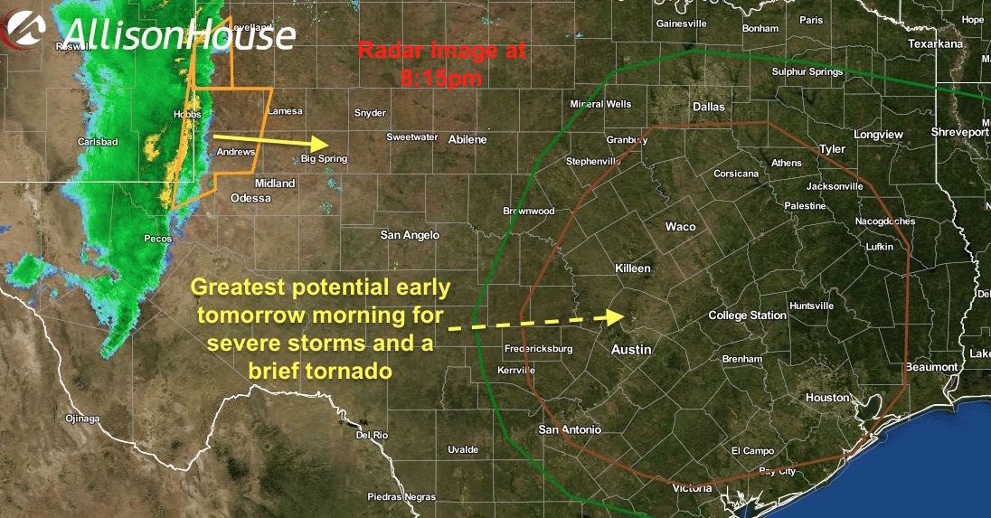
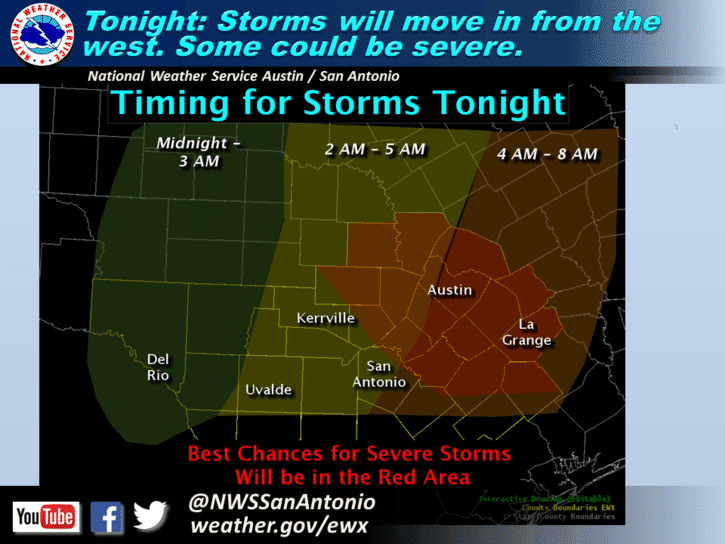
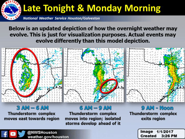
The line began its development several hours ago and is now crossing the TX/NM line and will be reaching the Midland/Odessa area within the next hour carrying the threat of wind gusts in excess of 60mph, small hail and frequent lightning. This line will continue to march east across the state overnight with additional strengthening after midnight as the line approaches areas east of the I-35 corridor…likely after 3am…and begins to tap into higher moisture and better instability. Here, winds in excess of 65mph and quarter size hail will be possible along with the threat of a brief tornado spin-up. Residents along and east of the I-35 corridor between Waco, Austin/San Antonio over into the Brazos Valley and Houston/Galveston areas should have their weather radios on tonight/tomorrow morning for alerts if Warnings are issued for your location.


0 Comments