
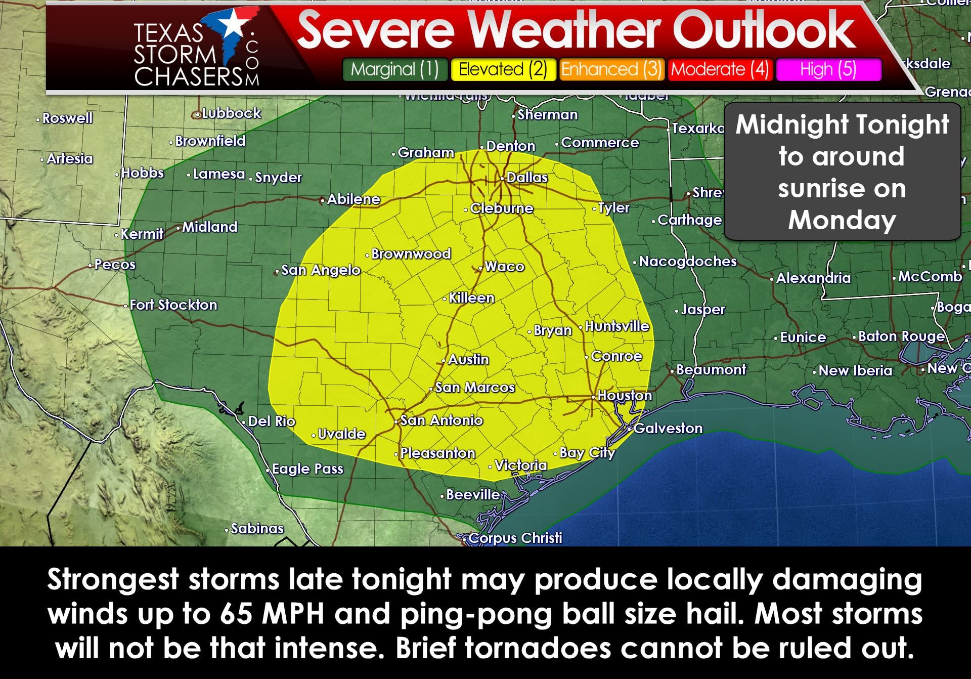
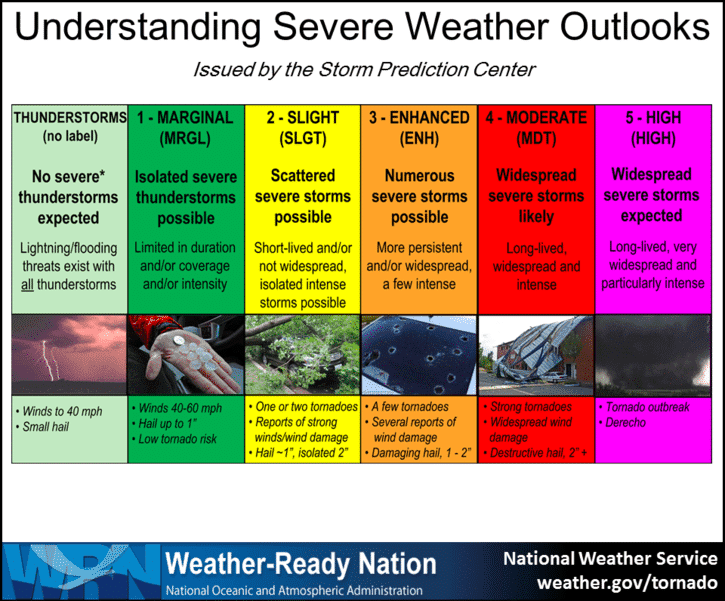
The Storm Prediction Center has maintained a category 2, standard risk, of severe weather in the Hill Country, North Texas, Central Texas, South-Central Texas, the Brazos Valley, Southeast Texas, and East Texas. Damaging straight-line wind gusts up to 65 MPH will be possible with the strongest storm segments tonight. Secondary threats include the potential for large hail and isolated tornadoes. A marginal risk of severe storms includes the Permian Basin, Northwest Texas, Texoma, and Northeast Texas. A small enhanced risk (category 3) may be introduced later today if confidence increases on an area of more widespread straight-line wind potential.
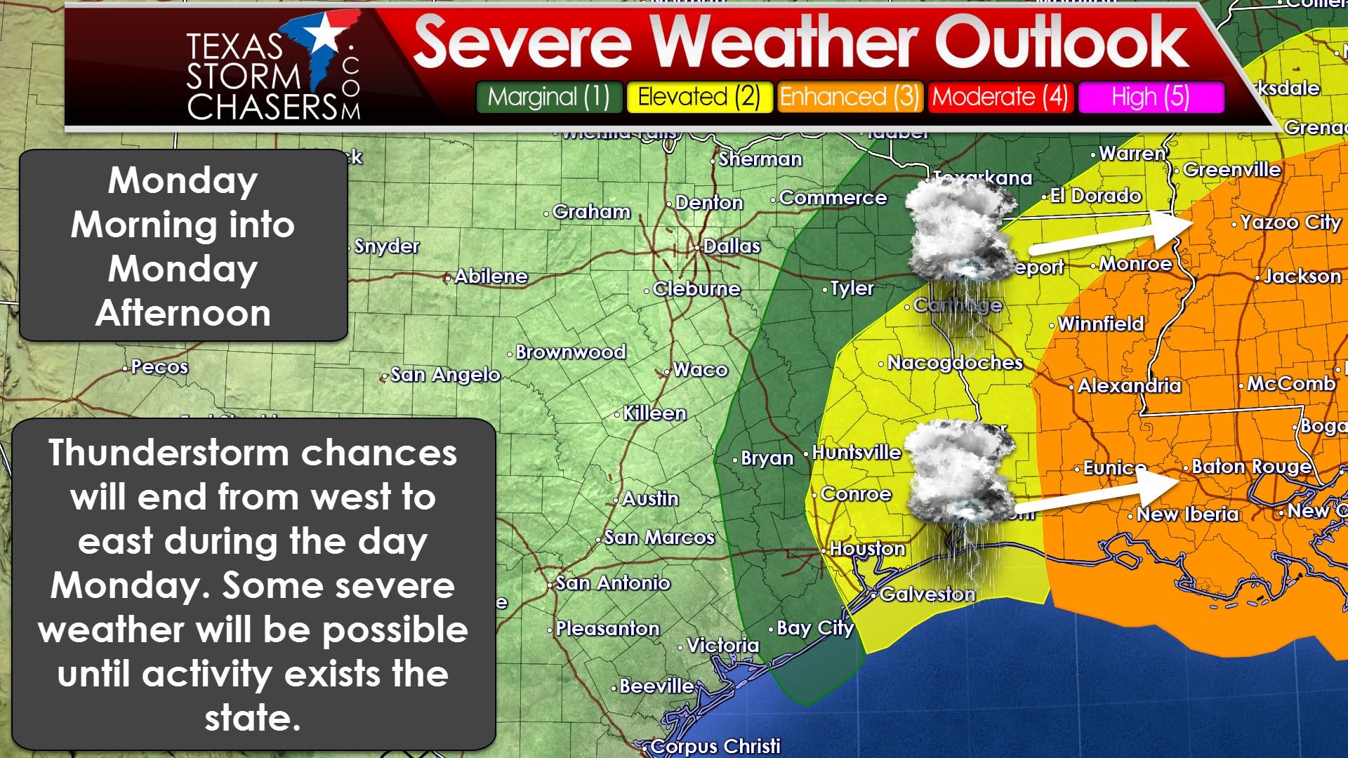
Much of today will be void of any severe weather potential. Later this evening we’ll see upper level lift quickly increase across western sections of the risk area in the Big Country and Concho Valley. A line of showers and thunderstorms will probably start to develop by 10-11 PM. This line will move east through the risk area, and consequently the eastern half of Texas, late tonight and into the morning hours Monday. Present indications are that the line of storms will be near Interstate 35 between 4 and 7 AM Monday. It should be moving out of the eastern sections of Texas by 11 AM.
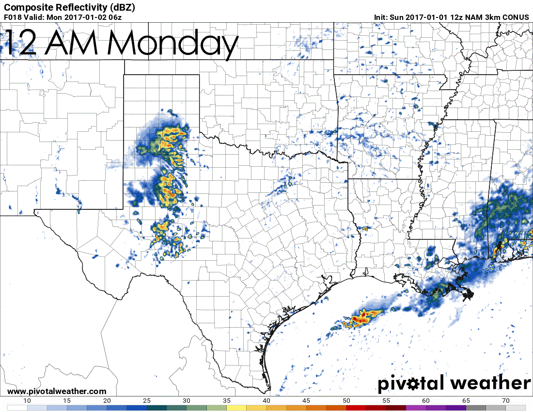
Southerly winds both at the surface and in the lower levels of the atmosphere will help increase moisture levels throughout the day. Scattered showers and weak thunderstorms are possible throughout the day. These storms are not expected to be severe. The upper level storm system responsible for tonight’s storm chances will stay west of the state until tonight. Once it arrives in the Permian Basin this evening we’ll likely see a line of showers and storms start to fire up. These showers and storms will move east, into a more unstable and moisture rich enviornment, after midnight in the eastern Big Country and Concho Valley. Some of the storms may start to be severe with damaging winds and large hail as they enter that more storm-friendly enviornment. The threat for severe storms will continue as the line moves east into North Texas, Central Texas, and portions of South-Central Texas. Damaging winds and large hail should be the primary threats. Isolated tornadoes cannot be ruled out with stronger sections of the squall line. Tornadoes that occur with strong squall lines are typically brief and weak – usually occuring in areas of enhanced damaging straight-line winds. Whether the wind is straight-line or spinning (tornadic), it can produce the same damage. A small part of the severe weather outlook may be upgraded to enhanced later on if confidence increases on an area of more widespread wind/hail potential. Not all storms in the squall line will be severe. Localized heavy rain will be possible, but the storms should be moving at a good pace – keeping the threat of flooding low.
With the severe weather threat expected to occur while most folks are sleeping we encourage you to have a couple ways to receive severe weather warnings. Have a severe weather plan ready to go in case you get woken up in the middle of the night. For severe weather tips head over here.


0 Comments