
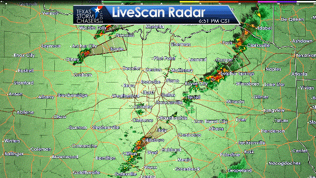
Thunderstorms have been increasing in coverage over the past hour in portions of North Texas. A broken line of thunderstorms has developed from north of Jacksboro to Bellevue to Nocona extending into southern Oklahoma. This broken line is just east of a dryline/cool front. The line itself will make eastward progress this evening with individual storms moving to the northeast. A few storms may become strong to severe with gusty winds up to 60 MPH and hail to the size of quarters. It is not out of the question that some southward development occurs over the next two hours. Those storms may threaten portions of the D/FW Metroplex.
The second area of increasing thunderstorm development is from near Hillsboro northeast to Ennis. This is the area where we have expected storm development to increase for much of the day. Over the next few hours we’ll see storms become more widespread from south of D/FW extending northeast into Northeast Texas and portions of East Texas. This area is where low-level wind shear is more favorable compared to back on the cool front west of I-35. We’ll be watching for any semi-discrete storms that try and become supercellular through about 11 PM. The strongest storms may produce hail up to the size of quarters, localized wind gusts over 60 MPH, and would need to be monitored for a potential tornado. The tornado threat isn’t expected to be widespread this evening, but we’ll have to watch any sustained supercell for signs of low-level rotation over the next few hours. Widespread severe weather is not expected at this time, but a few storms may get rowdy this evening.
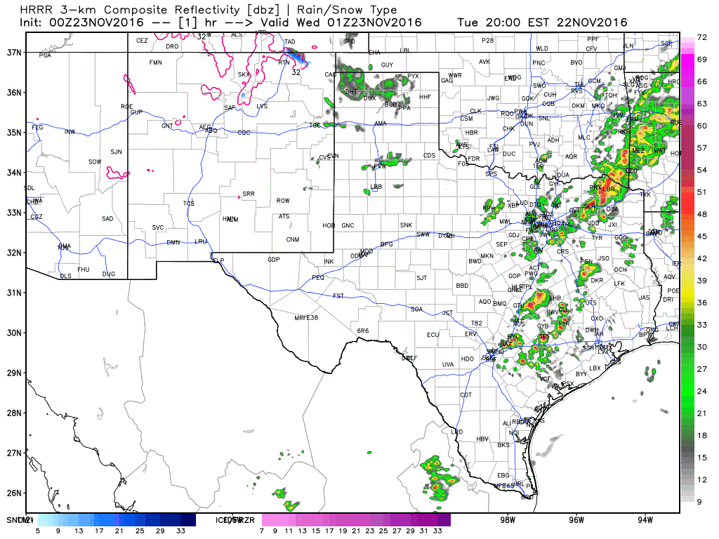
By around midnight a squall line should be in progress from near Texarkana extending southwest into the Brazos Valley. Individual storms will move east/northeast while the line as a whole will make progress to the east/south. Some storms in the line may be strong with localized damaging winds. Storms tonight will be efficent rainfall producers with a quick 1 to 2 inches of rain possible. A second, weaker line of storms may be moving just behind the first squall line in portions of North Texas at midnight. Current projections have the cool front and squall line moving into the Houston Metro around 5 to 6 AM Wednesday. The threat for severe weather should be low at that point, but localized street flooding will be possible as rainfall rates will still be efficient.
Rain chances will quickly end behind the cool front as it moves south/east tonight into Wednesday. Showers/storms will be possible in Southeast Texas and along the Texas Coast during the morning hours Wednesday. Otherwise no other hazardous weather should impact your travels across Texas on what many call the busiest travel day of the year.


0 Comments