
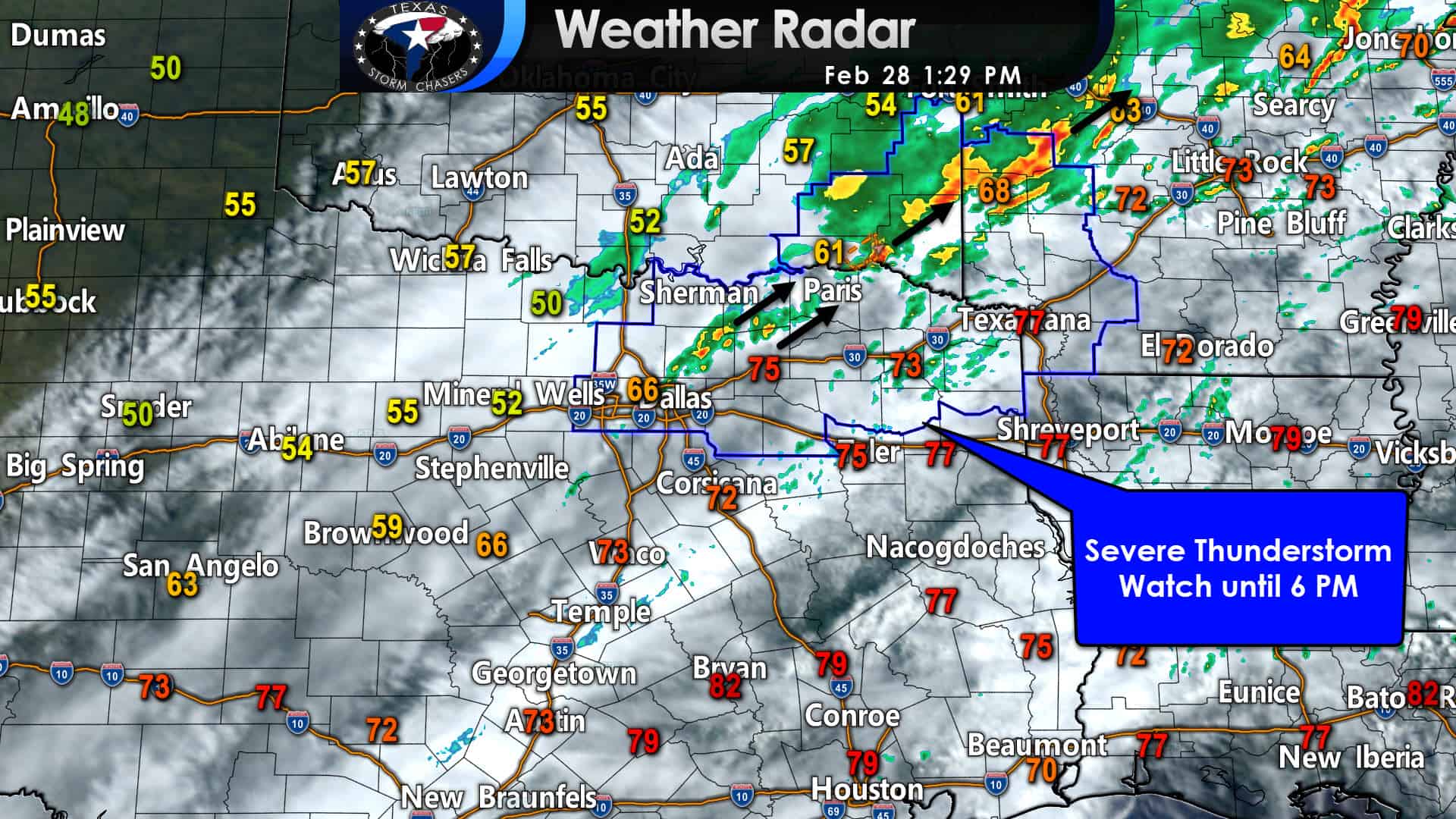
A cold front extends from near Paris to McKinney to Alvarado to Evant to Mason to Junction. An unstable airmass remains in place to the east of the cold front. Northwest winds, cooler temperatures, and a much drier airmass are in place behind the front. Over the next several hours, we’ll focus our attention on Northeast Texas and eastern North Texas. After a few severe storms a few hours ago near the Red River, we’ve been relatively ‘behaved’ stormy-wise.
Severe storms are underway in southeastern Oklahoma, and those will move into Arkansas soon. A severe thunderstorm watch remains in place for eastern North Texas and Northeast Texas through dinner-time. We’ll be watching for isolated severe storms through the afternoon. The strongest storms could produce large hail and localized damaging wind gusts. An isolated tornado is possible in the Ark-La-Tex and Northeast Texas. Most storms will probably continue to behave themselves, but we’ll be watching in case any decides to break the trend.
Forecast through Tonight
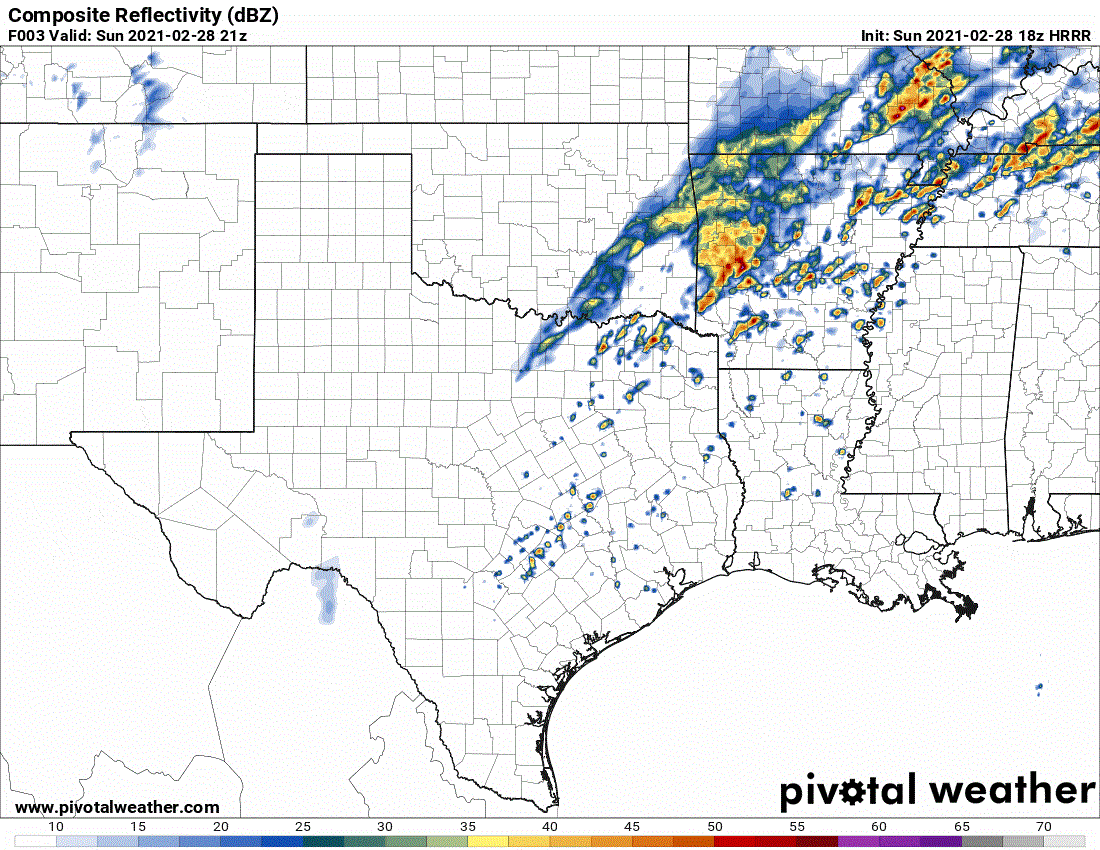
Simulated weather model radar from the 12PM run of the HRRR. The animation begins at 3 PM this afternoon and continues three hours (each frame) until 12 PM Monday. Remember, this is a weather model’s guesstimate on how things may evolve. If it were always perfect – I wouldn’t be here warning you it isn’t perfect.
As we progress through the afternoon and toward dinner-time, we may see an uptick in thunderstorm activity near the cold front. By that point, the front should be moving into East Texas, Central Texas, and the Brazos Valley. Assuming storms can fire up and increase in intensity, some of them may be hailers and produce localized damaging wind gusts. Compared to this afternoon, where a low tornado threat exists in Northeast Texas, the threat for tornadoes will be even lower tonight.
Precipitation coverage will increase late tonight across the Edwards Plateau, Hill Country, Central Texas, northeastward into the Brazos Valley and Southeast Texas. It’ll be a rainy night and Monday. Locally heavy rains may produce street flooding and rises on area streams, creeks, and rivers on Monday.
Overall, today is not shaping up to be a widespread, high-impact severe weather day in Texas. We’ll keep an eye out as we should see at least a few storms increase in intensity this afternoon in Northeast Texas.


0 Comments