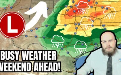
The remainder of Saturday will feature pleasant weather across Texas. The same cannot be said for Sunday or Monday. Southerly winds will increase a few hours after sunset this evening. We anticipate a windy night across Texas. Sunday will feature strong winds across a majority of Texas.
For the western third of Texas on Sunday
West/southwesterly winds will be very strong. Wind gusts of 50 to 65 MPH are possible, with localized gusts up to 70 MPH in the Texas Panhandle and West Texas. If upper-level clouds are more dense, winds may not become as strong. Humidity values will drop into the teens. With warm temperatures, dry surface fuels, and very strong winds – Sunday has the potential to be a dangerous wildfire day. The Texas Panhandle, West Texas, Permian Basin, Big Bend, Trans-Pecos, and Davis Mountains will experience critical wildfire danger tomorrow. Any fire ignitions have hte potential to spread rapidly, with substantial resistance to initial attack efforts. Wind-driven fire behavior is anticipated. A northerly wind shift from a cool front will complicate attack efforts Sunday evening into Monday morning, though humidity values will rise behind the cool front. Blowing dust will reduce visibility and create some travel difficulties. Some blowing dust may ‘follow’ the cool front further east in Texas on Monday. Patches of light rain/snow may fall in the Texas Panhandle and West Texas on Monday. Significant precipitation accumulations are not expected.
The eastern two-thirds of Texas on Sunday
Strong southerly winds are expected with wind gusts of 35 to 50 MPH possible at times. A few showers are possible in the morning hours. Mostly cloudy skies are expected. An isolated thunderstorm in Northwest Texas, Big Country, and the Concho Valley can’t be ruled out during the afternoon. If a storm did develop, hail would be the primary issue. A line of thunderstorms is expected to develop Sunday evening in those same regions as a Pacific cool front moves southeast. The line of thunderstorms will move east across the eastern half of Texas late Sunday night through early Monday afternoon. Some storms in the squall line will produce localized wind gusts over 60 MPH, dime to quarter-size hail, heavy rainfall, and perhaps a brief tornado.
Thunderstorms will exit Texas into Arkansas and Louisiana early Monday afternoon. Cooler temperatures will filter into the northern half of Texas behind the Pacific cool front. We’ll have to see if any West Texas dust makes it farther east. Monday and Tuesday will be cooler, but not ‘arctic cold’. We’ll warm back up by mid-week, with our next chance for rain returning on Wednesday for some folks.
If moisture values (dewpoints) were higher, Sunday’s weather setup would favor a significant tornado outbreak across Kansas, Oklahoma, and Texas. As it stands, relatively dry air in the low levels of the atmosphere will put a lid on the overall severe thunderstorm threat—at least concerning tornadoes. Some severe weather threat is still expected over the next two days, especially as moisture values increase early Monday.
My FREE & AWESOME weather app for radar/alerts/more: https://texasweather.app/
My website, also with radar: https://texasstormchasers.com
The 24/7 Texas weather tracker & music: https://www.youtube.com/watch?v=lNZuPEWS5AI&t=0s
Storm chaser videos: https://www.youtube.com/texasstormchasers
Facebook: https://www.facebook.com/TxStormChasers
TikTok: https://www.tiktok.com/@texasstormchasers
X (Twitter): https://twitter.com/TxStormChasers


It’s a Saturday Afternoon Special! Hit that like button and subscribe for the latest Texas weather updates! We’re almost to the big 20,000!