
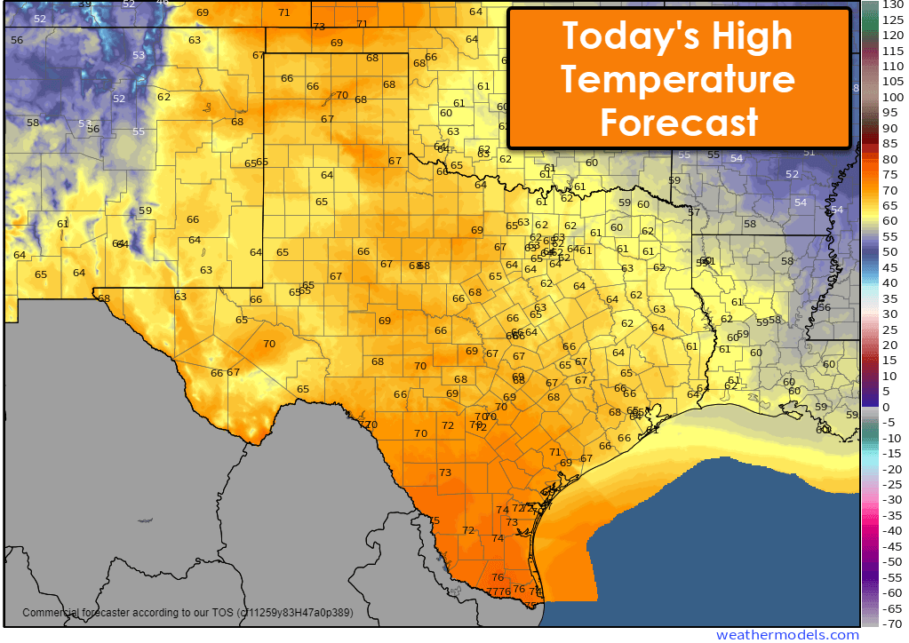
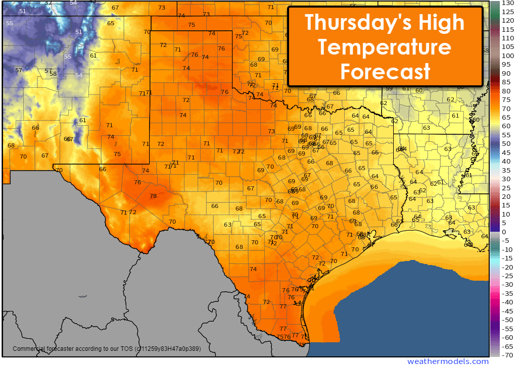
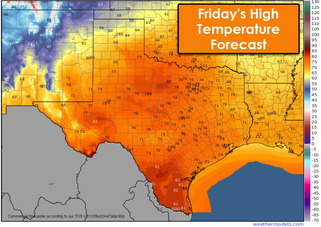
The next few days will take us up the temperature roller coaster before we plateau and head back down this weekend into early next week. Windy conditions will be noticeable on Thursday, Friday, and Saturday. Clouds will hang in tough across Texas through the day before beginning to clear across the northwest half of Texas on Thursday.
Localized dense fog is possible Thursday morning in the Guadalupe Mountains, the Edwards Plateau, Hill Country, South-Central Texas, and the Coastal Plains. Fog will lift by mid-morning, but be ready for quick drop-offs in visibilities, especially in valleys and near water sources.
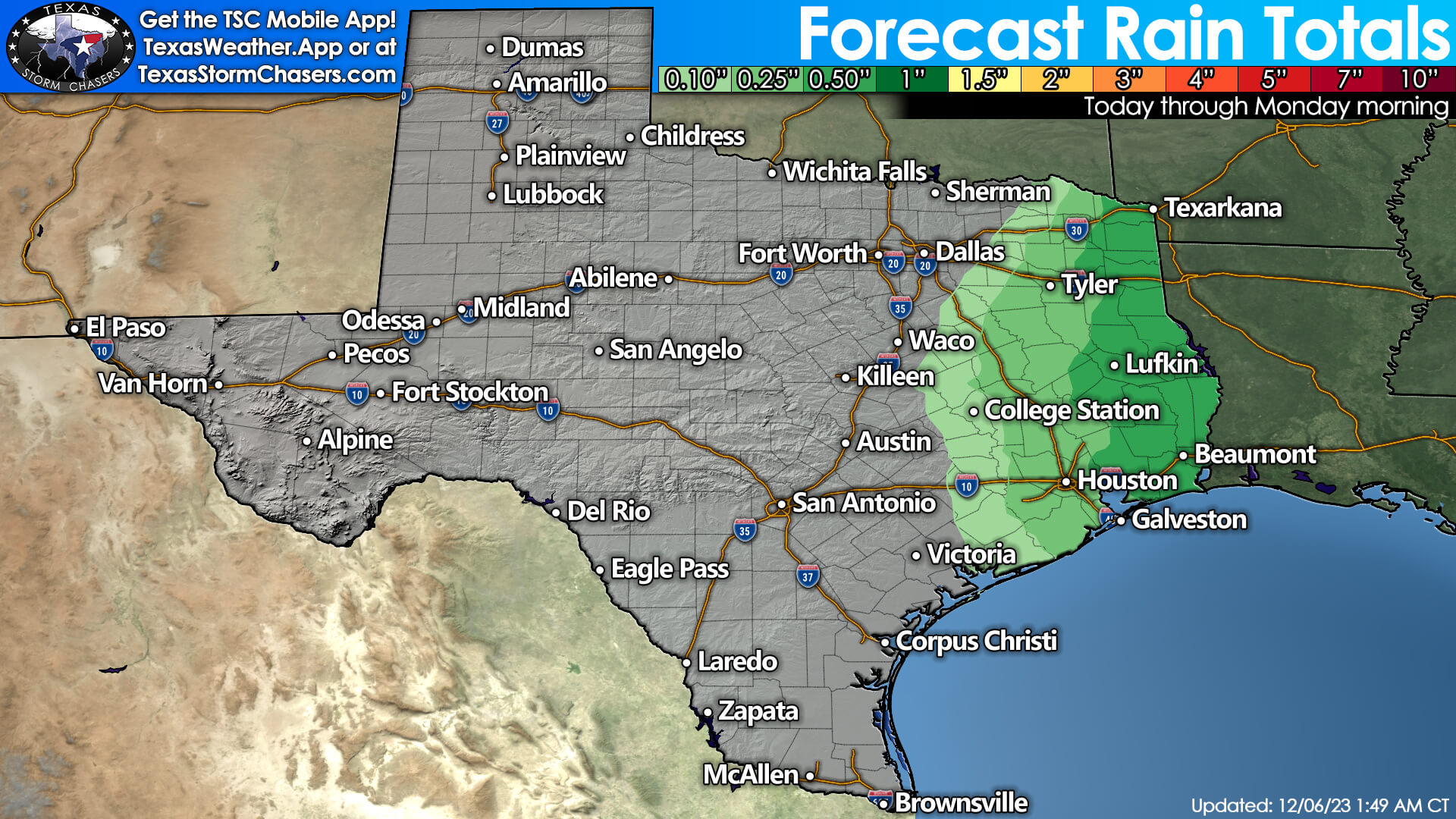
An upper-level storm system will bring changes to our weather beginning Friday night. A surface low pressure will develop in Northwest Texas, and quickly begin lifting northeast into the Midwest. Scattered showers and thunderstorms are expected Friday night through Saturday afternoon in the Ark-La-Tex, East Texas, the eastern Brazos Valley, Southeast Texas, and the Golden Triangle. One-tenth to one-half inch of rain may fall across the regions mentioned above, with the highest rain totals expected along the eastern state line.
Like prior severe weather threats over the last few weeks, the one on Saturday appears to be setting up to be ‘mistimed’ for Texas. A few strong to severe storms can’t be ruled out, but my confidence in Texas-related issues is decreasing. We’ll need to keep an eye on the timing aspects since we’re still four days away. There remains a low probability of light snow in the Texas Panhandle Friday night into Saturday morning. Some folks may get a dusting to one-half inch of snow, but accumulation probabilities remain low.
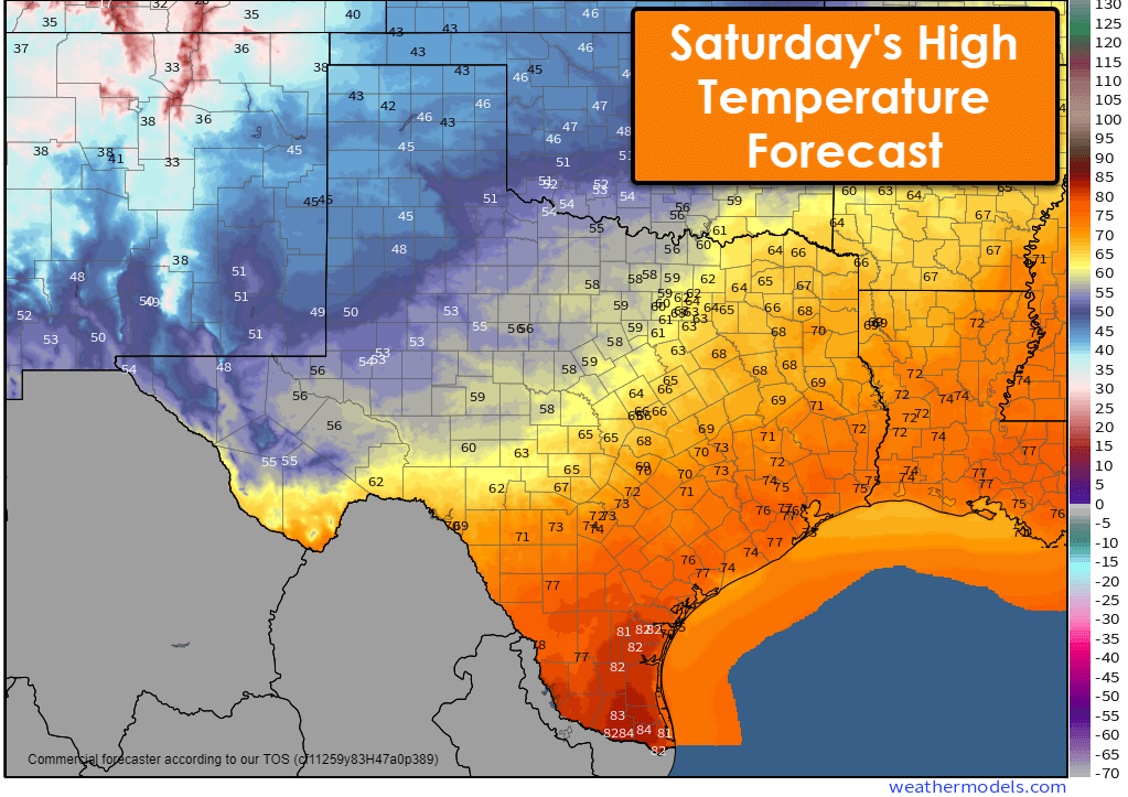
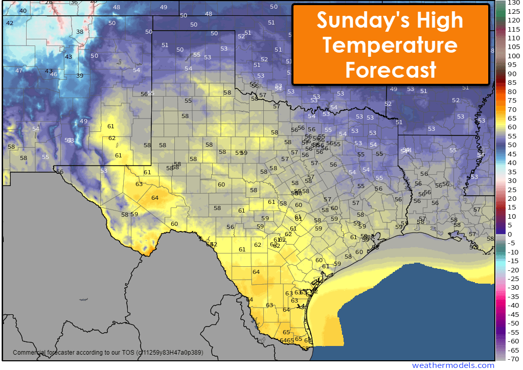
A return to December weather will accompany a strong cold front that’ll move southeast across Texas on Saturday. High temperatures Saturday through early next week will return to the 40s, 50s, and 60s. A reinforcing shot of cooler air looks to keep temperatures on the cool side through early next week.
https://youtu.be/6gPBfsktE68

All seasons in a week
Dana Messinger pretty much
Thank you 😊, good afternoon