
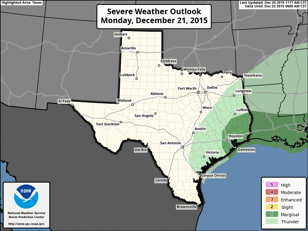
It’s not completely rare that we see the threat of severe weather in December in Texas, but it does happen and we will see that threat starting tomorrow across the southeastern portions of the state, then again Tuesday afternoon into early Wednesday with the approach of a couple of upper level disturbances. Gulf moisture has already been pushing north into central and northern Texas since last night. Temps will also be on the increase…well above where they should be at this time of the year…which will allow for a decent amount of instability to develop both afternoons. A weak cold front/dryline will push through the state tomorrow, slowly advancing south through the day before stalling somewhere across central Texas. We expect to see rain/showers develop early tomorrow across southeast Texas with the approach of the first upper level disturbance. A Marginal threat has been placed across this region for tomorrow afternoon/early evening when the best forcing will be present. Widespread severe is not expected, but a few of the storms could become severe. The tornado threat is low, but non-zero, so we’ll have to keep an eye on the activity tomorrow afternoon as it develops. Chances for rain/storms will continue overnight into Tuesday as well.
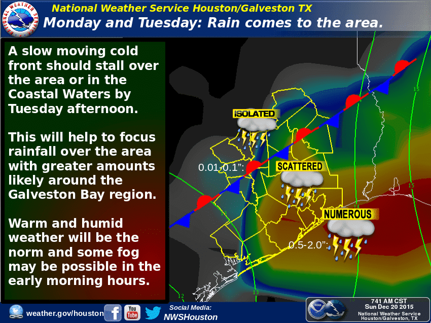
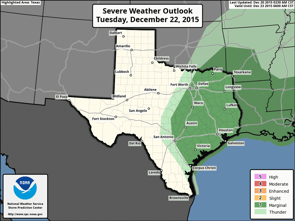
Winds will turn back from the south again by early Tuesday and the old front/dryline will lift north again with additional moisture streaming back up across central and northern Texas. Temps on Tuesday will easily reach the mid 70’s by late afternoon which will allow an unusually high amount of instability for this time of the year to build across parts of south central, central and southern north Texas. The Storm Prediction Center has placed much of central, north central, northeast, east and southeast Texas under a Marginal Risk for severe weather late Tuesday into early Wednesday. Current short-range forecast models aren’t showing much in the way of storm development inland from the southeast coast until later in the afternoon/evening…despite the instability available. Best forcing from the approaching shortwave doesn’t look to arrive until close to dark, so we expect to see most of the showers and thunderstorms developing in the late afternoon to early evening along and east of the I-35 corridor across south central and central Texas, then move north/northeast through the night. Some of these storms could become severe with damaging winds as the main threat, although a tornado or two cannot be ruled out. We’ll have another look at the timing of Tuesday’s severe weather threat once tonight’s forecast models start rolling in, so expect some updates to the timing and coverage with tomorrow’s forecast blogs. At either rate, plan on Tuesday afternoon through Wednesday morning being wet and a bit of a bumpy ride before the system moves out Wednesday afternoon.


0 Comments