
Above average temperatures will continue this week across much of Texas. A few severe thunderstorms are possible late Tuesday Night into the morning hours on Wednesday across East Texas. Christmas Eve and Christmas Day will be warm and humid but dry. Widespread shower and thunderstorm chances increase Christmas Night into Saturday and Sunday as a very powerful storm system enters the region. Flash Flooding, Severe Weather, and a Winter Storm are all possible but exact details on location and intensity of all hazards remains very uncertain.
Today and Tonight
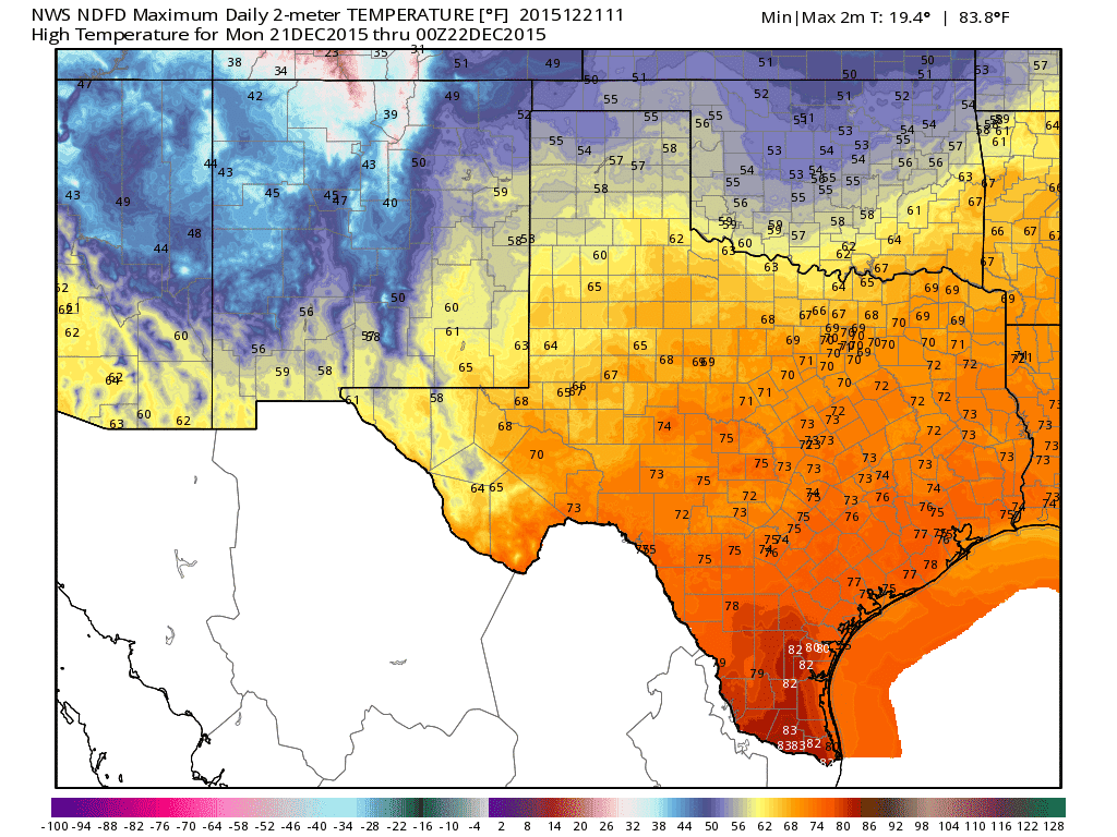
Monday’s High Temperature Forecast
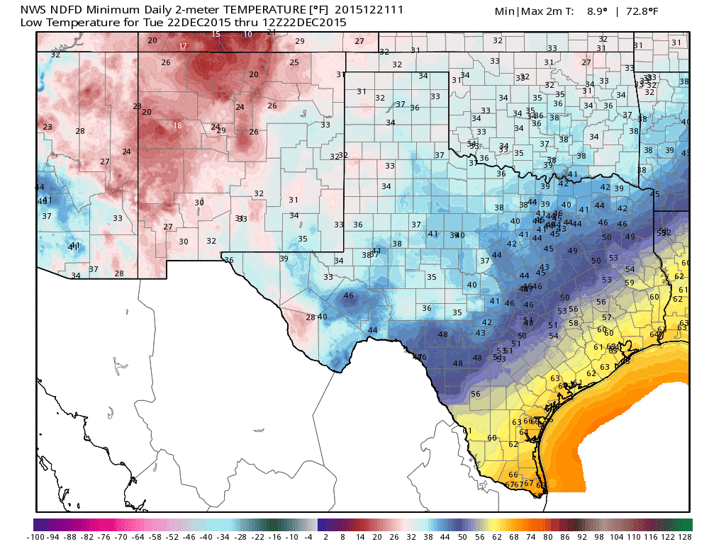
Tuesday Morning’s low temperature forecast
A weak cold front will push south through Texas today. There won’t be a noticeable drop in temperatures but the front should pusher higher moisture levels back south towards the coast. Patchy dense fog and mist will be possible along and south of the front at any given location. No measurable precipitation is expected and fog should clear out as the cold front pushes through.
Tuesday and Tuesday Night
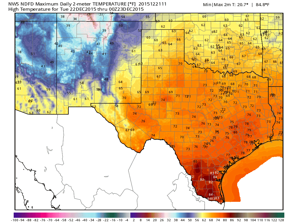
Tuesday’s high temperature forecast
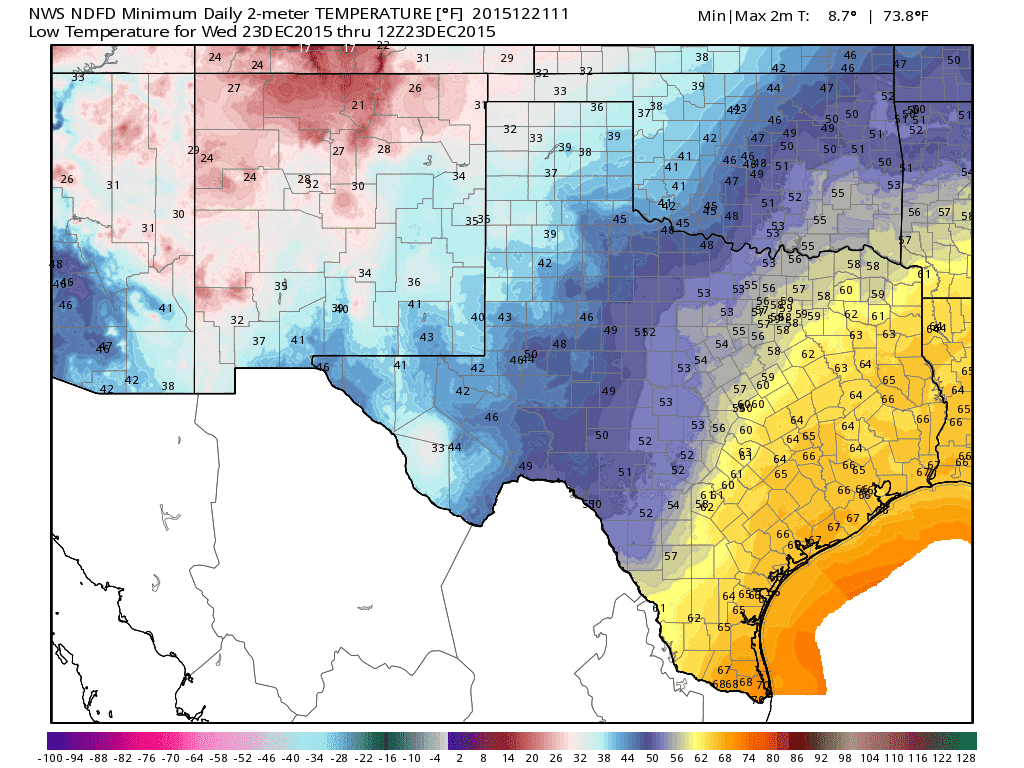
Wednesday morning’s low temperature forecast
Tuesday will be a day of change. The weather itself for much of the day will consist of partly cloudy to mostly cloudy conditions. Rapid moisture return will result in increasing dewpoint values from south to north through the day into Tuesday evening. Thus while Tuesday morning may start out with dewpoint values in the 30s in North Texas its likely they’ll be in the 50s by Tuesday evening.
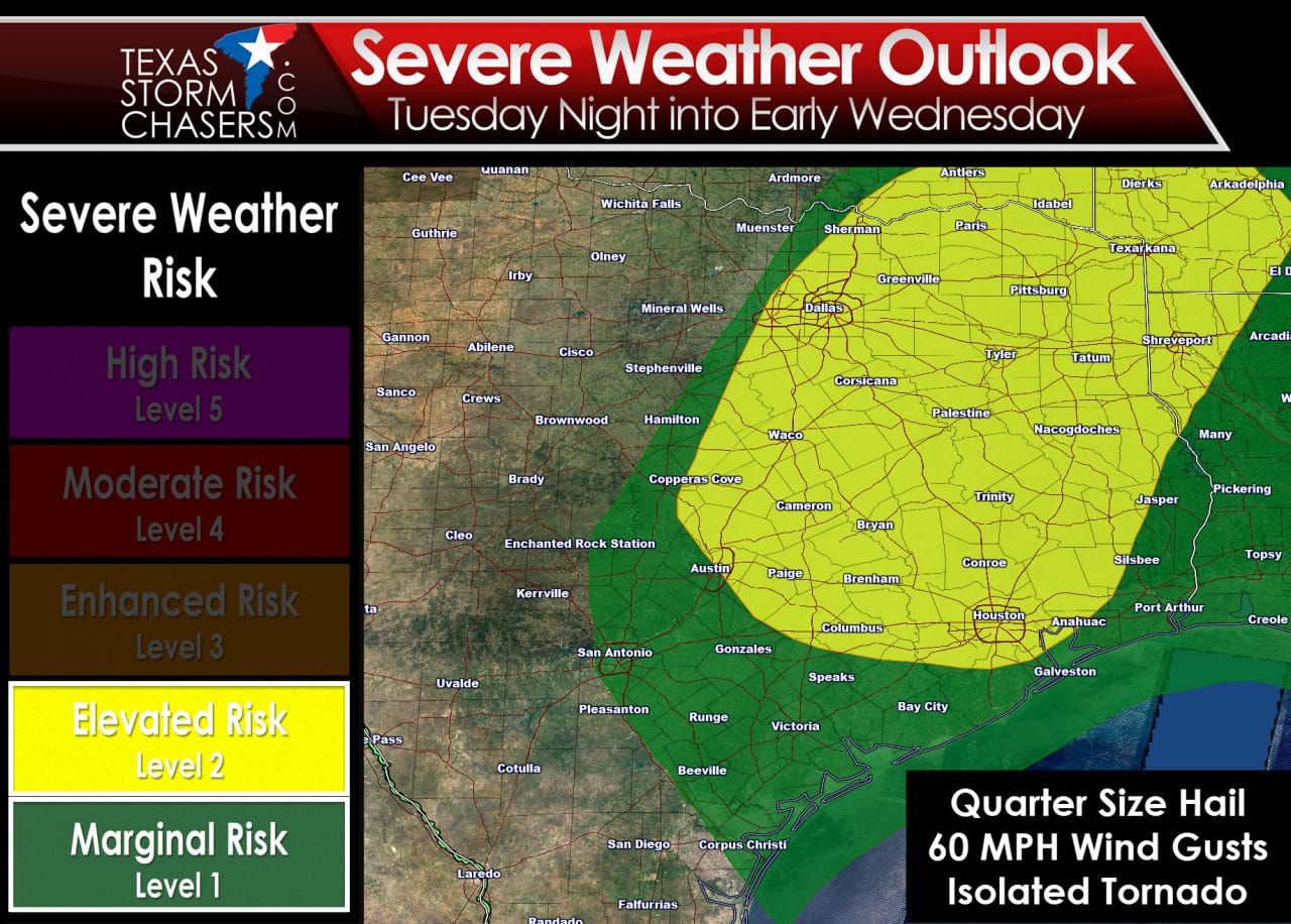
By Tuesday Evening an upper level storm system will traverse the area. An elevated mixed layer (EML) will be in place across all of the warm sector along/east of Interstate 35 through the day into the night. The EML, also known as a cap, will weaken Tuesday evening across Northeast Texas and East Texas. There isn’t expected to be a specific lifting mechanism like a surface front to spark thunderstorm development. However with the upper level storm system traversing the area tomorrow night it looks like there may be enough ‘lift’ in the atmosphere to cause isolated to scattered thunderstorms. The atmosphere will become more unstable after dark Tuesday thanks to cooling mid-level temperatures and warm air advection at the surface. An unstable air mass combined with moderate/strong wind shear will support the possibility of organized convection. Some storms may become severe with locally damaging wind gusts, hail up to the size of quarters, and a low-end tornado threat. Locally heavy rain is also possible. If there was a clear ‘spark’ to help storms develop I would be more concerned about tomorrow night’s severe storm chances. At this time the threat should remain localized versus a widespread outbreak. We’ll watch trends in case things start to look more volatile. Any storms that develop would do so after 9-10 PM Tuesday and be east of Texas by mid-morning Wednesday.
Wednesday and Wednesday Night

Wednesday’s high temperature forecast
Thursday morning’s low temperature forecast
Skies will clear from west to east as any morning precipitation moves east of Texas. West winds will prevail. Afternoon high temperatures are going to be well above average with 70s expected along and south of Interstate 20/30. Locations along and south of Interstate 10 from San Antonio to Beaumont could top 80 degrees. The South Plains, Northwest Texas, Texoma, and Northwest Texas will be in the 60s and 70s. The Panhandle will top out in the mid/upper 50s which will be well above normal for December. Temperatures Wednesday Night/Thursday Morning will be at or above seasonal averages under mostly clear skies.
Christmas Eve (Thursday and Thursday Night
Christmas Eve’s High Temperaure Forecast
Christmas Morning Low Temperature Forecast
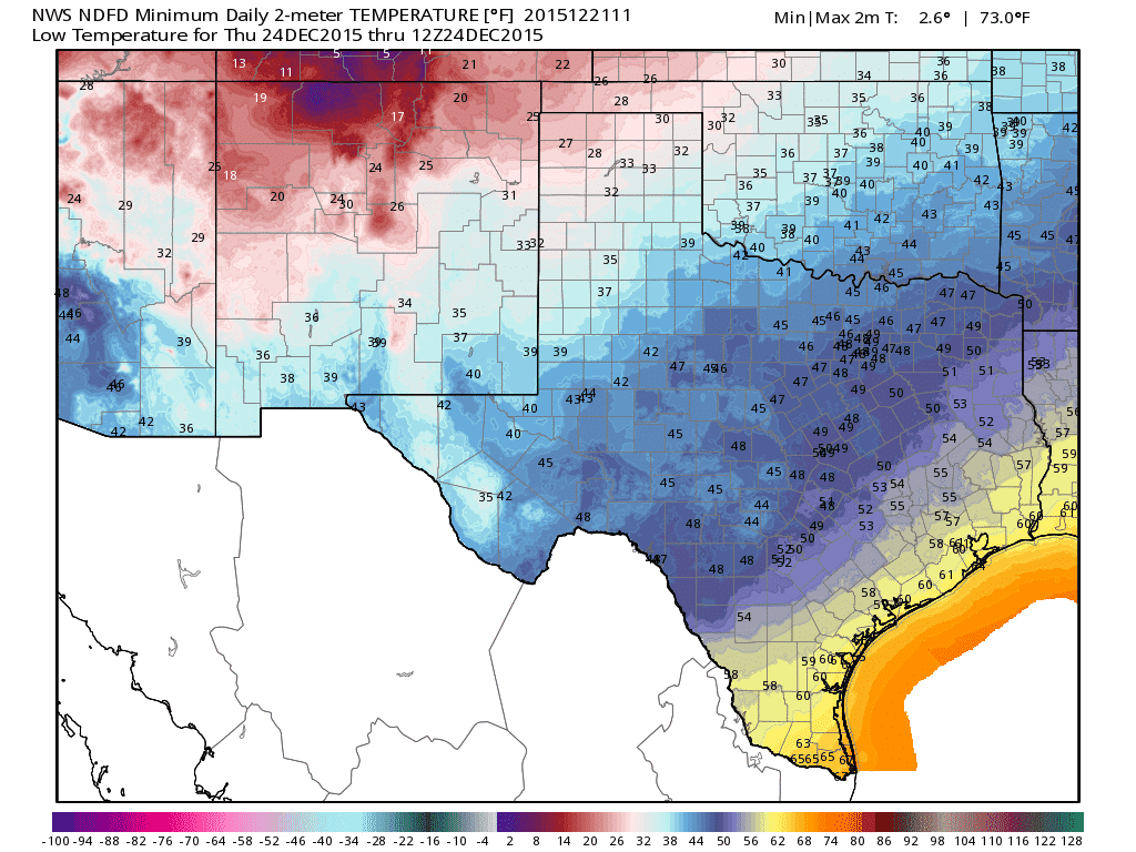
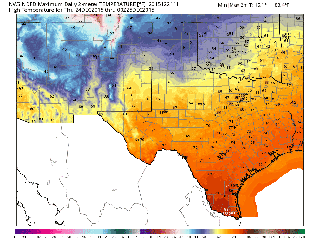
Winter fans are not going to be happy with this aspect of the forecast. High temperatures on Christmas Eve should be in hte 60s and 70s across the southern two-thirds of Texas. Compared to Wednesday temperatures will be about three to five degrees cooler across Texas. That isn’t saying much considering temperatures on Wednesday will be well above average for December. It’ll be a warm and mostly sunny day with light winds. We’ll start to see some weather changes by Thursday Night. Pockets of fog will be possible across Southeast Texas. Isolated showers could also occur across South-Central Texas, Southeast Texas, and East Texas Thursday Night. Any rainfall amounts would be light – but would be enough to make for a wet Christmas morning.
Christmas Day (Friday) and Christmas Night
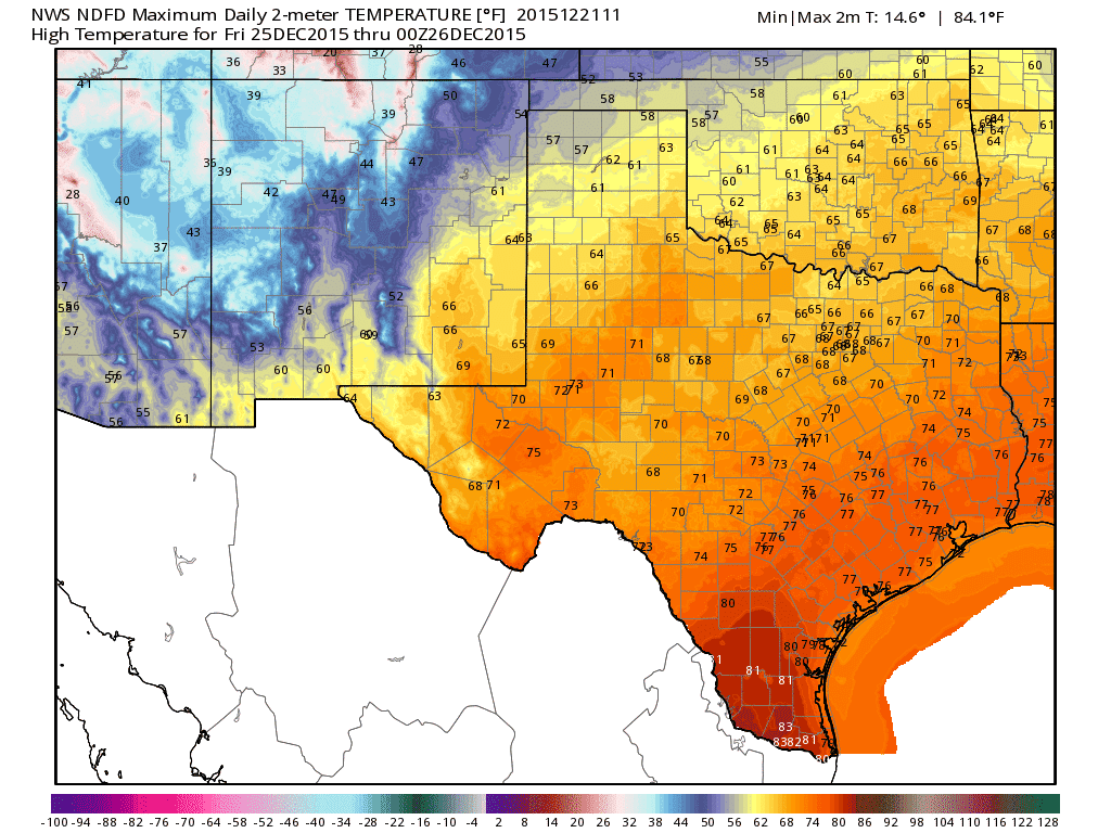
Christmas Day High Temperature Forecast
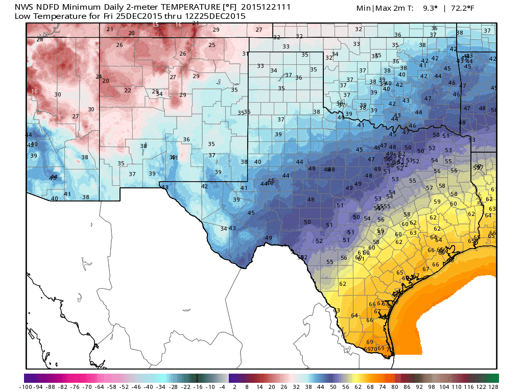
A very warm Christmas day is expected across all of Texas. High temperatures will be in the 60s and 70s across all of the state. South Texas and the Rio Grande Valley will be in the 80s. Some locations may approach or set new record highs on Christmas. Looks like my mom gets her wish for a warm Christmas. The day itself will be cloudy across the eastern half of Texas with pockets of mist. Dewpoint values will be in the 60s from the coast inland to the Red River from Gainesville and points east. It will truly feel like a spring day in April which isn’t a good thing when you have a powerful storm system a day away. Rain chances increase Christmas Night as rain coverage increases across North Texas, Central Texas, Northeast Texas, East Texas, and Southeast Texas. Thunderstorms will also become possible during this timeframe along with locally heavy rain.
The Weekend
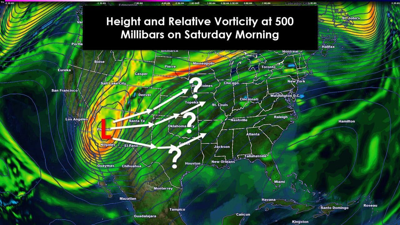
This period has the potential to be extremely active in the weather department across not only Texas – but the southern United States. Weather models are having a difficult time with the upcoming system but all agree it will be powerful. A closed upper level low is likely to be somewhere over the southern United States by Sunday. Moisture levels across Texas will be ridiculously high for late December – frankly it looks more like a spring setup in some ways. Flooding and severe weather will be possible on the ‘warm side’ of the low across the eastern half of Texas. The ‘cold side’ of the low is likely to bring winter precipitation to the Texas Panhandle and West Texas. Beyond those sparse details I can’t say much because so much uncertainity exsists. This has the potential to be an extremely busy weather period across the region with multiple weather hazards. A Major/Hign-End Winter Storm (the kind that is remembered) is likely to occur on the northwest side of the low’s track. If the low tracks across Kansas then we won’t deal with much winter weather issues in Texas. If the low tracks further south across Texas than we could be dealing with a crippling winter storm/blizzard by this weekend in the Texas Panhandle and West Texas with severe weather/flooding in North Texas, East Texas, etc. I emphasis the forecast confidence in any particular solution is extremely low. There will be major forecast adjustements as we continue through the week and approach the weekend – but I do expect hazardous weather in Texas this weekend. Be ready for it!


0 Comments