
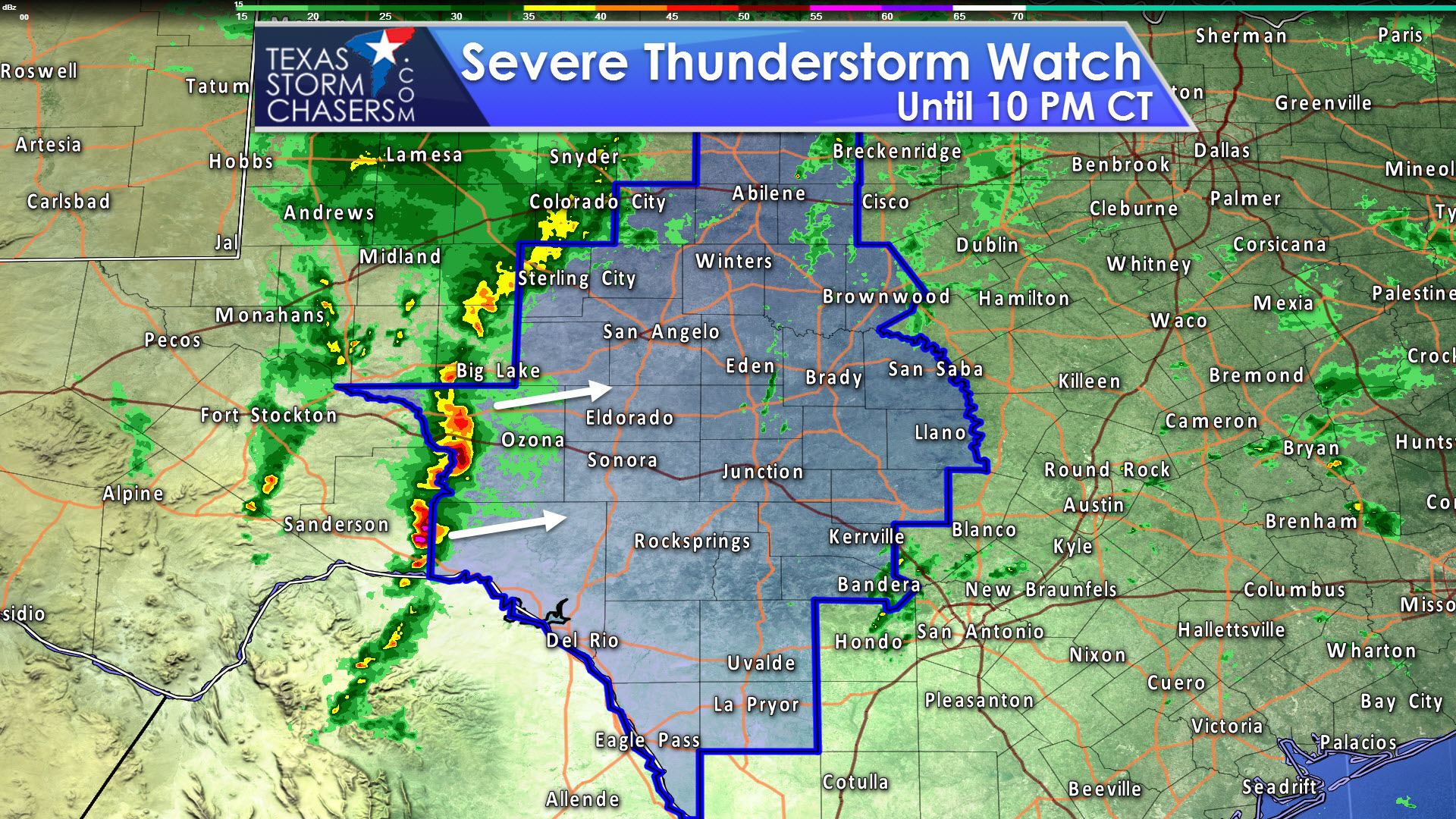
The Storm Prediction Center and National Weather Service have issued the first severe weather watch of the day. This severe thunderstorm watch includes portions of Southwest Texas, the Concho Valley, up into the Big Country. Del Rio, Junction, San Angelo, and Abilene are included in this watch. Storms entering the western sections of the watch will continue to organize as they quickly move east. The strongest of these storms may produce damaging wind gusts up to 70 MPH and perhaps a few pieces of large hail. The tornado threat within the squall line will be low, but not totally zero.
Severe Thunderstorm Watch Number 7
NWS Storm Prediction Center Norman OK
250 PM CST Sun Jan 15 2017
The NWS Storm Prediction Center has issued a
* Severe Thunderstorm Watch for portions of
West-central Texas
* Effective this Sunday afternoon and evening from 250 PM until
1000 PM CST.
* Primary threats include…
Scattered damaging wind gusts to 70 mph possible
Isolated very large hail events to 2 inches in diameter possible
A tornado or two possible
SUMMARY…Strong to severe thunderstorms are expected to increase
through the late afternoon and early evening hours ahead of an upper
low nearing the El Paso vicinity at mid-afternoon. The majority of
these will occur with a linear band of east/northeastward-moving
storms, although a few isolated supercells could occur ahead of the
convective line. Damaging winds should be the primary severe risk
overall, but some hail will be possible as well, and a tornado or
two cannot be ruled out, particularly across the Edwards Plateau
vicinity near a warm front.
The severe thunderstorm watch area is approximately along and 75
statute miles east and west of a line from 15 miles north of Abilene
TX to 40 miles south southeast of Del Rio TX. For a complete
depiction of the watch see the associated watch outline update
(WOUS64 KWNS WOU7).
PRECAUTIONARY/PREPAREDNESS ACTIONS…
REMEMBER…A Severe Thunderstorm Watch means conditions are
favorable for severe thunderstorms in and close to the watch area.
Persons in these areas should be on the lookout for threatening
weather conditions and listen for later statements and possible
warnings. Severe thunderstorms can and occasionally do produce
tornadoes.


0 Comments