
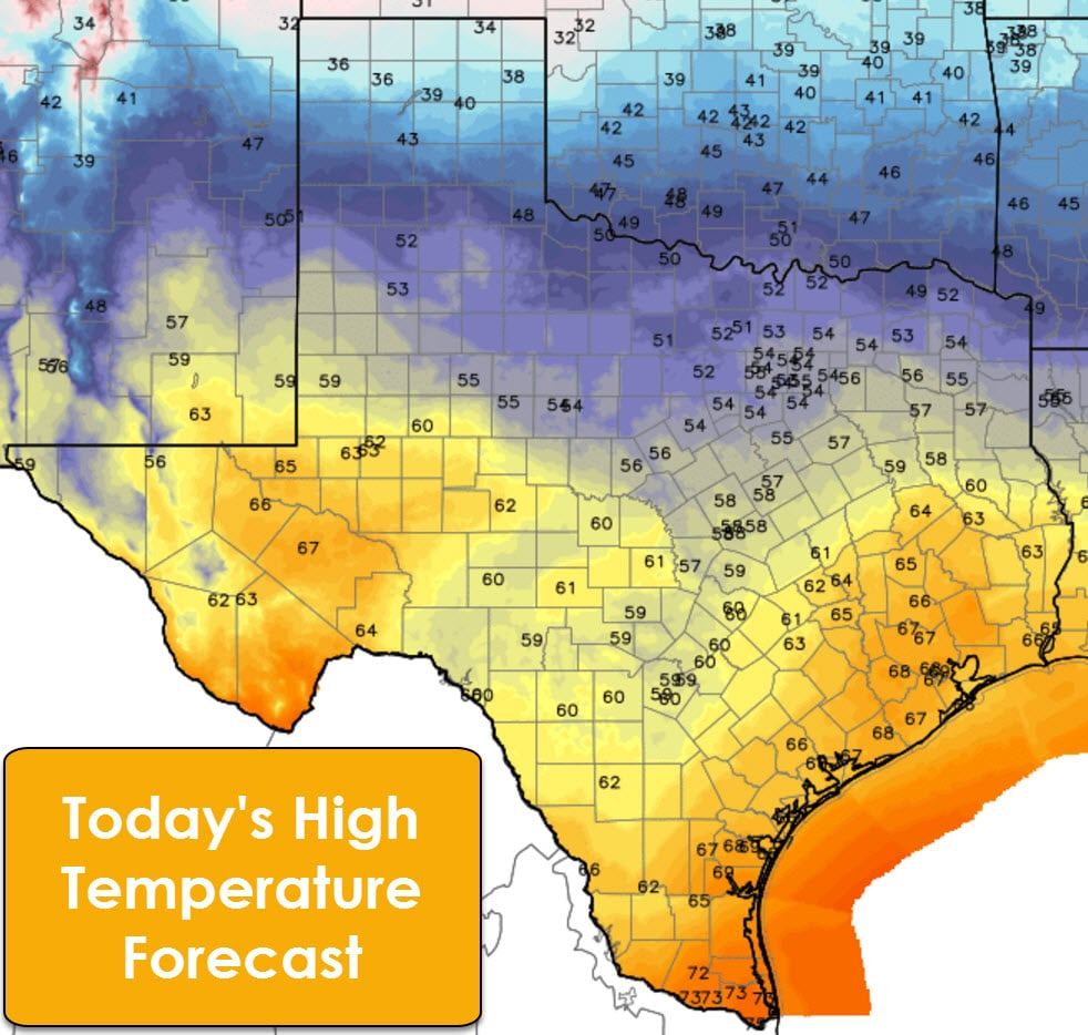
The southern half of Texas will enjoy high temperatures in the 60s and 70s today, but it’ll be pretty gloomy with a chance of showers. Still, enjoy the warmth because that’ll be changing tonight into Thursday. I will say that our upcoming arctic blast will taper off by Saturday with temperatures starting to moderate quickly. Arctic blast number two arrives around Wednesday of next week and will probably bring another batch of very cold air.
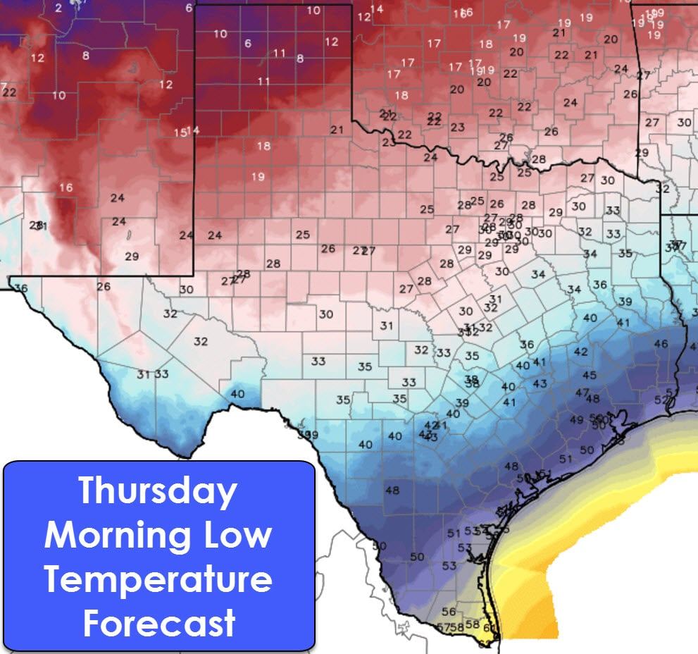
Winds will generally be out of the north across Texas by early this evening, but the actual cold front and associated air mass will be near the Red River extending into West-Central Texas. Temperatures north of the front will be falling into the 20s and 30s. By dinner-time temperatures in the Panhandle will be in the 20s with wind chills much colder than that. By midnight the front the front will be moving into the Permian Basin, the Concho Valley, and North Texas. The front will continue moving south during the morning hours Thursday. Conditions behind the front will be cold with gusty north winds and chilly wind chills. Thursday morning’s low temperature forecast generally reflects the position of the cold front quite well. Lows in the Panhandle will drop off into the single digits and teens with 20s as far south as the Permian Basin, Big Country, North Texas, and Northeast Texas.
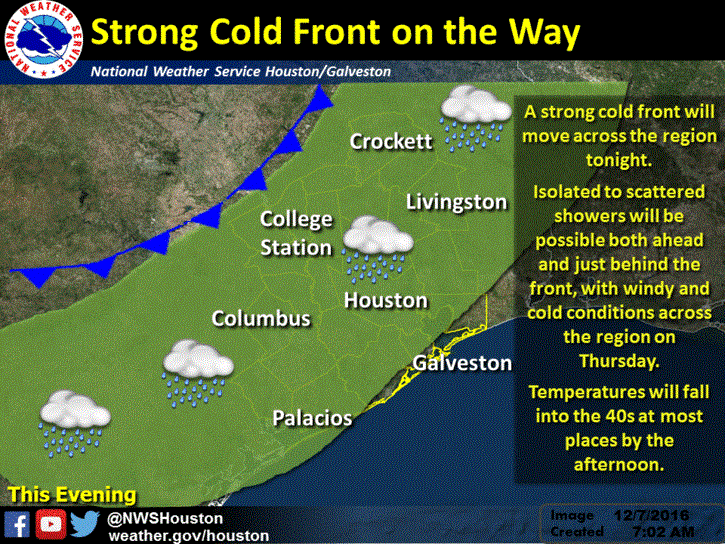
Showers will be possible along and ahead of the front tonight and Thursday as the front moves south. We’re not expecting heavy rain or strong storms, but some folks will undoubtedly get a quick soaking before much cooler air arrives.
A light winter mix is possible in portions of the Permian Basin, Concho Valley, and southwest sections of North Texas late tonight and on Thursday morning. Ground temperatures remain quite warm and we’re not expecting any impact to surface roadways. However, some icing of elevated surfaces may occur. This will be a low-end winter event and widespread issues aren’t expected. We’ll keep an eye on trends and post updates as needed.
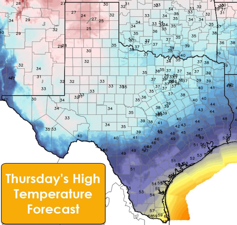
Highs on Thursday will not get out of the 20s in the Texas Panhandle. Temperatures won’t make it out of the 30s in West Texas, the Permian Basin, Concho Valley, Big Country, Northwest Texas, North Texas, Central Texas, into Northeast Texas. 40s can be expected as far south as San Antonio to Houston with 50s south of there.
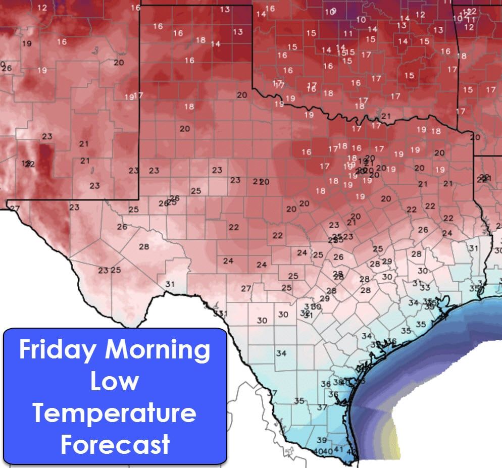
Friday morning will feature the coldest temperatures in two years for parts of the state – and the first freeze of the year for southern sections. Lows in the 10s can be expected in the Texas Panhandle, West Texas, Northwest Texas, into North Texas, and Northeast Texas. 20s expected into the Concho Valley, Central Texas, and Deep East Texas, the Permian Basin, and Borderland. 30s will be found in the remainder of Texas by Friday morning, including Southeast Texas, South Texas, and Deep South Texas.

With a hard freeze expected in the northern half of Texas its time to share a few common winter-safety tips. Turn off the outdoor sprinklers, leave the faucets dripping, bring the pets indoors, and make sure your elderly neighbors are in good-shape.
We’ll remain chilly on Friday, but will start to moderate on Saturday as our airmass moderates. Sunday through Tuesday will be warmer, but another arctic outbreak arrives around Wednesday of next week. That one looks like it’ll probably be a doozy as well.


0 Comments