
The chance for seeing wintry precipitation has increased for parts of the Big Country, Permian Basin and west central Texas Wednesday night into Thursday following the passage of an Arctic Front. Flurries will also be possible across portions of the panhandle region as well. Although amounts are expected to be light for most with minimal disruptions to travel, a few areas across the Big Country and Permian Basin region could experience icy and slushy patches overnight making travel dangerous. Folks in and around Big Spring, Midland/Odessa, Pecos, Van Horn and Ft. Stockton will see the greatest chance of seeing accumulating ice and snow overnight Wednesday into early Thursday morning. Temperatures across this region are also expected to remain in the 30s on Thursday which means little chance for melting of any accumulating icy precip until late in the day. As usual, elevated surfaces such as bridges and overpasses will be the most impacted. Heavily traveled roadways will likely see fairly dry conditions during the day on Thursday, but caution on less heavily traveled rural roadways is advised especially through the morning hours.

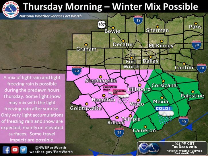
Further east across west central Texas and for areas immediately southwest of the DFW metroplex, a wintry mix of flurries and freezing rain will be possible early Thursday morning…mainly along and west of the I-35 corridor. Again, travel impacts are expected to be minimal with only light accumulations mainly on elevated surfaces. The immediate Dallas/Ft. Worth metroplex is not expected to see any issues with winter weather at this time, but we are keeping an eye on it in case this forecast changes!


0 Comments