
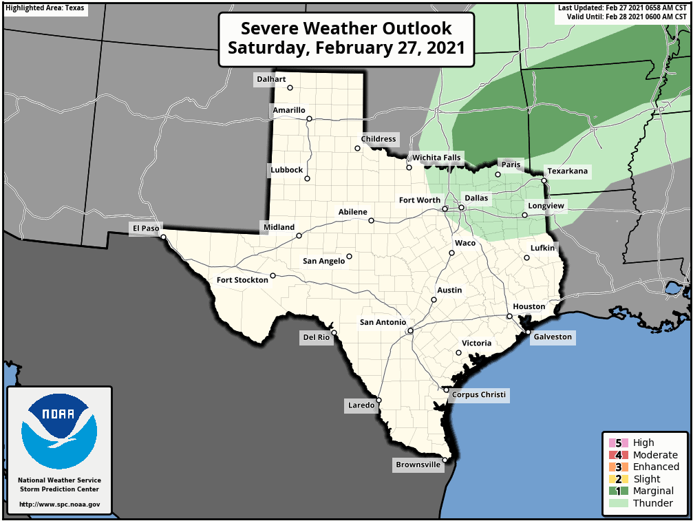
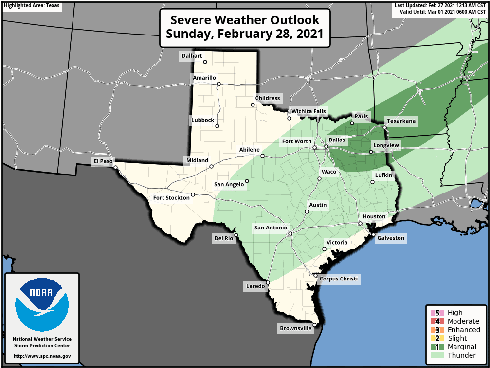
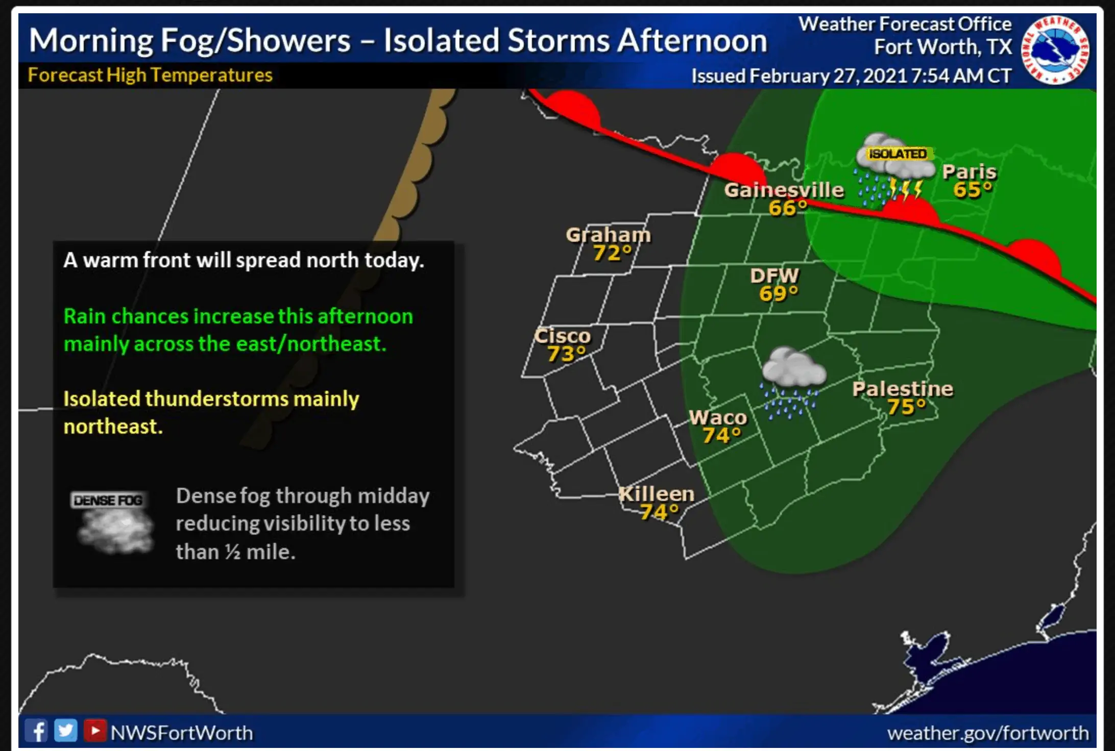
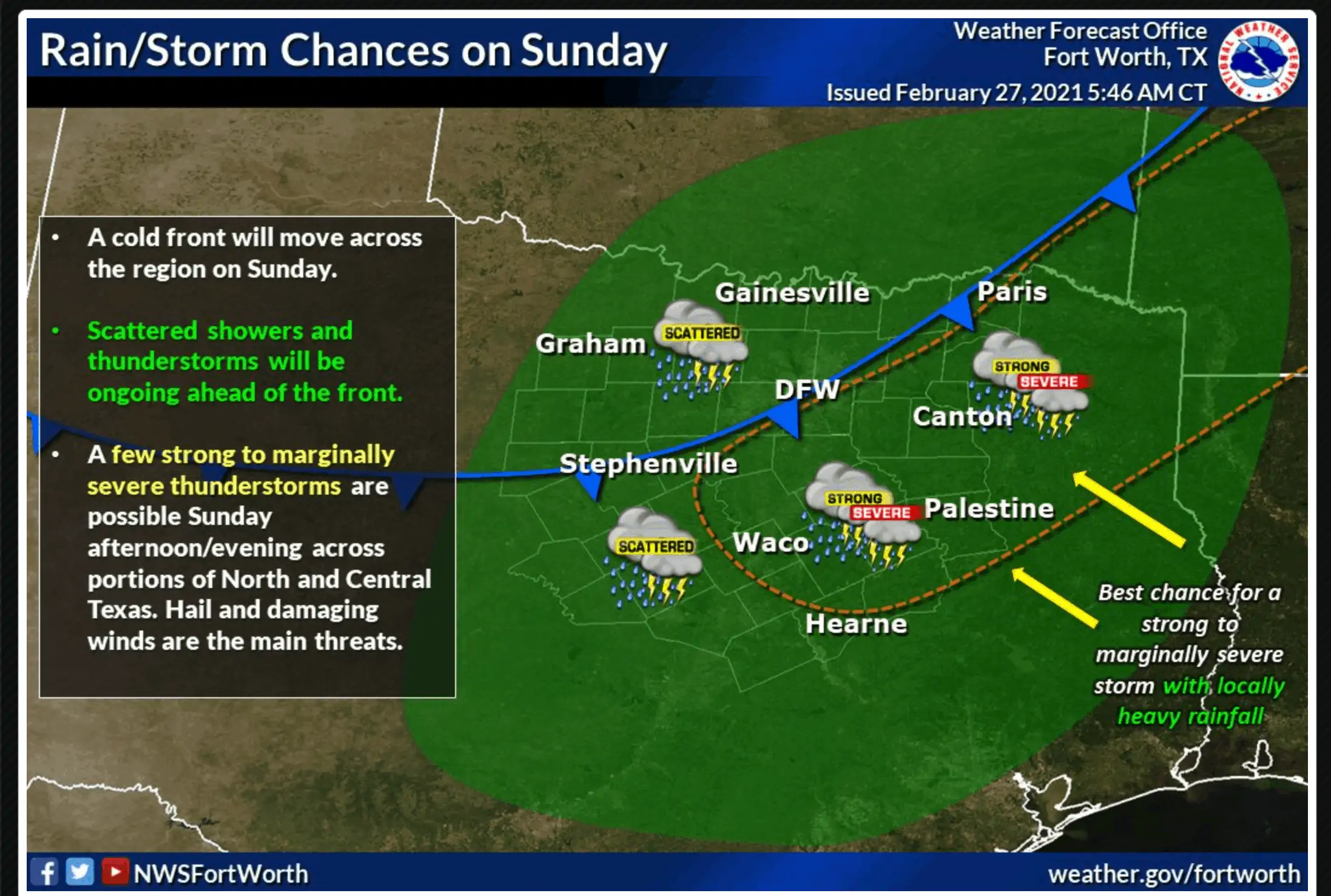
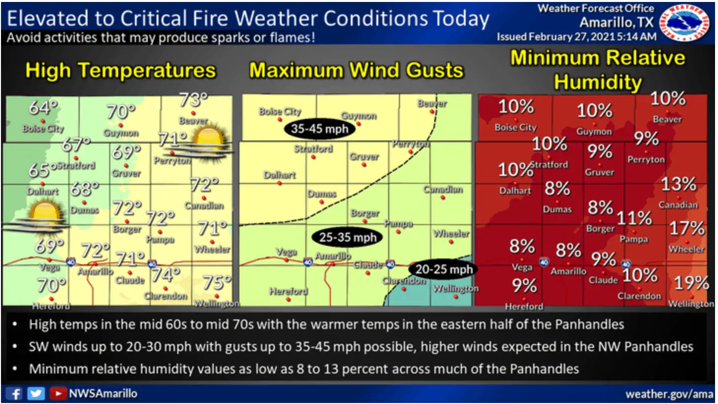
Our main weather hilights for this weekend will be the chance for scattered showers and storms across central, northern and northeast/eastern Texas and the arrival of a cold front on Sunday. For today, expect to see continued fog and drizzle across much of the Hill Country, Central Texas, North and Northeast Texas through at least the late morning early afternoon hours. As we transition into the early afternoon hours, expect to see a gradual uptick in scattered pockets of rain and marginally severe storms mainly east of I-35/ I-45 and north of I-20. The risk for seeing any severe weather today is very low, but we can’t rule out one or two more robust storms with small hail, frequent lightning and gusty winds. By Sunday morning, our next cold front will be moving into parts of western north Texas and we’ll have slightly better chances for seeing strong to severe storms mainly across Central, North and Northeast Texas during the afternoon hours on Sunday. For Sunday, the Storm Prediction Center has placed a Marginal Risk (Level 1) indicator for Northeast Texas. Storms on Sunday will have access to better instability and we’ll see a greater chance for seeing a few robust cells with the chance for quarter size hail. Across parts of the Texas panhandle region, we’ll see dry and very windy conditions with Critical Fire Weather conditions in place today for counties north/northwest of Amarillo. Ongoing drought conditions across this area have left the region quite dry with plenty of dry vegetation. Please be careful with anything that could cause a spark or fire there today!
Severe Weather Outlook Saturday and Sunday
Thunderstorm Chances Saturday and Sunday
Elevated to Critical Fire Weather Today
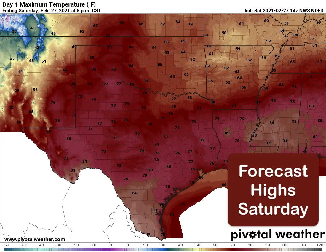
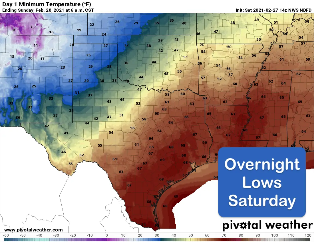
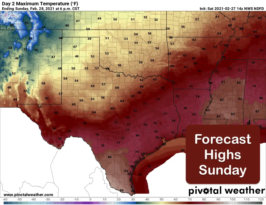
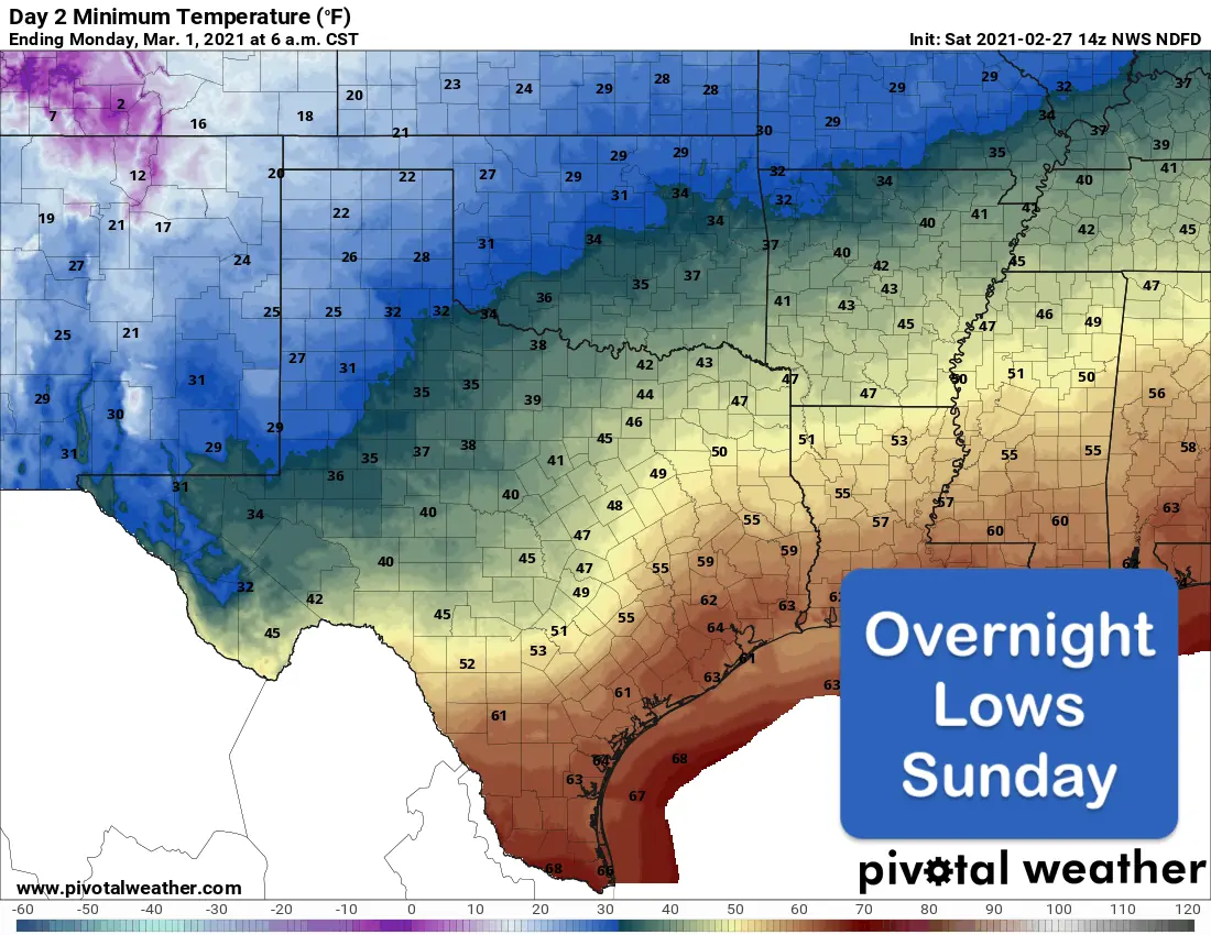
Even with overcast skies today across a large portion of the state, our forecast highs will be quite pleasant. A cold front will begin moving into the panhandle region later this evening and continue to ooze south and east overnight. This will be a slow-moving front that will take until at least late Monday to make it to our coastal counties. Temperatures behind the front will drop us back down to seasonal temperatures with a gradual warm up expected by mid to late week next week.
Your Weekend Temperature Forecast


0 Comments