
An arctic cold front will continue pushing south through Texas today. At 2 PM, the leading edge of the front will be near Midland to San Angelo to Hillsboro to Mount Pleasant. Temperatures will drop into the 40s and 50s within an hour of the front’s arrival. We’re thinking the arrival time for the cold front in Austin and Bryan will be around 6 PM, Between 7 and 8 PM for San Antonio, and a little before 10 PM for Houston. North winds will gust up to 40 MPH behind the cold front.
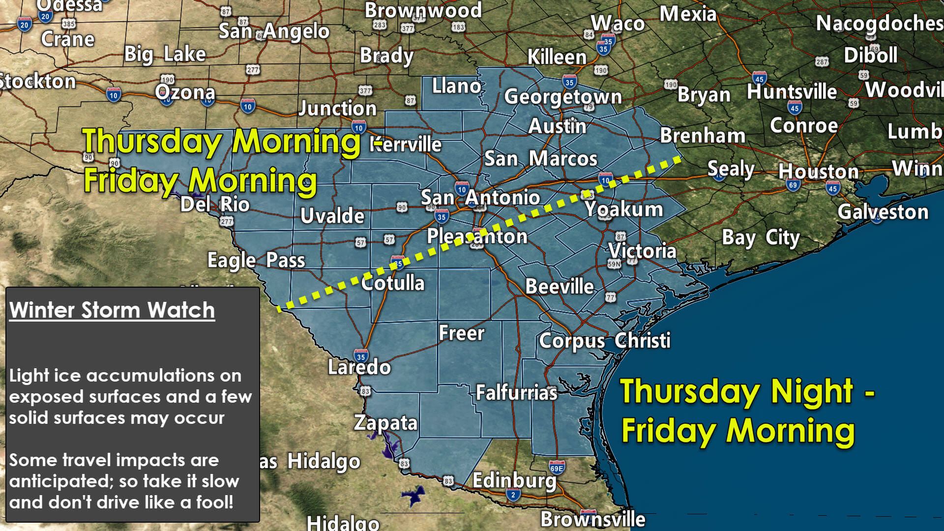
A Winter Storm Watch is in effect beginning at 6 AM Thursday through 6 AM Friday for the Hill Country and South-Central Texas.
A Winter Storm Watch is in effect beginning at 9 PM Thursday through noon Friday for all of South Texas, the Coastal Bend, the Coastal Plains, and Deep South Texas.
WHAT & WHEN
There is the potential for a mixed-bag of winter precipitation. Rain may mix with, or change over to, freezing rain and sleet. A little snow cannot be ruled out, especially across the northern Edwards Plateau and Hill Country Friday morning. We’ll also have to watch for freezing drizzle – which can be problematic for elevated surfaces. As temperatures climb above freezing, precipitation will change back over to rain by lunchtime on Friday.
ACCUMULATIONS & IMPACTS
Combined ice accumulations (freezing rain and sleet) could total between a trace (0.01″ inch) up to fifteen-hundredths of an inch (0.15″) on exposed surfaces and a few solid surfaces. Slick and hazardous conditions are possible on some bridges, overpasses, and elevated roadways. Spotty ice cannot be ruled out on surface roadways, though warm ground temperatures will likely initially limit that potential. If they occur, heavier bursts of frozen precipitation could overcome the ‘warm ground temperature’ effect. Temperatures will rise above freezing by lunchtime Friday, changing any ongoing precipitation back over to rain with a few sleet pellets.
DISCUSSION
A complex and rather headache-prone (at least for the ones making it!) weather forecast is in the cards over the next two days. National Weather Service offices across Southern Texas have hoisted winter storm watches to raise awareness over the potential for travel issues at times tomorrow into Friday morning. Surface temperatures will be falling tomorrow as colder air continues to filter in behind an arctic cold front. An upper-level storm system will move overhead tomorrow night, providing the necessary ‘lift’ to create precipitation.
Where surface temperatures are below freezing, we’ll likely see rain change over to freezing rain. Some sleet may also occur. It’s all going to be about the temperatures. If we end up staying a few degrees warmer, the chance for frozen precipitation and travel impacts will be more limited. If temperatures end up falling more quickly than expected, we could see widespread freezing rain and sleet tomorrow night well into Deep South Texas and into the Coastal Bend.
Weather model data has trended slightly colder overnight, so we’ve seen an increase in the chance for frozen precipitation across South Texas tomorrow night.
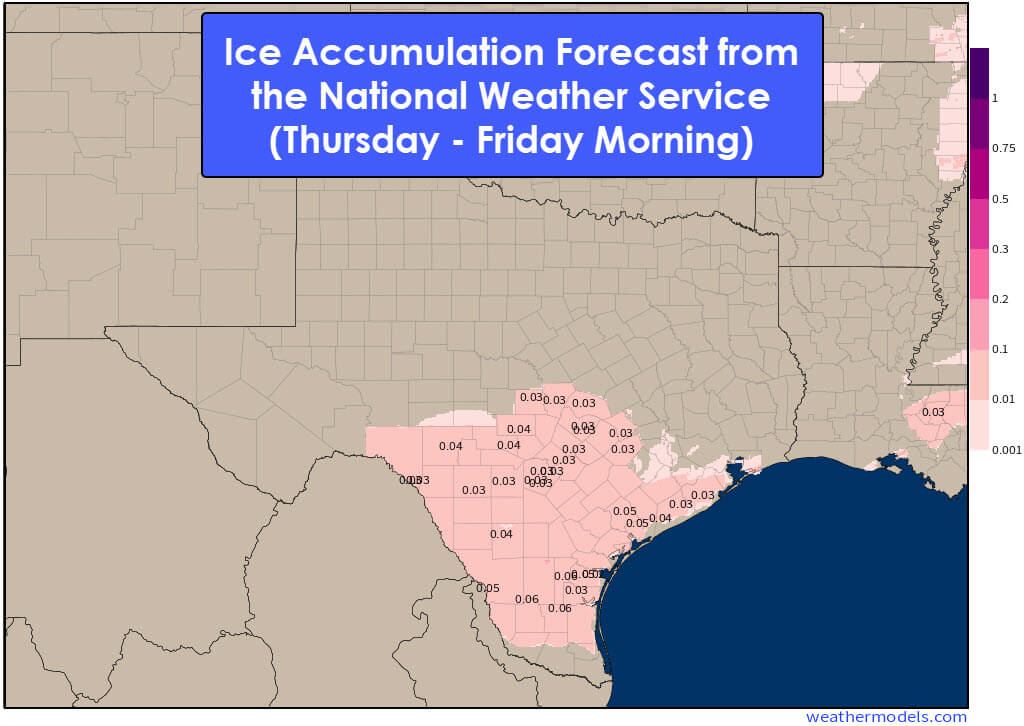
Overall precipitation amounts are anticipated to be on the light side. As discussed above, ice accumulations between a trace up to one-tenth of an inch will be possible on exposed surfaces. We generally need to see ice accumulations above one-quarter inch to three-tenths of an inch before damage to power lines and trees occurs. Our upcoming winter mischief seems to be primarily a travel-impact scenario versus a more significant ice storm that damages infrastructure.
Temperatures will climb above freezing by lunchtime on Friday. Although a few sleet pellets may mix in, any ongoing precipitation will change over to rain. Once surface temperatures rise above 32 degrees Fahrenheit or 0 degrees Celsius, we’ll start seeing any accumulations melt off on Friday.


0 Comments