
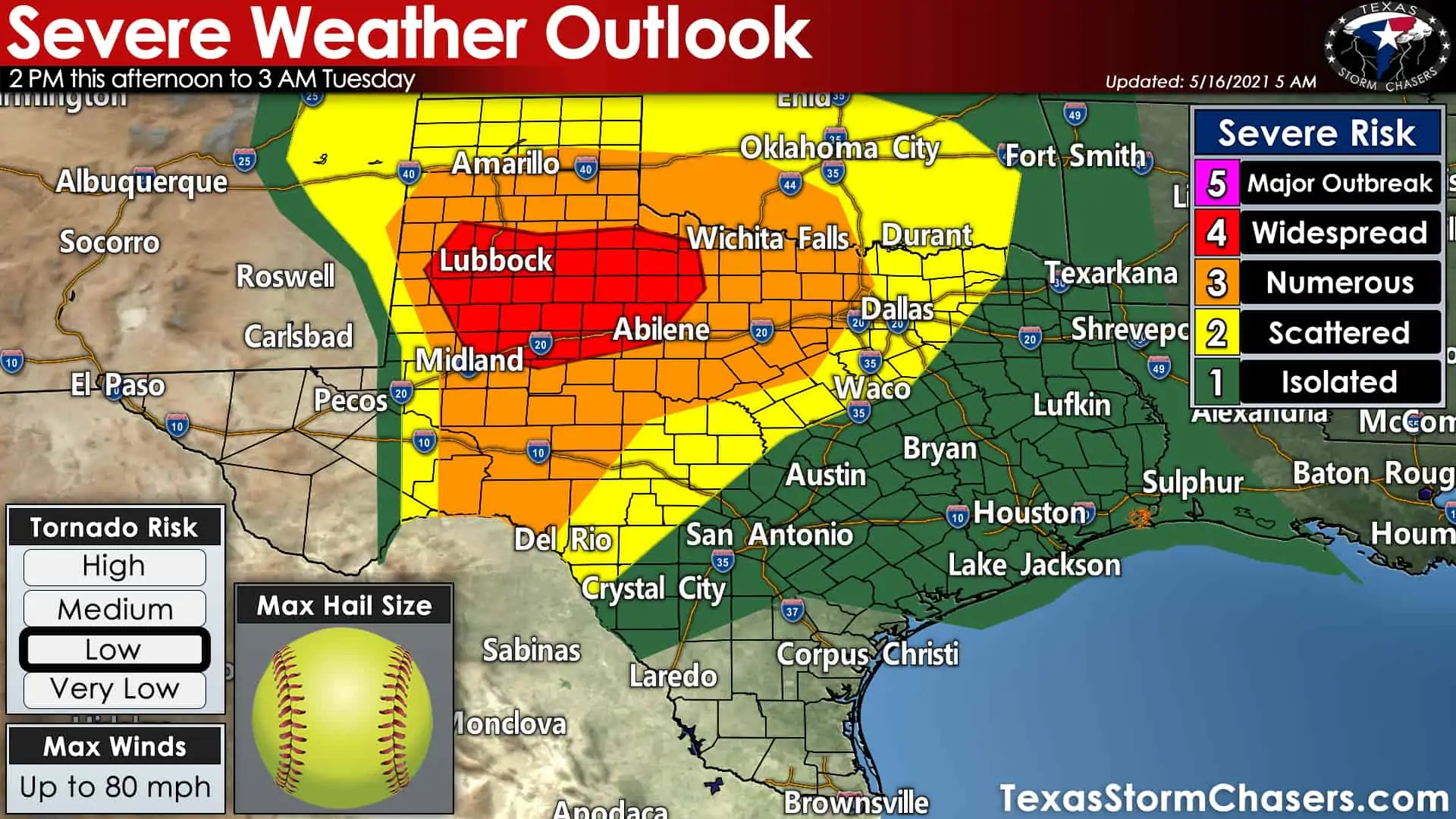
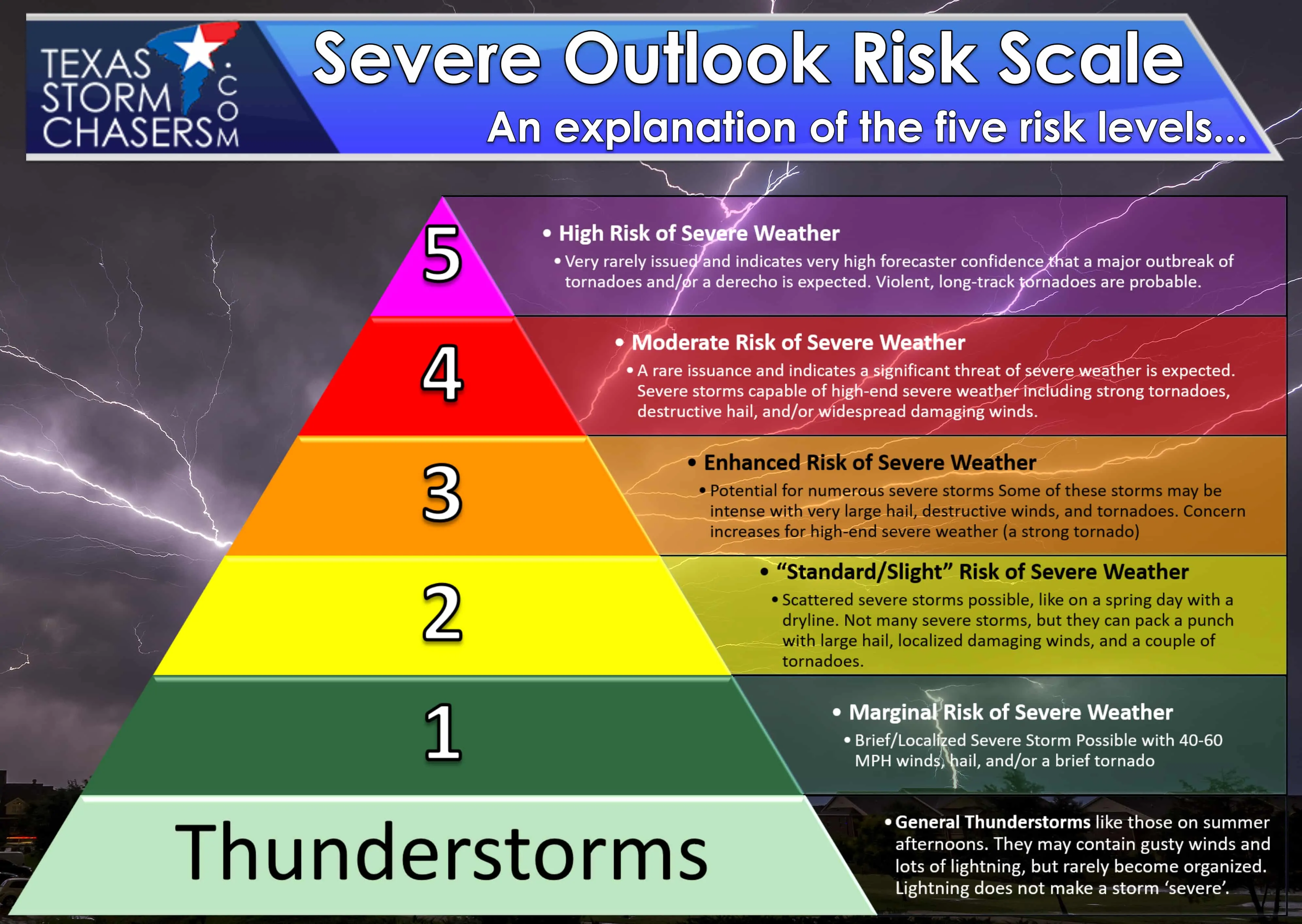
Another active day of severe thunderstorms is expected across the western half of Texas. The Storm Prediction Center has added a level four (out of five) risk for widespread severe storms across West Texas, Northwest Texas, the northeastern Permian Basin into the Big Country. A level three (out of five) risk for numerous severe storms includes the Concho Valley, southern Texas Panhandle, and North Texas west of Interstate 35/35W into the western D/FW Metroplex. Comparatively lower risk levels, indicating fewer/lower chances for severe storms, encompasses Northeast Texas, East Texas, Southeast Texas, the Brazos Valley, all the back southwest to near Laredo. The higher your risk level – the more likely it is to have a severe storm in your area later today and tonight.
Threats
While a few tornadoes are possible this afternoon and evening, today’s higher severe weather probabilities are based on large hail chances. The Storm Prediction Center highlights the higher hail threat by saying, “As mid-level flow increases during the evening, there is reasonable confidence that numerous hail-producing supercells could merge into an MCS that will propagate toward north-central TX.”
Today’s overall tornado threat is low but could be locally enhanced in proximity to an outflow boundary draped across West Texas and Northwest Texas later today. By far, we expect many times more hail-producing thunderstorms versus tornadic storms. In Texas in May – this is a fairly typical severe weather setup that is favorable for numerous hail-producing storms. That being said, the most intense supercells today could produce giant hail up to the size of softballs (most won’t, but don’t tempt Mama Nature).
Timing
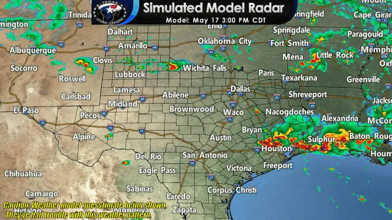
Simulated weather model radar from this afternoon through early Tuesday morning. Use this with some common sense; it is only a guesstimate, and this model has had some difficulties with the ongoing weather pattern. (In other words, Mama Nature has been trolling)
Scattered supercelluar thunderstorms are expected to develop between 2 and 4 PM this afternoon in the southern Texas Panhandle, West Texas, and Northwest Texas. Storms are expected to become numerous by or shortly after dinner-time. Most storms will be capable of producing hail – with the most intense storms producing destructive hail. Damaging straight-line winds and a few tornadoes are also likely, especially with any storms crossing an outflow boundary (which will become a focal point of storm development).
By tonight, we expect storms to grow upscale into one or more thunderstorm clusters. Those storms are expected to push into Oklahoma and North Texas. Large hail will continue to be likely with the more intense cores, but damaging straight-line winds will also become more likely.
Brief tornadoes and heavy rainfall are also threats with the thunderstorm complex/squall line tonight. Thunderstorms should weaken as they move east toward Interstate 35 late tonight but may continue to be severe through the D/FW Metroplex. Additional thunderstorms capable of producing hail, gusty winds, and flash flooding may redevelop overnight in West Texas, the Big Country, and the Permian Basin. While thunderstorm coverage will remain high late tonight into Tuesday morning, the overall threat of severe weather should decrease after 2 AM.
So begins a week of heavy rain & storm chances.
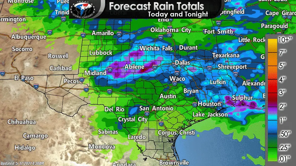
Today marks the continuation of what will become a week-long precipitation event. It won’t rain all the time or every day, but we’re looking at some pretty hefty rainfall totals. The animation above shows forecast rain totals over the next five days. It does not include any rain that fell yesterday – everything shown is for the upcoming forecast. Flooding will become more likely tomorrow night through Thursday morning from North Texas and the Hill Country east into Southeast Texas and East Texas. We’ll address the upcoming heavy rain event(s) in a separate blog post later today.


0 Comments