
Good morning and happy pre-Christmas weekend to everyone! A strong cold front is currently moving south through the state. As of the time of this writing, it’s currently draped from about Longview down into the Austin area and west towards Rocksprings. It will continue to push south today making it through the Houston/Galveston area by early to mid-afternoon and Corpus by mid to late-afternoon and Brownsville by around sunset.
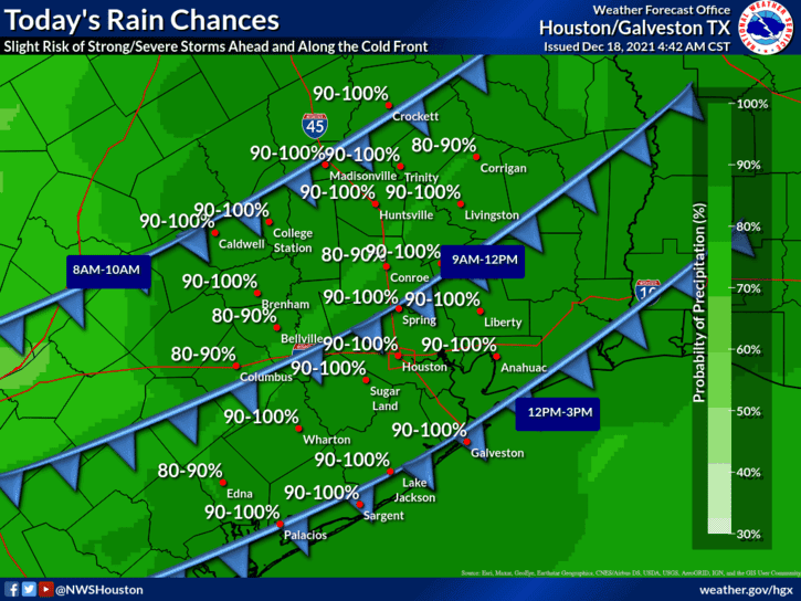
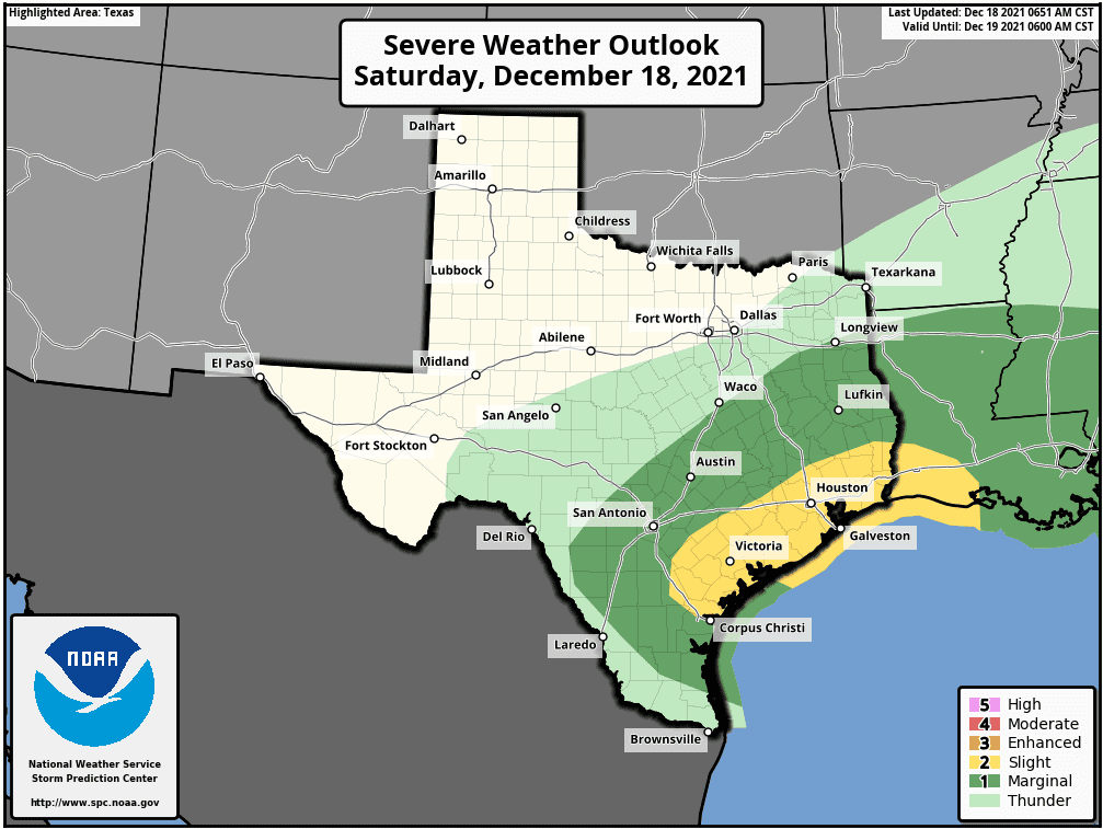
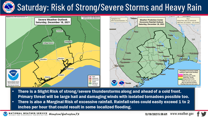
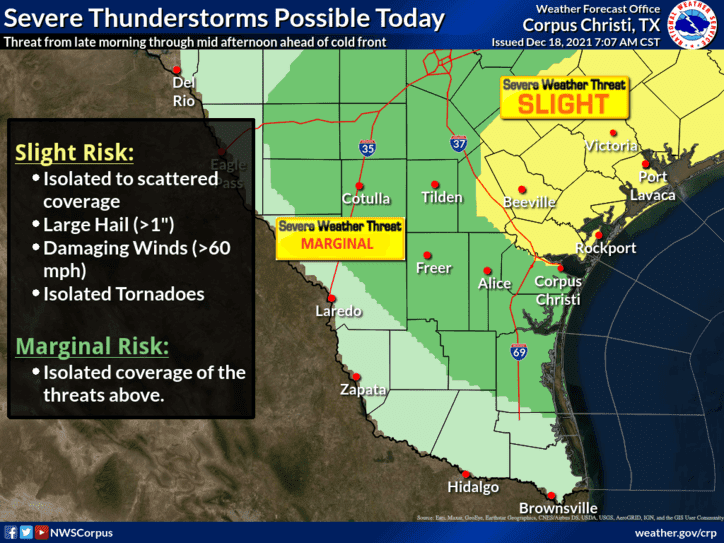
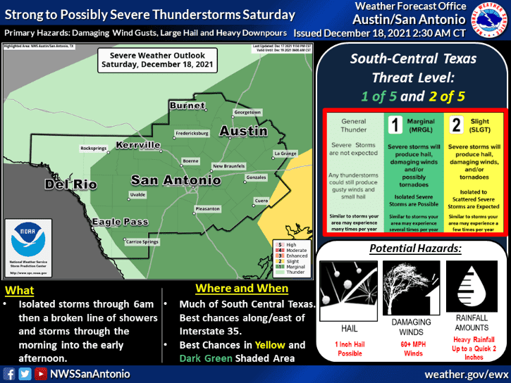
Ahead 0f the cold front, there will be sufficient instability in place for scattered strong to severe storms this morning and through the afternoon hours across much of central, southeast and coastal Texas. The Storm Prediction Center has placed parts of central, coastal and southeast Texas under a Slight Risk (Level 2) for severe weather today. The main threats will be gusty winds, hail and heavy rain with the potential for flooding with any of the more robust storms that develop later this morning and through the afternoon hours. There is also a risk for a tornado spin-up, especially for much of the Houston/Galveston/Beaumont corridor. The risk of tornadoes is not all that high, but it is worth watching this afternoon as storms move into the area coincident with peak daytime heating and instability. If you live in this region, keep an eye on the weather this afternoon and have a way to receive severe weather notifications should any be issued for your location. By midnight, all of the mischievous weather should have moved offshore and we’ll be in for a much quieter remainder of the weekend.
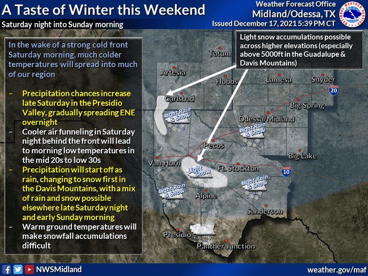
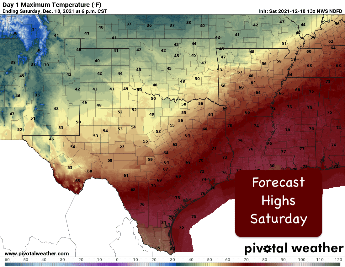
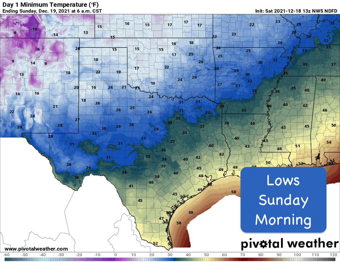
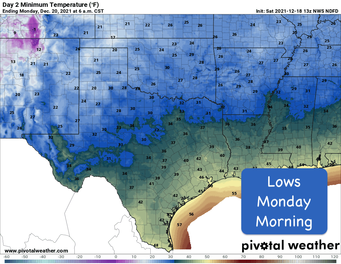
Temperatures behind the front today will be dropping off rather quickly accompanied by a stout north wind. Overnight, temps across the panhandle, west Texas, and northwest Texas will drop down into the teens and 20s. Upper 20s and 30s will be widespread across north and northeast Texas and into parts of central Texas. Coastal and deep south Texas will see lows drop into the mid 40s to low 50s by Sunday morning. Snow is also possible overnight into Sunday in parts of far western Texas, especially in the higher elevations of the Davis and Guadalupe mountain ranges. Warm ground temps will keep accumulations light in the lower elevations, so we really should not see any major impacts with travel. Still, keep an eye out for those random frozen spots especially on any bridges or overpasses!
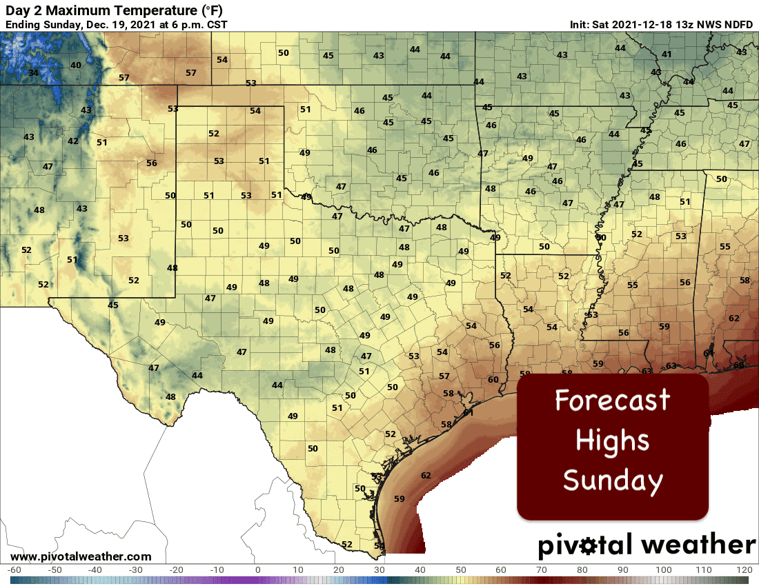
Sunday’s weather should be much nicer and quiet. We’ll still be pretty darn chilly with highs ranging from the mid-40s to mid 50’s statewide. Rain chances Sunday and Sunday night will be mainly across far southwest and south Texas as a weak upper level disturbance moves out of northern Mexico and into the region. At this time, no severe weather is expected.


0 Comments