
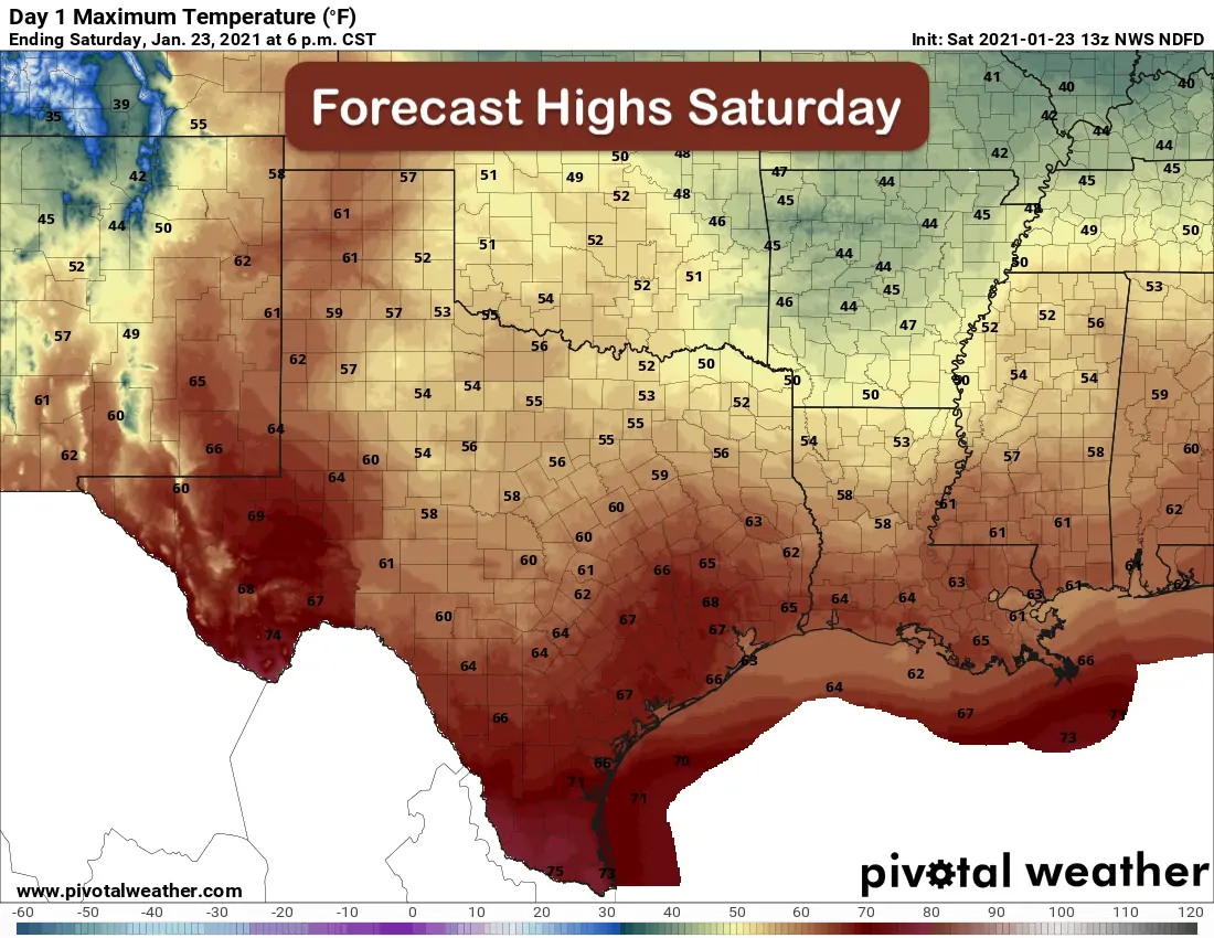
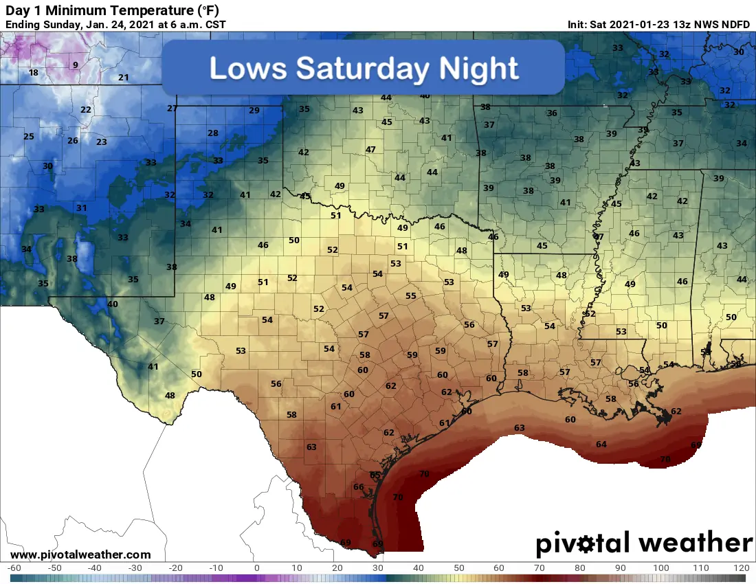
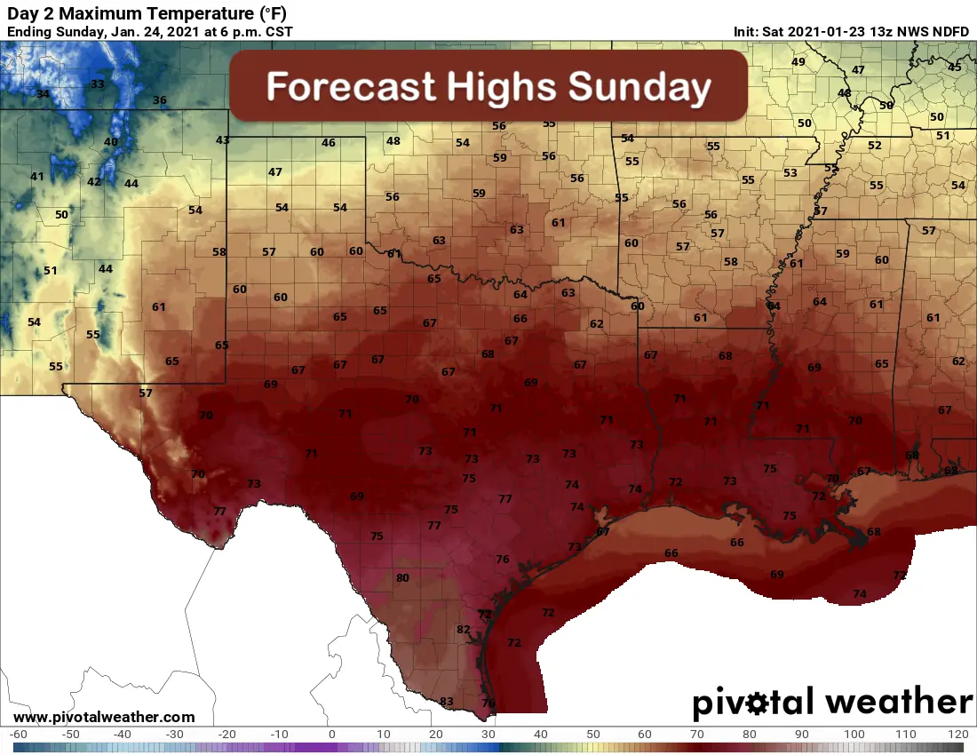
Good morning and happy weekend to everyone! Quiet conditions are expected today, tonight and most of Sunday before our next round of storms. Clouds will be persistent today across all but far western Texas and down into the Rio Grande valley where we may see clouds erode and temperatures warm up quickly. On and off foggy drizzle and an overall dreary winter day can be expected for pretty much everyone else. Our forecast highs today will be above what we typically see this time of the year with highs generally in the 50s and 60s across the state. As usual, the warmest conditions will be found across deep south and the Big Bend region where highs today will be in the low to mid 70s. Our overnight lows will remain on the mild side for this time of the year despite a weak cold front which pushed offshore yesterday. This frontal boundary will shift back north tomorrow as a warm front, so we’ll see even warmer forecast high temperatures…a good 15 degrees above normal for many areas by Sunday afternoon. Honestly not a bad weekend, despite the dreary conditions, to be outdoors. Another cold front will sweep through the area Sunday night into Monday, but it will not be very cold and will have only a minimal impact on temperatures to start the next work week.
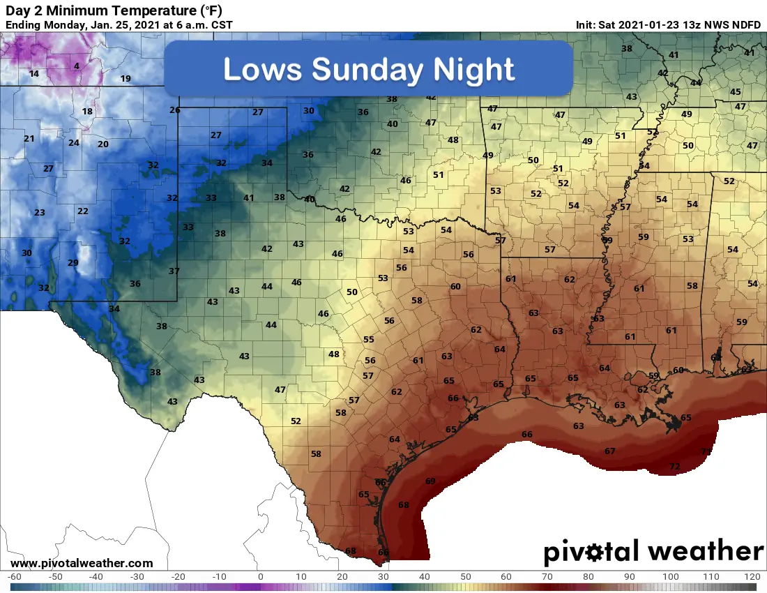
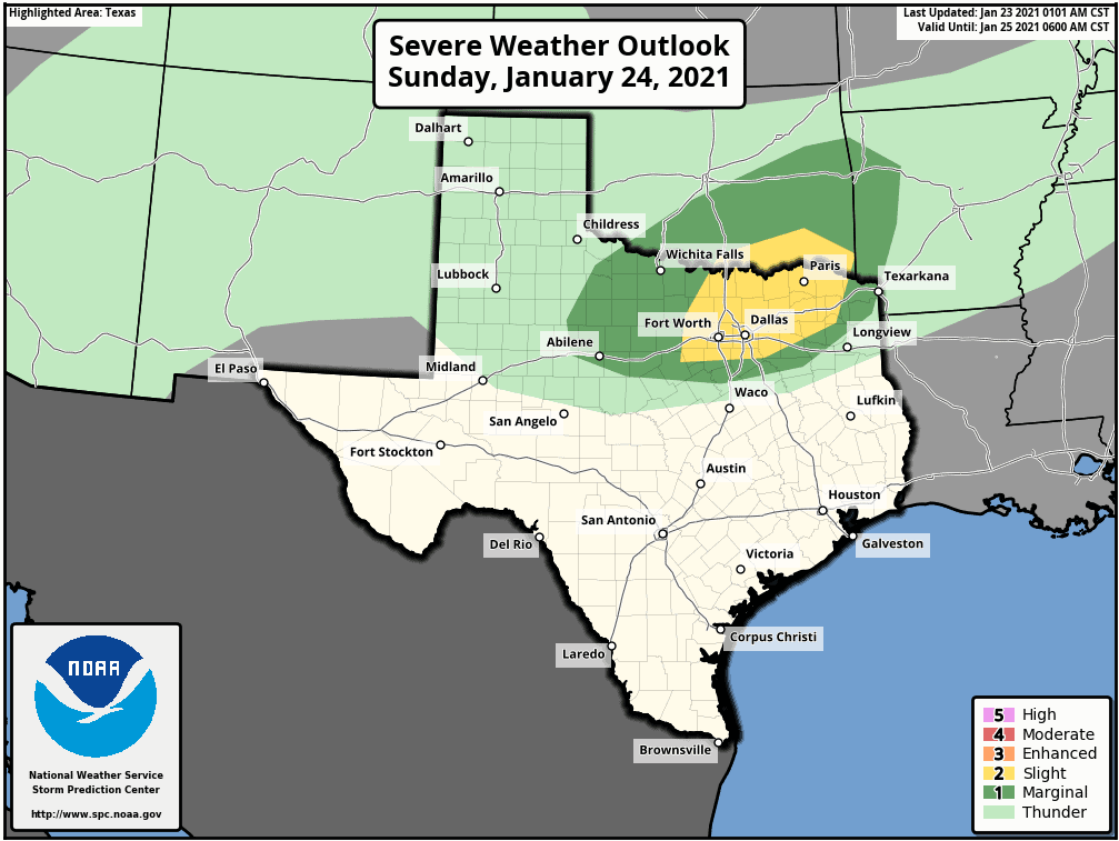
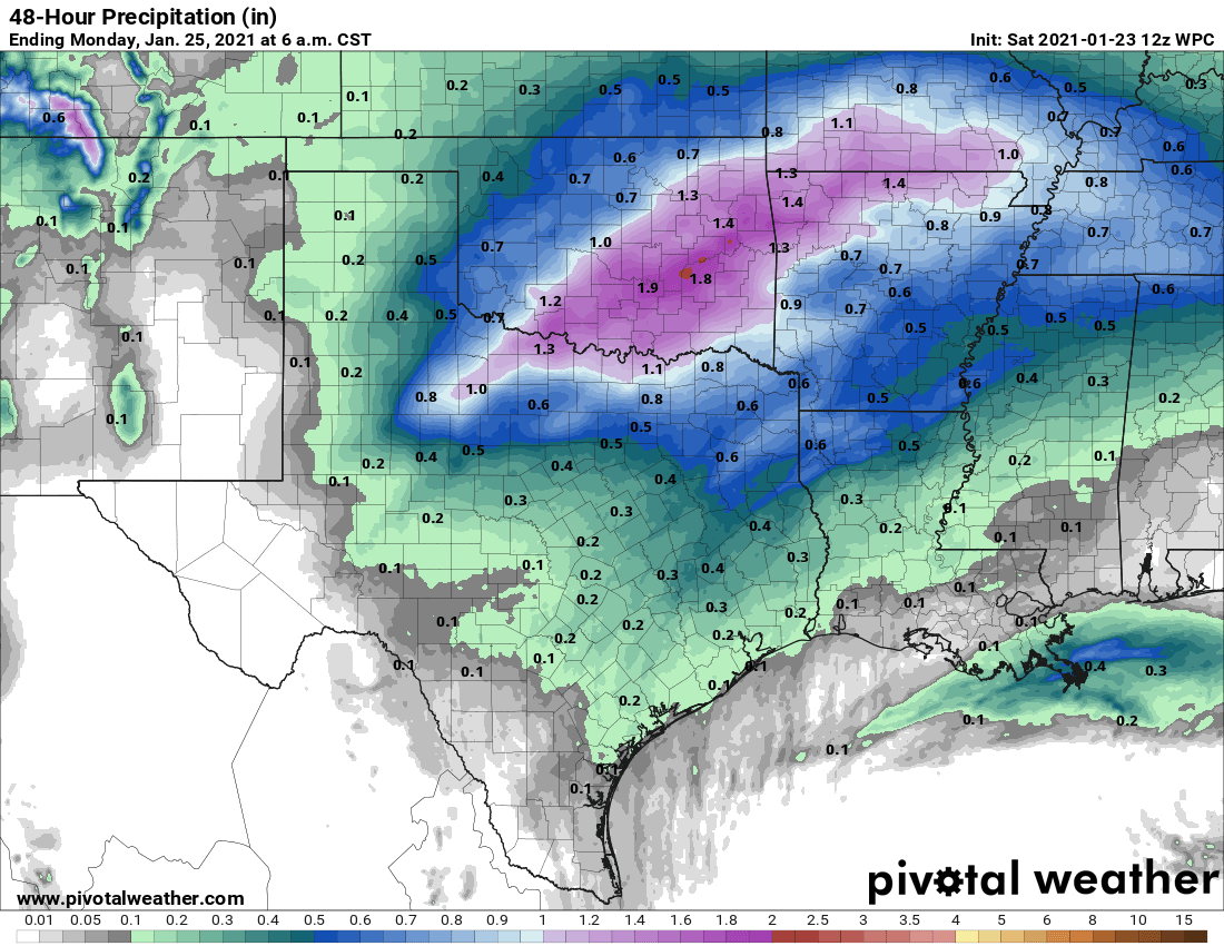
As mentioned yesterday, we’ve been keeping a close eye on the forecast for late Sunday into early Monday for a conditional threat of severe weather. Conditional meaning, a few things would have to come together atmospheric-wise, to bring a larger threat for severe storms. As it stands now, that threat is looking low, but it’s not a non-zero threat, so the Storm Prediction Center has outlined portions of north central and northeast Texas under a Slight Risk (Level 2) for Severe Storms. A Pacific cold front will sweep through the state from west to east Sunday night which will increase the chance for strong to severe storms across north central and northeast Texas during the overnight hours. We will begin to see an uptick in showers from south to north Sunday afternoon. Most of these showers will remain below severe levels with a strong atmospheric capping inversion in place. If we can get any storms to form at all, they will struggle to stay organized with the capping inversion firmly in place and strong wind shear that will interfere with the development of thunderstorm updrafts. The greatest chance for severe weather will be along the Pacific cold front as it sweeps through overnight Sunday into the wee hours on Monday morning. With the passage of the front, we’ll see the atmospheric cap quickly eroded which will allow stronger storms to develop along the leading edge of the frontal boundary across north and northeast Texas. Hail will be the primary threat within any of the strong storms. As the threat will be during the night, have a way to receive weather warnings should any be issued for your location. Make sure you have your weather radio ready to go, or if you receive weather alerts on you cell phone, make sure the volume is set high enough to wake you up! Rainfall amounts look pretty good across north Texas Sunday night into Monday with a quick 1/2 to 1 inch possible across the region.


0 Comments