
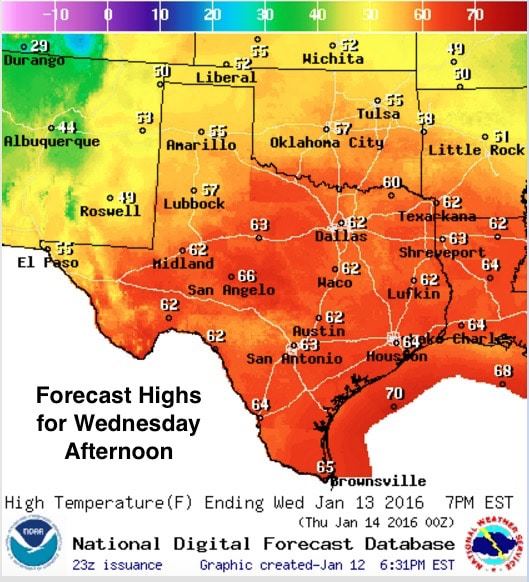
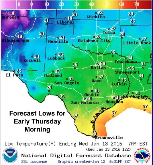
Wednesday is shaping up to be another beautiful day across a majority of the state. We’ll see the return of cloud cover and rain chances by tomorrow evening for deep south Texas and along the central Texas coastal plains, but everywhere else, skies will be mostly clear with no chance for rain. Temps will be above average once again tomorrow and through early Friday before the first of two cold fronts impact the region.
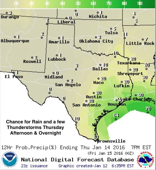
The chance for rain, and possibly a few thunderstorms mixed in, will return by Thursday afternoon ahead of cold front #1 which will arrive in tandem with a weak-ish upper level disturbance. We won’t have much to work with in regards to instability, so widespread coverage of strong storms is not expected. Rain chances will be highest along the coast, decreasing in probabilities the further north you get. Cold front #1 will knock temps down a few degrees overnight Thursday into Friday, but for the most part will do little more than shift our winds from the west/northwest and drag drier air into the region.
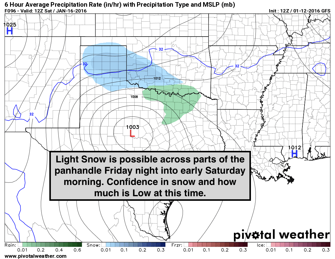
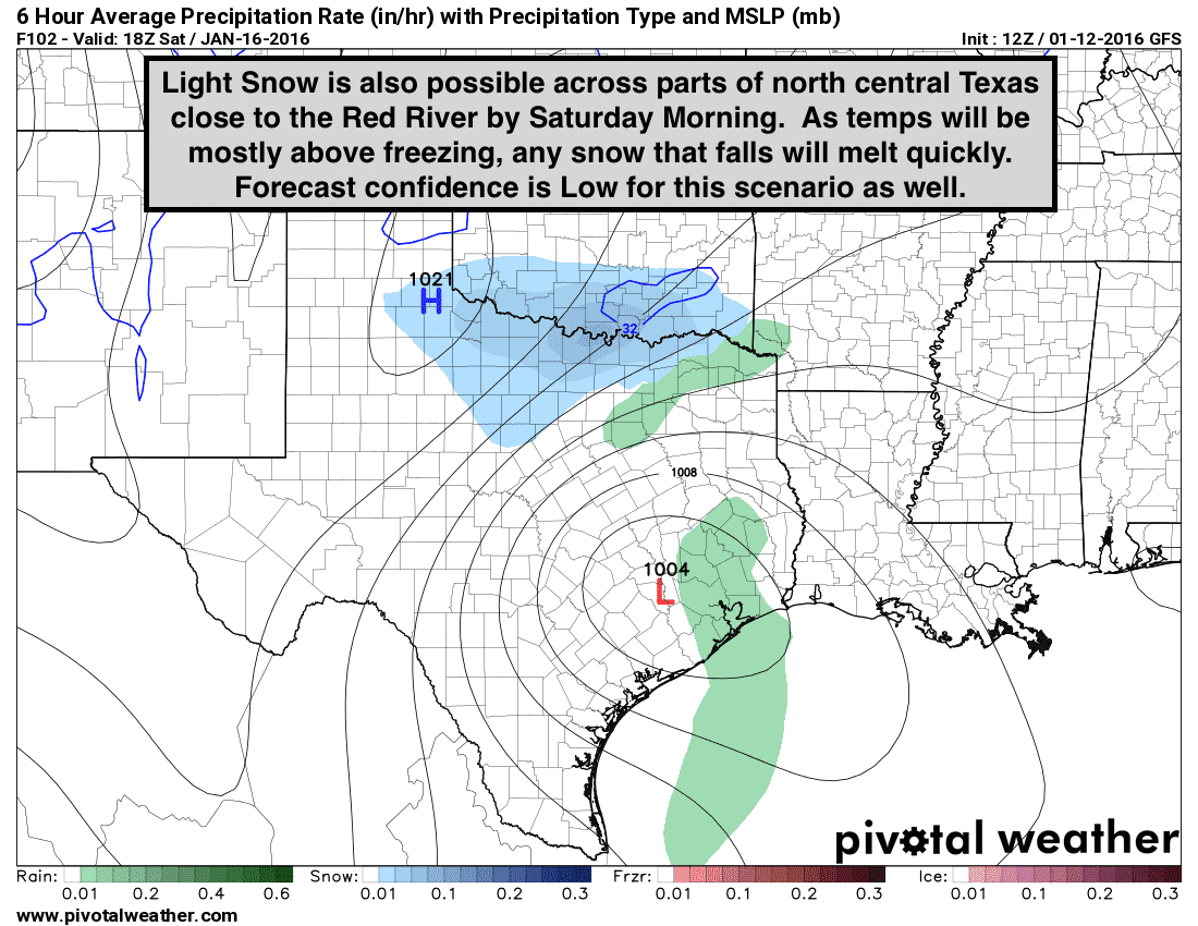
The forecast for this coming weekend…Friday night through Saturday…remains a bit unclear. We are expecting cold front #2 to arrive late Friday into early Saturday, and it is forecast to be much stronger than Thursday’s front. What remains unclear is will the next upper level disturbance be enough to generate winter weather across the northern half of the state. Since the forecast models for the past several days have been flip flopping back and forth on this probability, forecast confidence for any snow and how much snow is fairly low at this time. Both models have been presenting a fair amount of disagreement on where the coldest air…basically the 32 degree line…will be at the time precip is still falling late Friday and through Saturday. It seems reasonable to assume that the cold air will likely outrun any of the forecast model timing because it frequently does, so we may very well have sufficient cold air in place in time for the precip to begin falling…but that’s not the only issue. What isn’t as easy to assume right now is where the upper level disturbance will be, and will it have enough lift and wrap-around moisture to generate widespread precipitation. Yesterday, the forecast models were much more generous with the precipitation; however for today, much less so…almost a complete 360 degree difference. So, with a “split down the middle” assumption that the atmosphere may be able to squeeze out a little bit of precip, most of the local forecasters are going with a slight chance of light snow across the panhandle late Friday and possibly some light snow along the Red River counties by Saturday morning. The surface temperature profiles across the Red River counties, and for the counties surrounding the DFW metroplex, all look to be too warm for any snow to stick. So, IF we get any snow, it will likely be mixed with rain and will melt right away. This will bear watching closely as better data feeds into the forecast models over the next couple of days. That said, assume there will be some updates to what you’re seeing below.


0 Comments