

Today may end up being the nicer ones this week with warmer temperatures. Highs this afternoon will top out in the 60s from the Permian Basin and Northwest Texas and points south and east. The Texas Panhandle and South Plains of West Texas will reach the 50s today. The Rio Grande Valley should peak out around 70 degrees. Overall its going to be a great day with mostly sunny skies. The only exception to that will be South Texas and the Rio Grande Valley where skies will remain mostly cloudy.
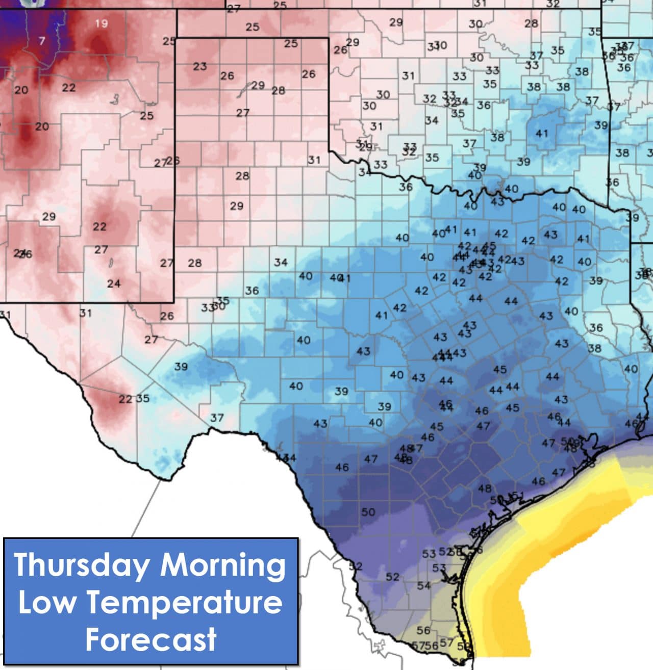
Temperatures tonight will be cold across the Texas Panhandle, South Plains, into the western Permian Basin and Alpine Mountains with 20s expected. The Concho Valley, Big Country, North Texas, and Central Texas will drop off into the upper 30s to mid 40s. South-Central Texas, South Texas, and the Rio Grande Valley will be in the upper 40s to upper 50s.
Rain chances will increase late tonight into Thursday across the Rio Grande Valley, Deep South Texas, and Coastal Plains. An area of precipitation across the western Gulf of Mexico and northern Mexico will move northeast. The heaviest rain totals, up to half an inch, will be across the Rio Grande Valley and immediate coastal areas. A majority of precipitation will remain off-shore. Rain chances on Thursday will expand northeast to include Southeast Texas. Like tonight I expect most rain to remain off the coast with the most likely locations to get wet being coastal locations. Isolated to widely scattered showers will be possible on Thursday across South-Central Texas, the Brazos Valley, and East Texas. No severe weather or flash flooding is expected at this time. A few showers will remain possible on Friday across East Texas and Southeast Texas along with above-average temperatures.
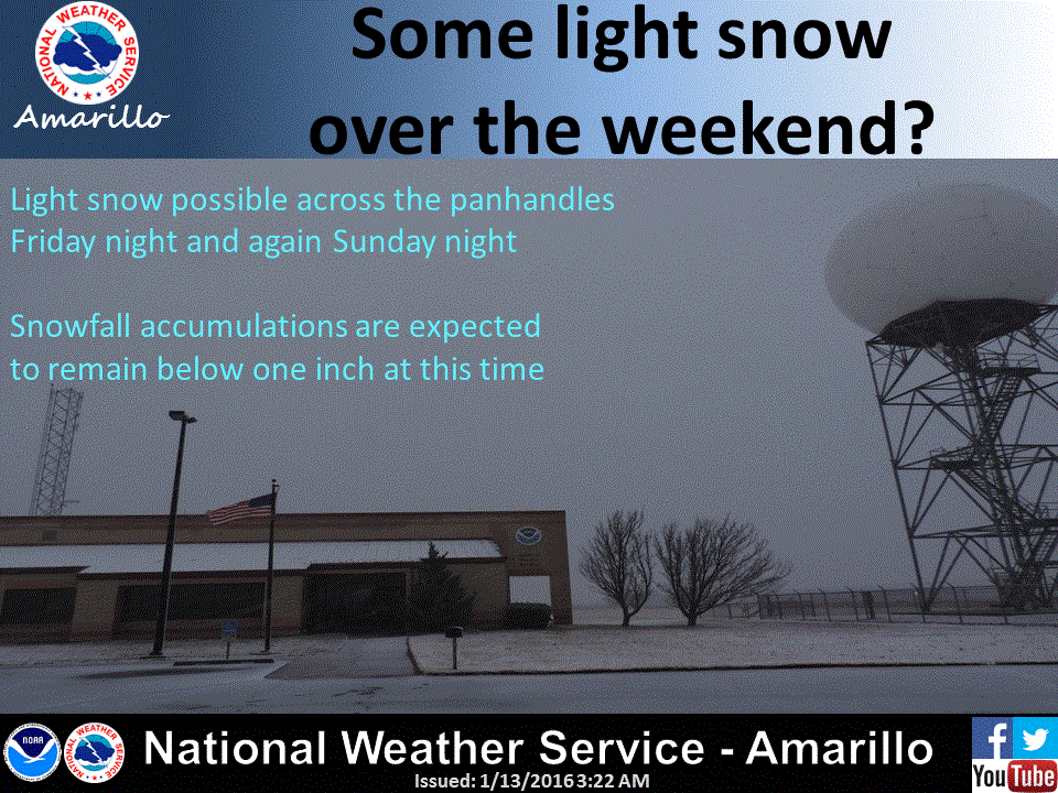
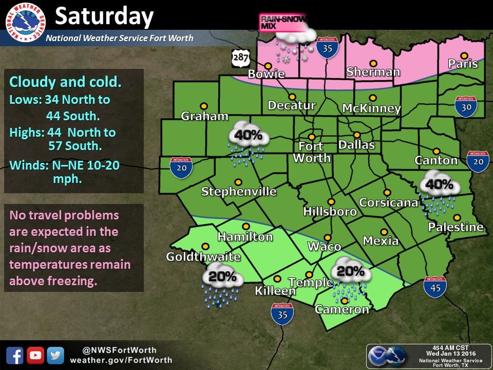
The next storm system and cold front will begin pushing into Texas on Friday. Light snow may be possible across the Texas Panhandle Friday Night with light snow accumulations. On Saturday the system will move southeast along the Red River. Precipitation will remain light and surface temperatures above freezing. Some snow may mix with rain along the Red River with locations south of that remaining all liquid. Since temperatures should remain above 35 degrees no travel impacts are expected. We’ll continue to refine the forecast as we get closer to the weekend. Weather models continue to vary drastically on their solutions and on the exact path of the storm system. Regardless a significant winter weather event is very unlikely. Another system early next week may bring another round of precipitation chances.


0 Comments