
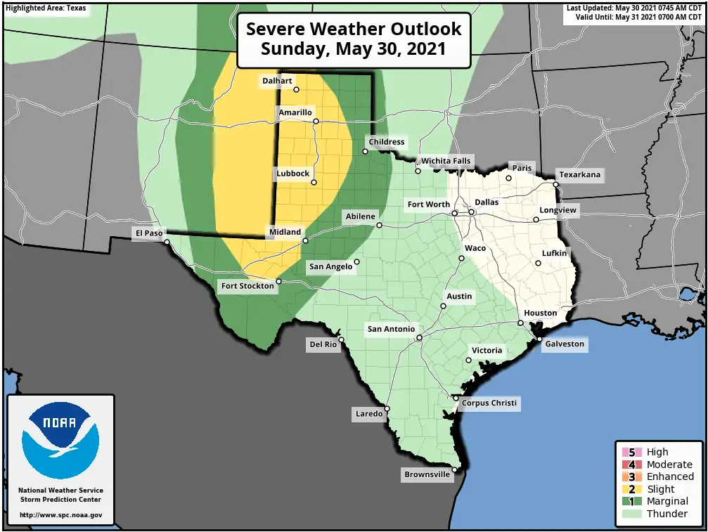
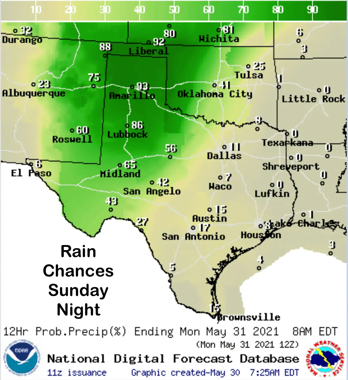
Rain and severe weather chances increase today and tomorrow across parts of the state. Let’s begin with today’s Severe Weather Outlook from the Storm Prediction Center which has outlined a portion of the Texas Panhandle and far West Texas Trans-Pecos region under a Slight Risk (Level 2) of Severe storms later this afternoon and throughout the evening hours. Storms are forecast to begin firing up by around 3 to 4pm this afternoon across eastern New Mexico and the Oklahoma panhandle region and drift into the western panhandle after 6-7pm. Early on in the development phase, storms will be a bit more isolated and carry a large hail, damaging wind and tornado threat. As we move into the early evening hours, we’re expecting to see the storms congeal into clusters and eventually develop into one or two squall lines which will tend to decrease the threat of tornadoes but increase the threat for damaging straight-line winds. In addition to the wind threat, once the storms get organized into squall line mode, we’ll be looking at the threat of torrential rain with flash flooding. Folks within the Slight and Marginal risk areas today will need to keep a weather eye out this afternoon and evening, especially if you have outdoor plans. We would highly recommend anyone camping in Palo Duro Canyon, Caprock Canyons State Park, Lake Meredith and Copper Breaks State Park today/tonight be mindful of the severe weather and flash flooding potential and be prepared to seek shelter as these storms roll through later this evening. During the overnight hours, this area of storms will continue to advance eastward out of the panhandle/rolling plains region into western north Texas. They are expected to decrease in intensity as they move eastward overnight, but will still carry a damaging wind, heavy rain and frequent lightning threat into the early morning hours on Monday.
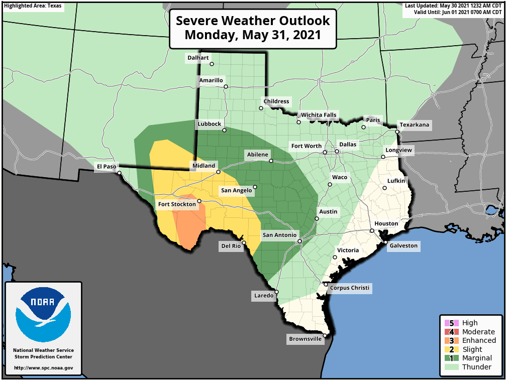
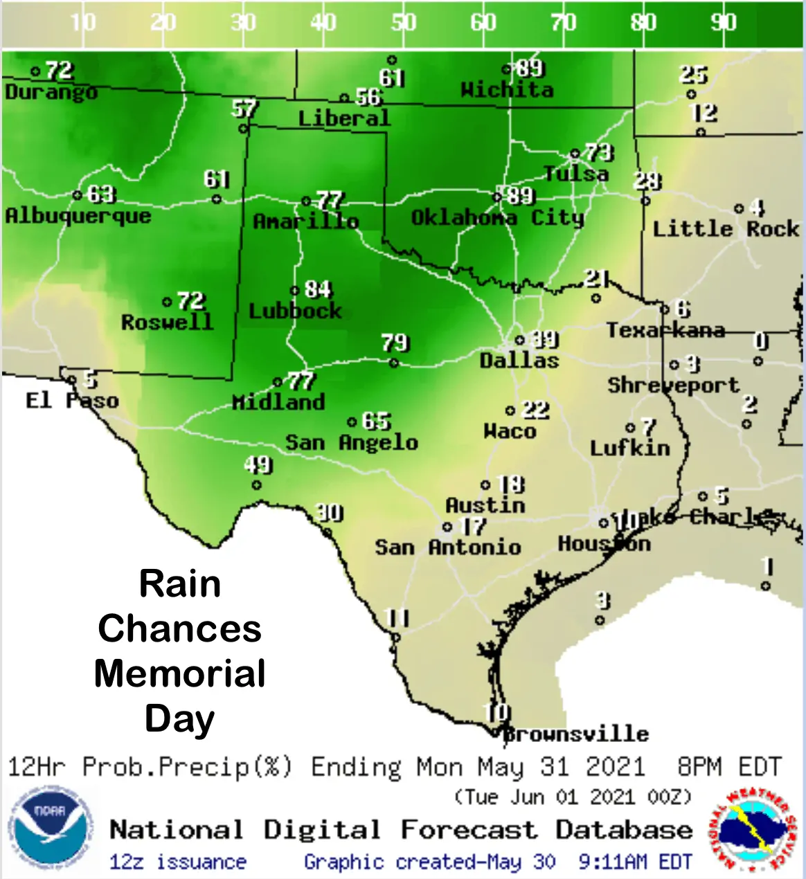
For Memorial Day, the potential for severe weather shifts south into the southern Permian Basin/Concho Valley and Big Bend region where the Storm Prediction Center has outlined an Enhanced Risk (level 3) for severe weather. Folks recreating down in Big Bend on Monday for the long weekend will need to be on high alert for the development of strong storms Monday afternoon which will carry the threat of very large hail, damaging wind, lightning and the potential for a tornado or two. Elsewhere across central Texas, depending on how far south the outflow from today’s storms drifts, we expect to see ongoing showers and storms throughout the day on Monday which will certainly put a damper on outdoor plans. It won’t be a total washout for everyone, but definitely keep an eye on radar and have a Plan B in place in case you have to move indoors quickly.
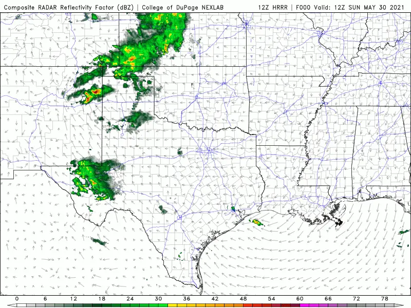
Here’s a look at the current HRRR high-resolution forecast model depicting how the radar may shape up between now and about 7am Tuesday morning. As always, keep in mind this is just a forecast and could change.
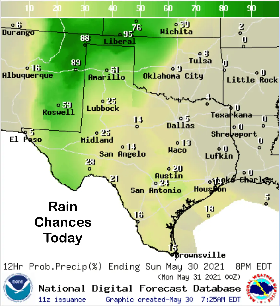
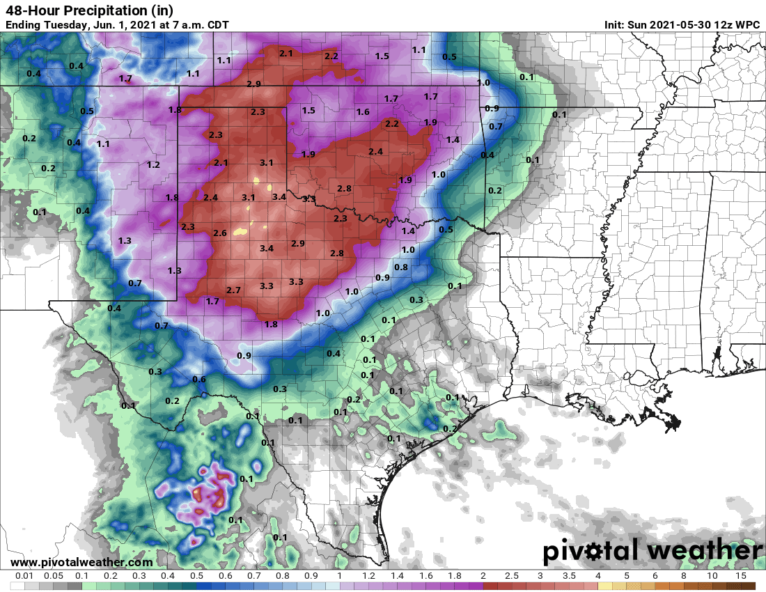
Lastly, here’s a look at the anticipated rainfall amounts between now and Tuesday morning.


0 Comments