
Happy Humpday, at least for those who work a Monday through Friday job. I know many folks have variable work schedules, so if it is your Saturday, hey, happy weekend! It has been a long while since I’ve sat down and written out a weather forecast on the Texas Storm Chasers blog. Life has a way of getting in the form of things, and the ‘summer from hell’ sure didn’t need much discussion. Anyway, here’s hoping some of Y’all stuck around during our absence!
Those interested in a video version of this article may view our Texas Weather Roundup…
Finally feels like fall!
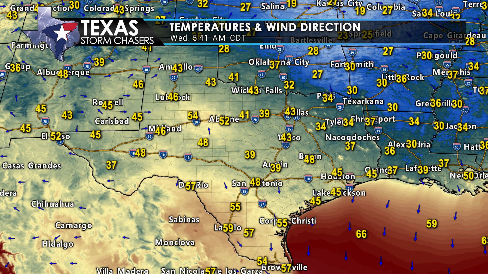
We’re starting on the chilly side this morning across Texas. At the time of this writing (shortly before 5 AM), temperatures range from 29 degrees near Atlanta (Northeast Texas) to 59 degrees in Laredo. That’s an impressive cool snap for mid-October, especially considering this summer drew several parallels, or exceeded in some communities, the summer of 1980. We’ll likely see temperatures fall a few more degrees through sunrise across Texas.
Warm-weather fans need not fret…
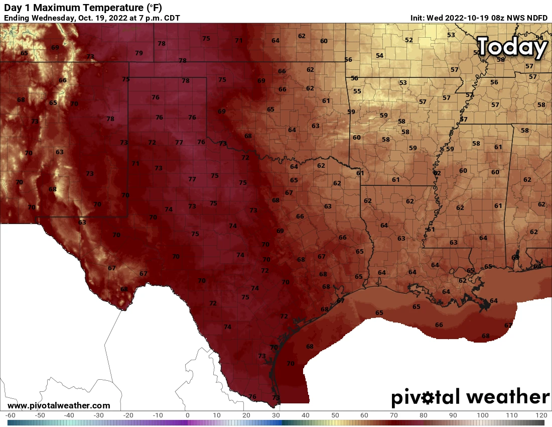
Warm-weather fans need not fret. Mother Nature will be cranking the heat up rather quickly as we move toward the end of the typical work week and head into the weekend. We’re not talking about triple-digit heat, but we’ll still be back up into the eighties and even some nineties for high temperatures. Dry weather is forecast through Saturday and probably most of Sunday as well. As a weather pattern change takes hold, we’ll likely see winds become noticeably stronger by Sunday afternoon across Texas.
Pattern change arrives on Monday
Weather models and their various ensemble solutions show an impressive upper-level storm system moving east across the Plains around Monday of next week. Precisely what that means for Texas is still very much up in the air. However, Monday looks likely to feature gusty to downright strong winds across Texas, so ensure outdoor decorations won’t blow around. A surface dryline will likely take shape, with high wildfire danger and southwest winds across the western half of Texas by Monday afternoon. East of the dryline, strong south to southeasterly winds will bring moisture inland from the Gulf of Mexico. Rain and thunderstorm chances will likely return to parts of the eastern half of Texas on Monday. Of course, we’re still several days out, and changes in timing and specific weather hazards will occur. Nevertheless, we’ve transitioned from months of mostly dry and hot weather into a more dynamic fall weather pattern.


0 Comments