
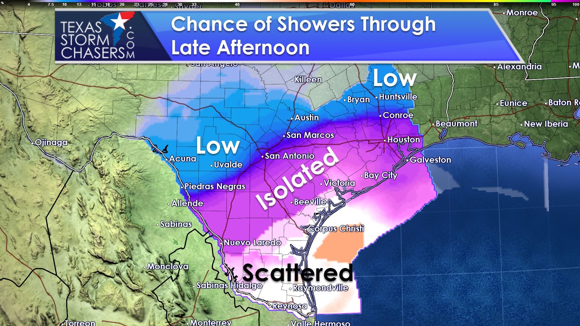
The Rio Grande Valley has had a wet streak lately. Like the past few days there will be more scattered showers throughout the day. Rain amounts should remain light and below one quarter of an inch for most. Outside of the Rio Grande Valley a rouge shower may try to make it up to Interstate 10, but moisture levels are much lower with inland extent. Rain chances in the RGV drop tonight. A few showers will be possible on Monday in East Texas and Northeast Texas, but coverage will remain isolated with only light amounts expected. Monday through Wednesday should be dry across most of Texas. Thunderstorm chances may increase on Thursday and Friday as a strong cold front moves into Texas. At this time it looks like the best storm chances will be east of Interstate 35, but that probably will change a couple times by the time we get to Thursday.
After a few days of cooler weather, including today, temperatures will be quite warm until our next potent cold front arrives on Thursday and Friday. High temperatures in the Tuesday through Thursday timeframe will be ten to twenty degrees above average for mid-November. Highs will range from the middle/upper 70s to the upper 80s. Winds will be gusty at times this week. Warm weather fans will certainly appreciate this week’s weather. At this point it doesn’t look like too many record highs are in jeopardy.
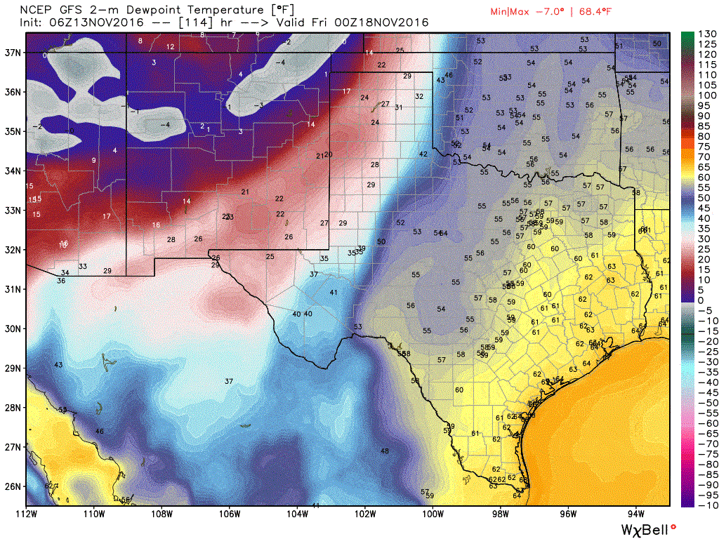
06Z GFS – Surface dewpoints with upcoming cool front
A strong cold front will arrive on Thursday and Friday. Temperatures behind the cold front will be noticeably cooler as we head into the weekend. A very dry airmass will accompany the cold front with dewpoint values dropping from the 40s, 50s, and 60s down into the single digits and teens. Dangerous fire weather conditions may develop on Thursday in the Texas Panhandle, but specific details will have to wait until we’re closer in time. As mentioned previously a thunderstorm threat may also develop on Thursday/Friday as the front interacts with higher moisture values in Northeast and East Texas. A few storms may be strong, but again we’ll have to determine any severe weather potential once we’re closer to our late week system. Temperatures will be cool next weekend with highs in the 40s, 50s, and lower 60s. Lows will drop off into the 20s, 30s, and 40s.

0 Comments