
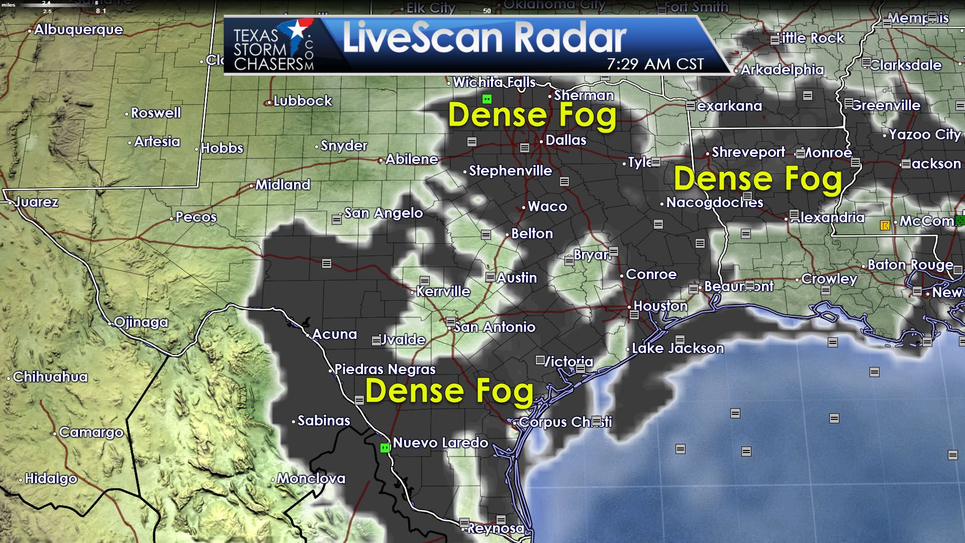
The primary weather hazard this morning will be dense fog across the eastern two-thirds of Texas. The worst of the fog is keeping visibilities around 100 meters. We’ll start to see improvement in visibilities now that the sun is up, but the worst fog won’t burn off until lunchtime. Use your low beam headlights and give yourself a little extra wiggle room when driving. The last thing we need is a 70 car pileup on an interstate because folks are tailgating in the fog.
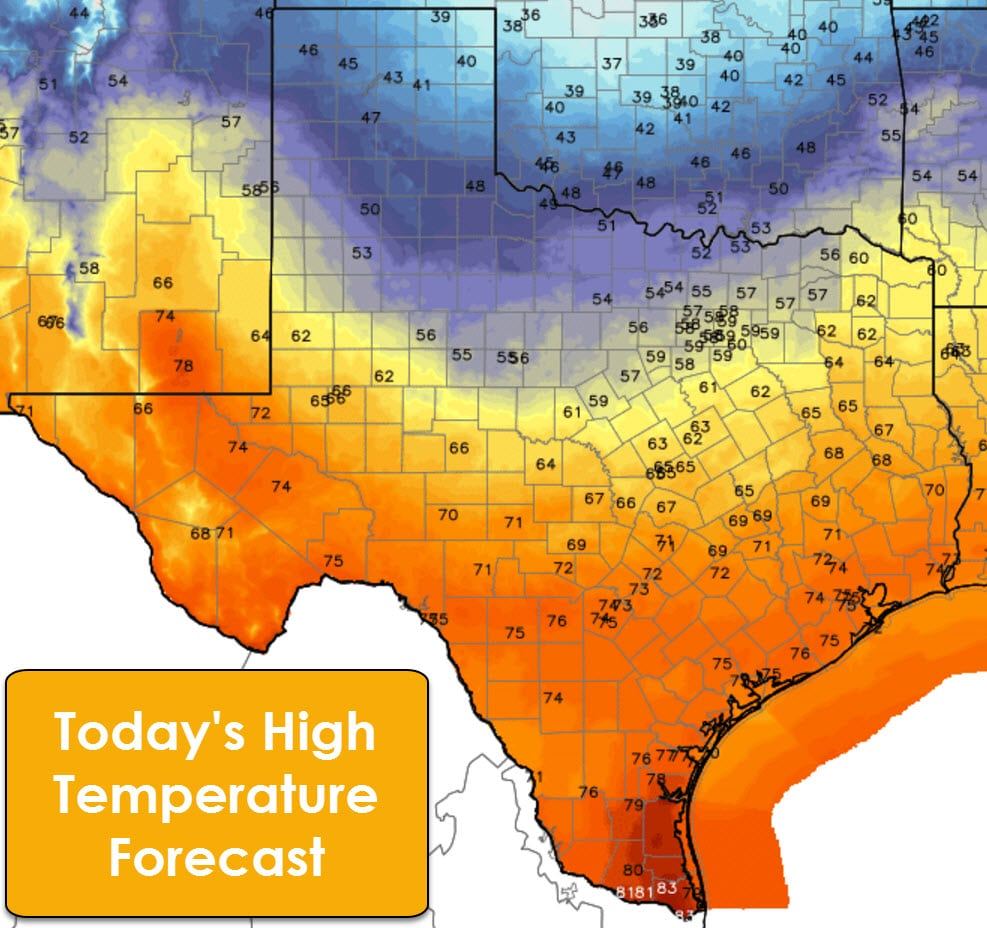
Temperatures this afternoon will be warm across the southern two-thirds of Texas, or south of where a cool front has hung up. Those high temperatures will range from the 60s around Midland and Odessa up into the middle 70s in San Antonio and Houston. McAllen and Brownsville in the Rio Grande Valley will be our warmest spots of the day with temperatures peaking in the lower 80s. On the opposite side of the spectrum, a cool front will help keep temperatures on the chillier side across the Texas Panhandle today. Canadian will only make it to 40 with Amarillo topping out around 47. Wind chills will be in the 20s and 30s. West Texas, Northwest Texas, and North Texas will make it into the 50s.
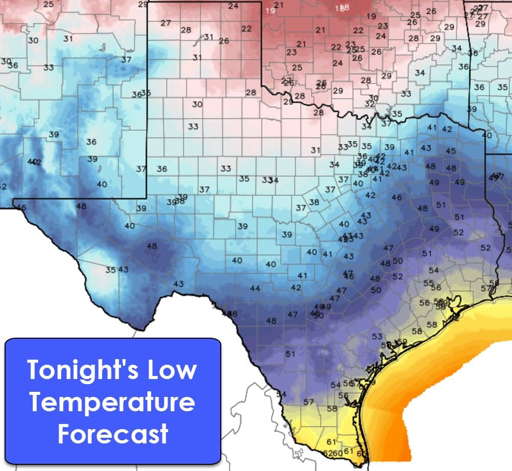
Tonight will feature low temperatures around average for a December’s night. The coldest will be in the eastern Panhandle with Canadian making it down to 22 degrees by sunrise Wednesday. Otherwise temperatures will range from the upper 20s to upper 40s with southward extent into Central Texas and East Texas. Southeast Texas, the Middle Coast, South Texas, and Deep South Texas will make it into the upper 40s to upper 50s. The Rio Grande Valley will probably make it into the lower 60s by sunrise tomorrow.
The weak cool front will make a bit more southward progress on Wednesday and Thursday. High temperatures will tend to remain in the upper 30s to lower 50s in the Texas Panhandle, Northwest Texas, the Big Country, North Texas, and Northeast Texas by Thursday.
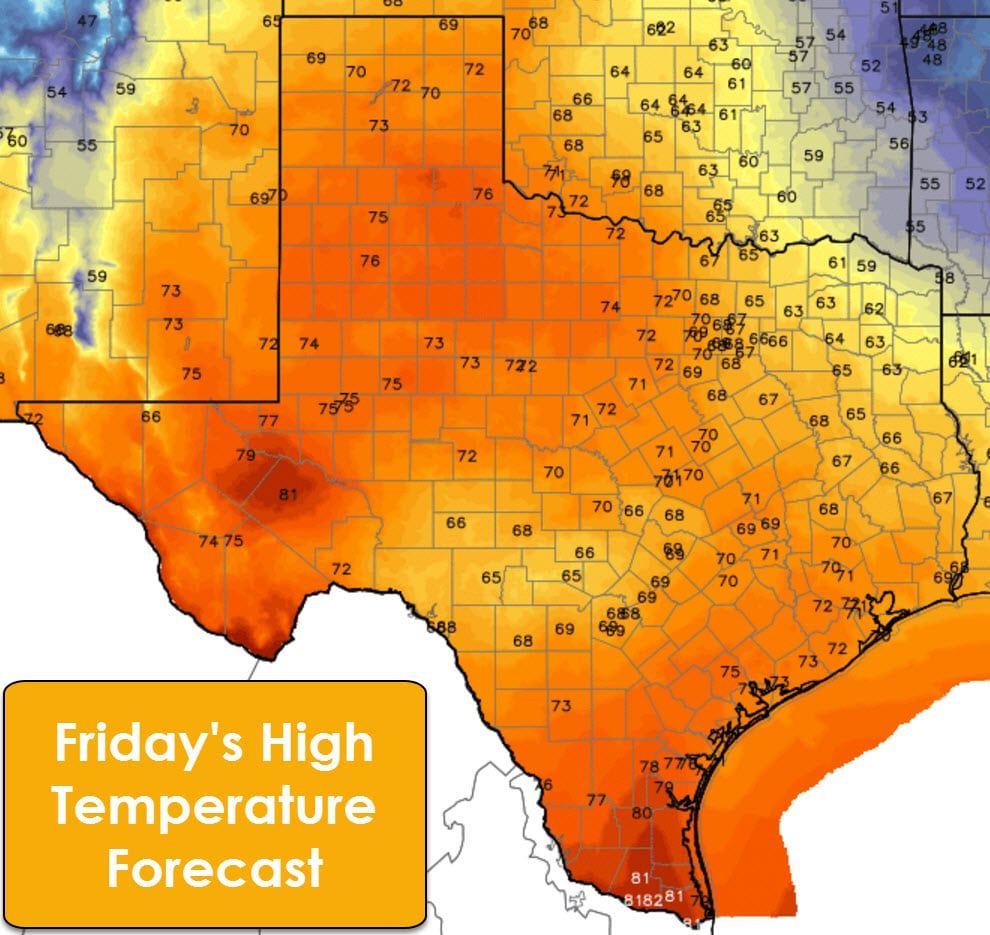
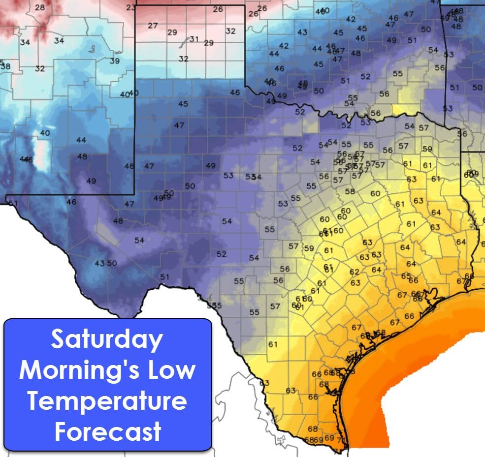
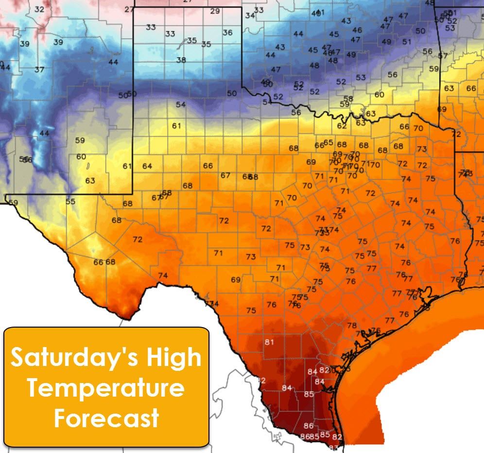
Significant changes occur on Friday with a big warm up ahead of our next arctic cold front. Friday looks to be a warm day state-wide with high temperatures across Texas with highs ranging from the lower 60s in Northeast Texas up into the lower 80s in the Permian Basin and Deep South Texas. The rest of Texas will generally make it up into the upper 60s and 70s. It’ll certainly feel good, especially when you consider that wind chills will be 60 to 70 degrees colder by Sunday morning.
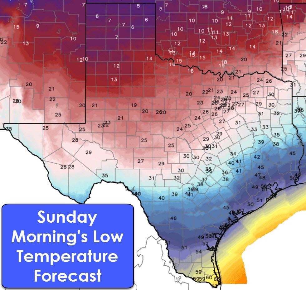
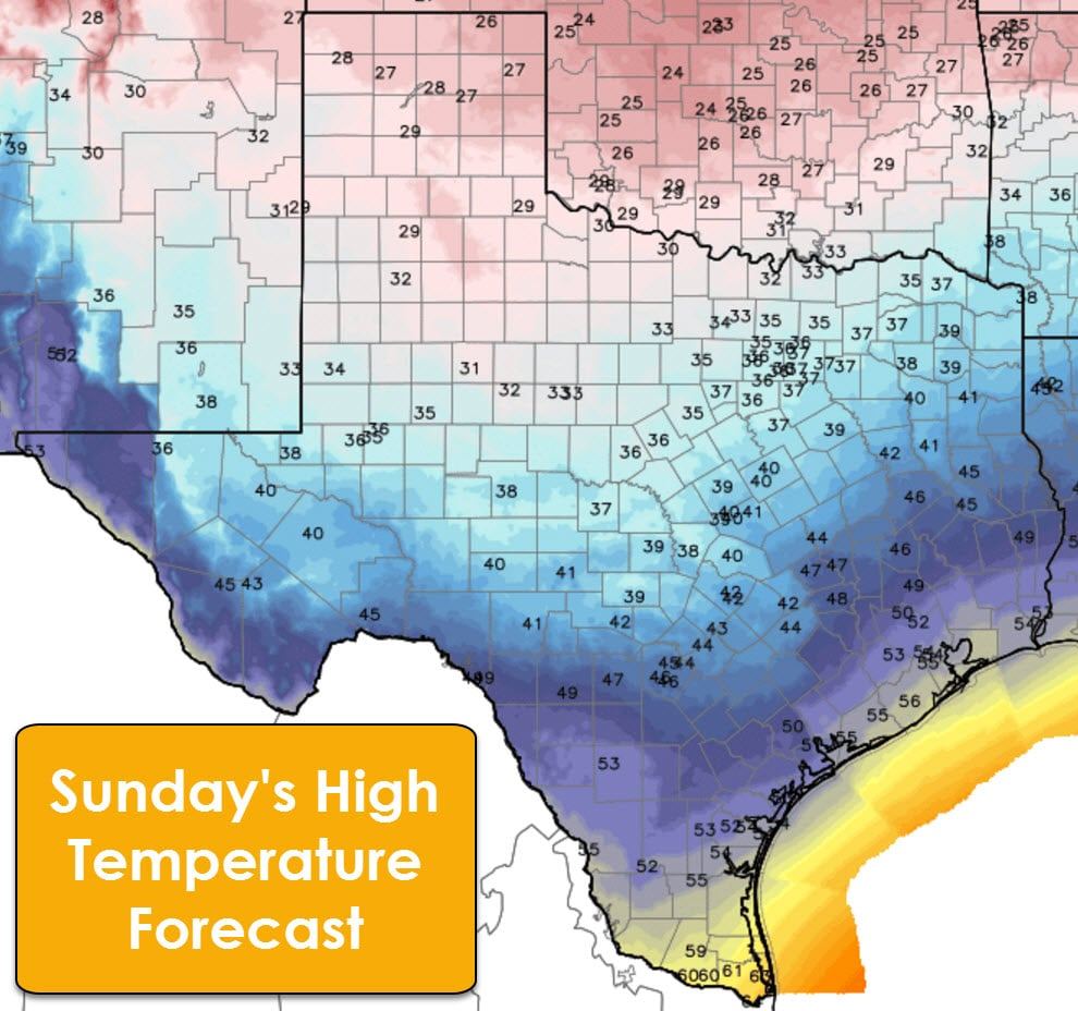
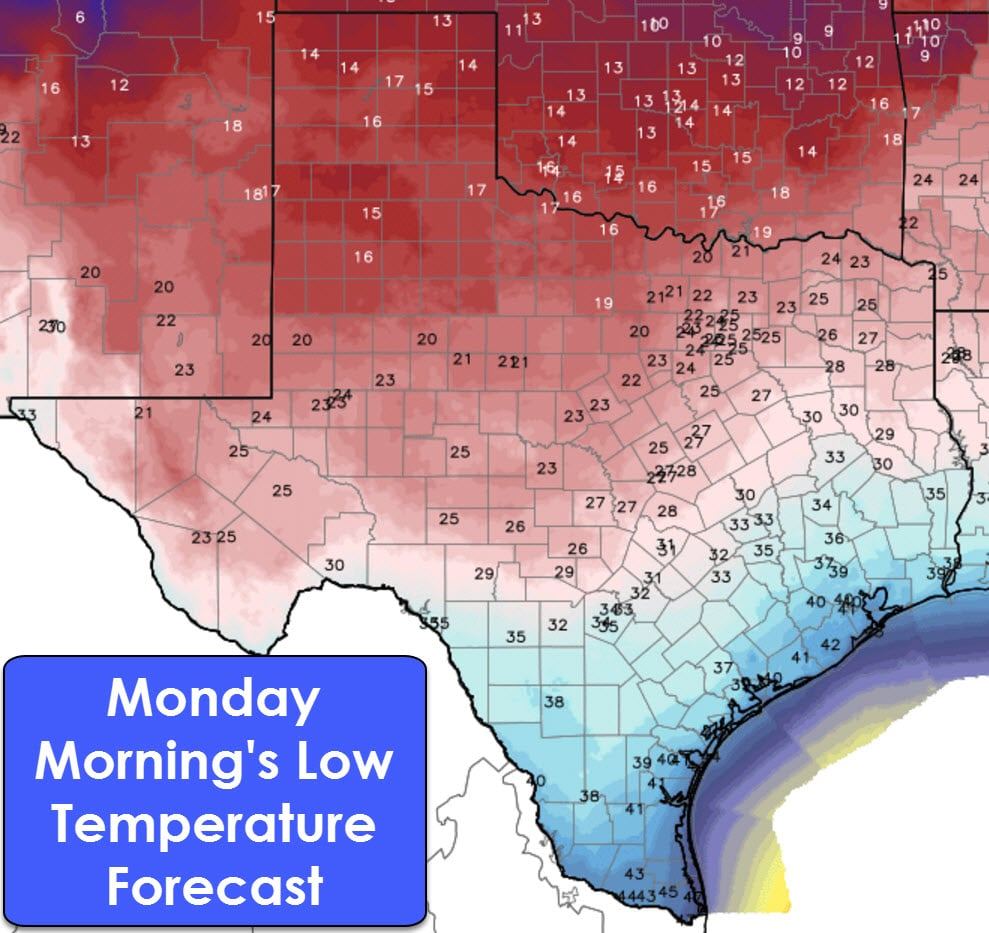
While specific arrival timing is up in the air a big-time arctic cold front looks to arrive on Saturday and Sunday in Texas. Temperatures will be much colder behind the front with a brutal north wind. Temperatures on Sunday will not make it above freezing in the Texas Panhandle, West Texas, Northwest Texas, the Big Country, and western North Texas into Texoma. Highs will not get out of the 30s in the Concho Valley, Central Texas, into Northeast Texas. Wind chills will range from below zero in the Texas Panhandle up into the teens in the Big Country and Central Texas. This upcoming arctic blast will be comparable to the arctic chill we experienced late last week, although this one will probably end up being colder.
Precipitation chances will exsist from Thursday through Saturday with the arrival of the arctic front, plus warm air advection ahead of the front. MOst precipitation will tend to be on the light side, with 3 day rain totals possibly up around an inch in Northeast Texas, East Texas, and Southeast Texas. At this point the precipitation totals are way below flooding thresholds, but we’ll see if those totals come up in subsequent forecasts.
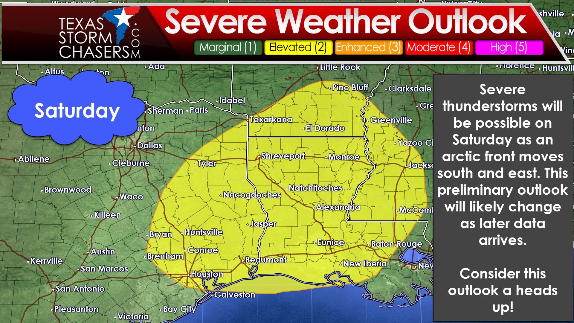
The Storm Prediction Center has highlighted a severe weather risk for Saturday across East Texas, Southeast Texas, and the Brazos Valley. This risk will be due to the arctic cold front arriving from the north and west. We’re way too far out to speculate on specific severe weather hazards or timing, but this does look to be a high shear-low instability event. That means wind shear values will be strong, but the atmosphere will only be marginally unstable. If you get a good combination of those two ingredients severe weather is probable. Too little instability means a fast moving line of showers/non-severe storms are possible. We’ll see how things come together, but severe storms are possible on Saturday. Keep tuned for updates.
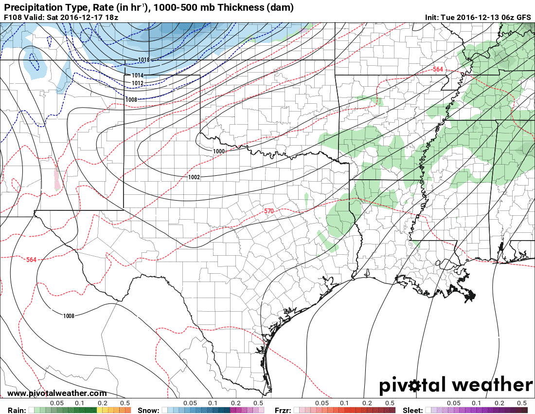
Light snow may occur in parts of the Texas Panhandle on Friday and Saturday. At this point this potential winter precip episode looks light, but again we’ll have to see how things play out in model-land as we get closer to the late week front.


0 Comments