
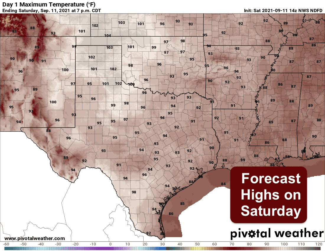
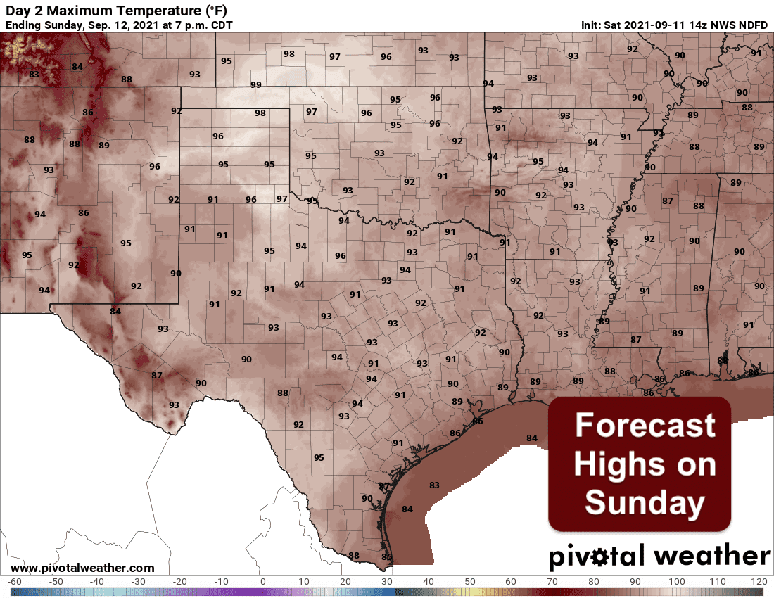
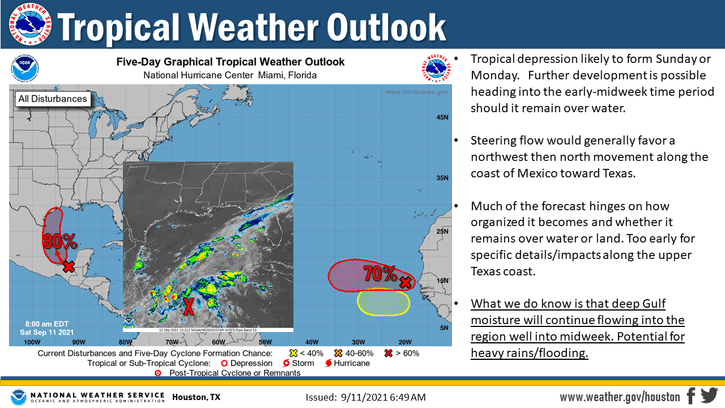
Our forecast for the weekend will be warm, mostly dry and seasonal throughout the state. Thanks to the “cool” front that pushed through mid week, lingering drier air will keep humidity levels on the lower side for the time being. By Sunday though, we’ll begin to see a rapid influx of gulf moisture thanks to a developing tropical system currently working its way into the Bay of Campeche. That system is currently expected to develop into a tropical depression by sometime late Sunday or Monday and continue a northward track along the eastern Mexico coast and towards Texas. Regardless of whether or not it develops into a tropical depression or even a tropical storm, this next system is expected to bring widespread rain chances to our coastal counties through much of the work week ahead. But first, here’s a look at the forecast highs for today and Sunday. Overall, not too hot for most areas with highs topping out in the low to mid 90’s. The exception will be the Texas Panhandle and northwest Texas regions which will see highs topping out today in the upper 90s to low 100s. Those highs back off just a bit on Sunday, but this region will still experience the warmest temperatures across the state. Lots of sunshine today and tomorrow for most folks, but hazy on and off due to continued infusion of smoke across the state from western wildfires.
Forecast Highs Saturday and Sunday
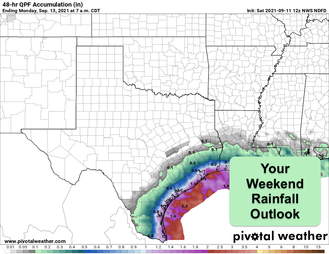
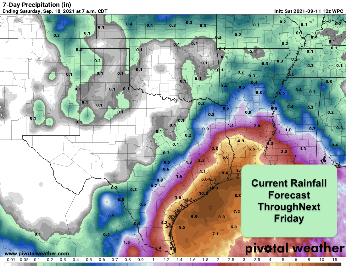
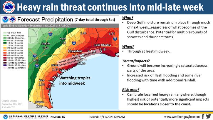
Weekend rainfall chances will be slim to none with the exception of our immediate coastal counties. With the northward advancement of the aforementioned tropical disturbance, we will see increasing chances for scattered to numerous showers today and especially on Sunday into Monday. Beyond Monday, where and how much rain we receive will depend on the strength of the tropical system…if it even develops into a tropical depression or tropical storm at all…and where it tracks. There’s still a great deal of variance between short and mid-range models on what will happen with this system. Some models yesterday had it developing into a tropical storm that ends up tracking northeast all along the Texas coastline. Others had it fizzing out once it reaches the south Texas coast and moves inland. Regardless, we will expect there to be a high potential for seeing heavy to significant rainfall along the coast during the work week ahead. We urge those that live or have interests along the coast to keep a very close eye on the forecast for the week ahead and start making preparations now for heavy rainfall and flooding impacts.
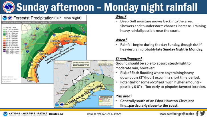
Tropical Development Possible By Sunday or Monday
Weekend Rainfall Forecast
Current 7-Day Rainfall Forecast


0 Comments