
Rain chances will increase this weekend into next week across the southeastern half of Texas. We could be looking at a real gully-washer for the Middle and Upper Texas Coast and adjacent inland regions. We’ll have to get a bit closer to next week before we can pin down where the heaviest rain totals may occur – and how much rain may fall.
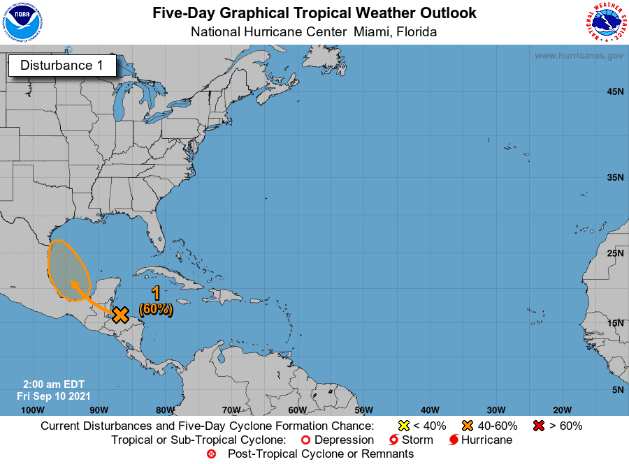
A tropical wave is producing thunderstorms across Honduras and the western Caribbean Sea. This system is expected to move north into the Bay of Campeche and the Southwestern Gulf of Mexico this weekend. Environmental conditions look favorable for the gradual development of the system – and a tropical depression or tropical storm may form. Landfall would likely occur along the Mexico or Deep South Texas coast on Monday. No weather model data shows this system rapidly intensifying, and we do not expect a ‘ragecane’ to make landfall early next week.
Moisture flowing inland from the Gulf of Mexico and the resultant rain chances are our primary focus. Even if the system does attain a name, the widespread impacts will be rain chances next week. Of course, we’ll keep an eye on things. Everyone along the Gulf Coast should do the same since we’re at the peak of the Atlantic Hurricane Season.
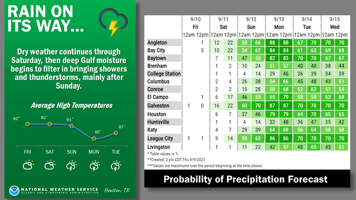
Rain chances along the South Texas coast will increase on Saturday. Those higher rain chances will spread inland and further up the entire Texas coast on Sunday. From Sunday Night through at least Wednesday, we will have rain chances, some quite high, across the southeastern third to the southeastern half of Texas.
There will be a sharp cutoff across Central Texas from ‘no rain’ to decent rain chances. Closer to the coast you get and the more rain you’re likely to pick up next week. We’ll fine-tune the specific day-to-day rain chance maps once we get toward Sunday.
How much rain are we talking?
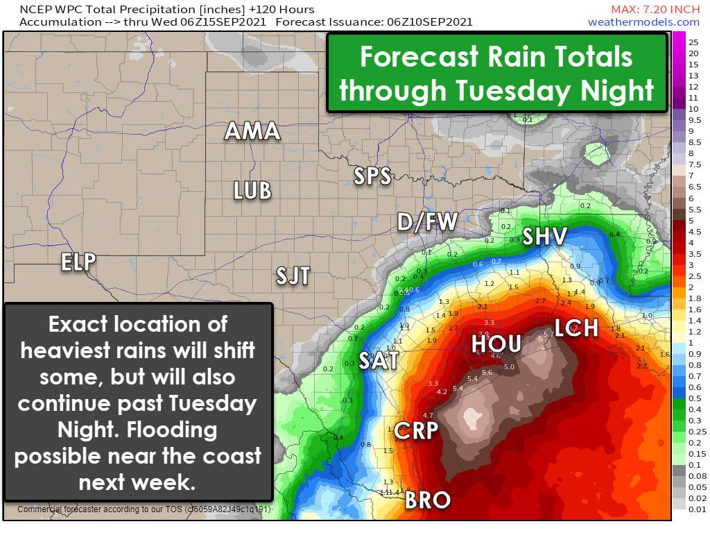
One-half inch of rain or more is currently forecast by Tuesday Night from San Antonio to Temple to Palestine to near Shreveport. Those rain totals quickly ramp up as you get closer to the coast. Keep in mind these are relatively regionalized, and there will be local variations (up and down).
We may have some locations approaching six inches of rain by Tuesday evening along the Middle and Upper Texas Coast. On Wednesday and Thursday, several more inches of rain are possible as heavy rain chances continue in those regions – possibly into the Golden Triangle. By Thursday, some locations along the Upper Texas Coast and Golden Triangle may have a foot of rain.
It goes without saying that we’d be dealing with some flooding. Still, the magnitude and specific locations will depend on where the heaviest rains set up shop and how high rain totals end up going.
Anyhoo…
Anyway, that was a long-winded way of saying it will rain next week across the southeastern third of Texas. Some folks are going to get too much rain.


0 Comments