
We interrupt the summer doldrums to bring a short-term disruption to the Upper Texas Coast. As usual for the summer months in Texas, we’re relatively quiet except for the monsoon in Far West Texas and the potential for tropical mischief in the Gulf of Mexico. This time, our interruption of the summer doldrums will be from the Gulf of Mexico.
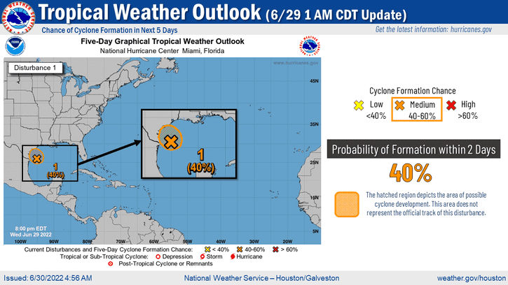
A tropical disturbance named Invest 95L for the weather-weenies out there is located off the South Texas coast. This system is disorganized in trying to become a tropical cyclone. Still, it has collected a fair amount of tropical moisture. Tropical moisture from the Gulf of Mexico will be pushed up into the Upper Texas Coast and Southwest Louisiana over the next thirty-six hours. For most of Texas, there will be no impacts from 95L tonight through Saturday.
For portions of the Upper Texas Coast and Southwest Louisiana, there will be impactful weather – very heavy rain. Southeast Texas and the Golden Triangle are in drought conditions. Rainfall is welcome, but too much rain falling in a short period – even in drought – could cause problems. We all know what happens if we see a bucketload of rainfall in an urbanized section of Southeast Texas, which usually involves floating vehicles.
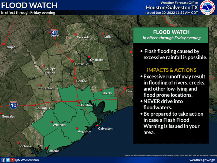
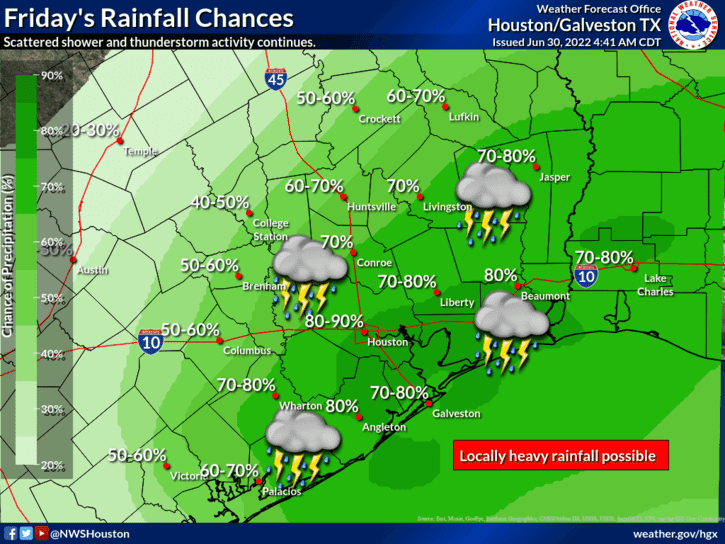
The highest chance for rainfall tonight and Friday will be along the Upper Texas Coast and in the Golden Triangle. A flood watch is in effect through Saturday morning from Wharton and Matagorda east/northeast up the coast, through the Houston metro, and for simplicity purposes, to Beaumont, Orange, and Port Arthur. The corridor of heaviest rains will depend on the track of 95L over the next day.
If the moisture plume shifts further east, we’ll see most flooding rains fall in Louisiana. However, someone will probably end up with over ten inches of rain by Saturday morning – anywhere from the Upper Texas Coast to Southwest Louisiana. Even in a drought, rainfall rates of three to four inches per hour will cause problems.
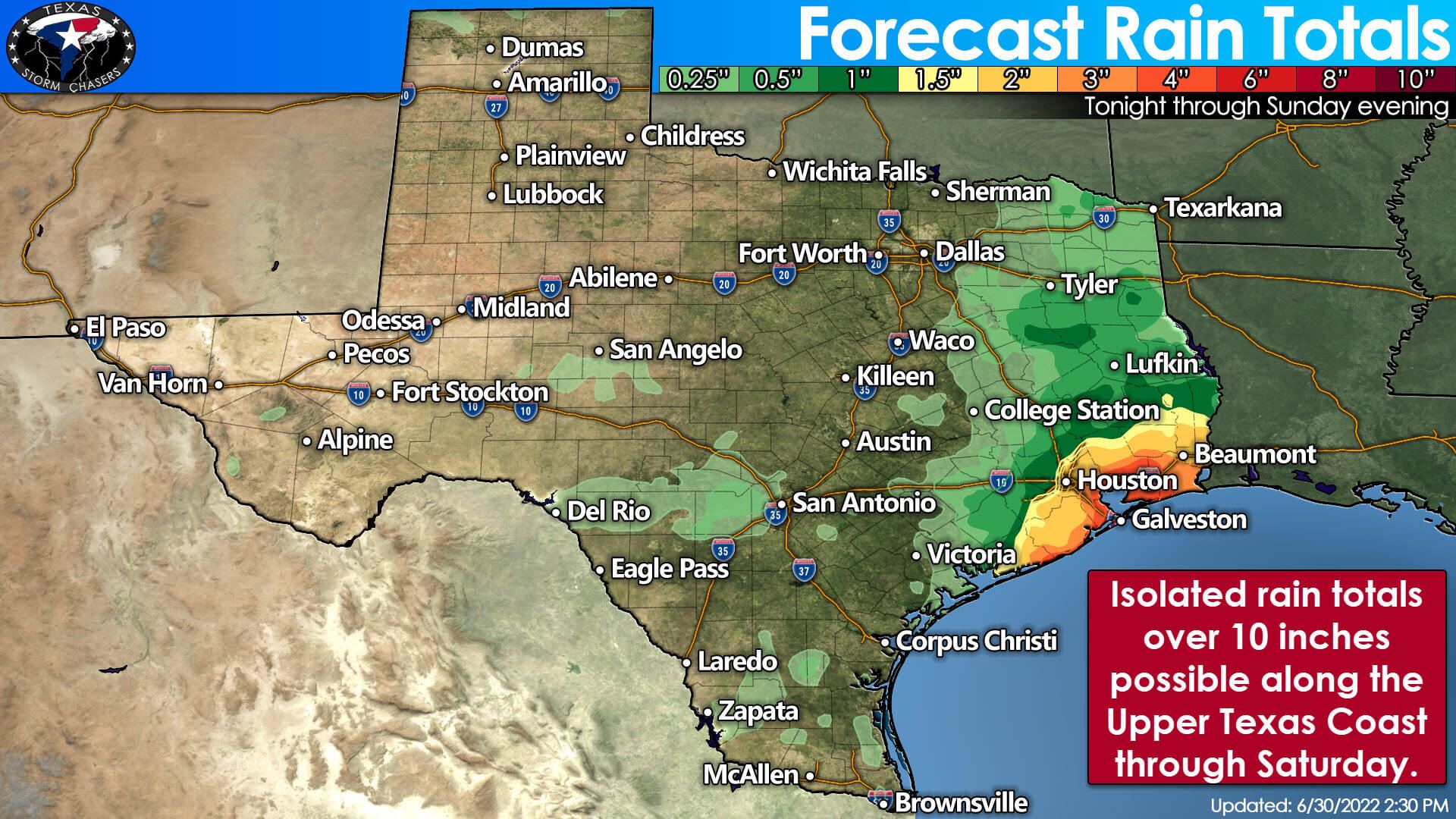
The most likely zone for those hefty rainfall rates will be along the immediate Upper Texas coast. Still, heavy rains may also push inland toward Interstate 10 on Friday. Widespread rainfall amounts of two to four inches are possible, with localized amounts exceeding ten inches in the heaviest rain bands. Overall, we anticipate an isolated flooding threat versus a widespread, higher-impact event. That being said, if we have the heaviest rains in a highly-urbanized area, the isolated flooding could still be impactful.
We’ll see our precipitation chances drop Saturday morning, and we should be back into a primarily summer-like atmosphere by Saturday afternoon.


0 Comments