
Our forecast discussion from this morning generally remains on track. The Storm Prediction Center did upgrade portions of the eastern Texas Panhandle to a level 4 risk of severe weather around lunch-time. This upgrade does not reflect an increased tornado potential, but confidence in numerous storms capable of producing large hail this evening. There will be the threat of localized damaging wind gusts and perhaps a few tornadoes. The extent of any tornado threat later this afternoon and evening will depend on if storms can remain discrete. Numerous storms are expected and having too many storms may keep them from being able to sustain organized low-level rotation for a greater period of time. Flash flooding will also be a threat, especially tonight when a line of storms fires up across the eastern half of the Texas Panhandle south into West Texas.
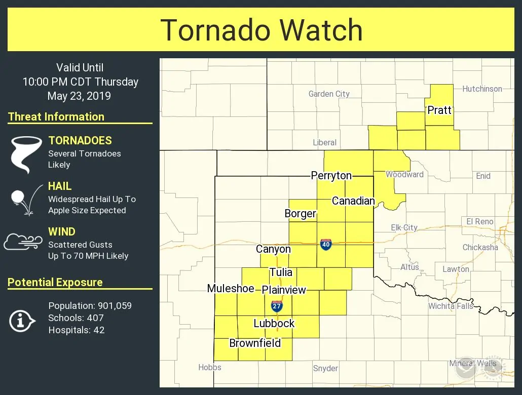
The just issued tornado watch includes the eastern half of the Texas Panhandle south into much of West Texas. The watch goes until 10 PM – although I’d expect a new severe weather watch to be issued thereafter for much of the night. The strongest storms this afternoon and early this evening may produce very large hail up to the size of baseballs, localized damaging wind gusts over 70 MPH, and perhaps pose a threat for tornadoes. Flash flooding is also possible, but that threat will increase later tonight when storms become more numerous and begin training, or moving over the same areas.
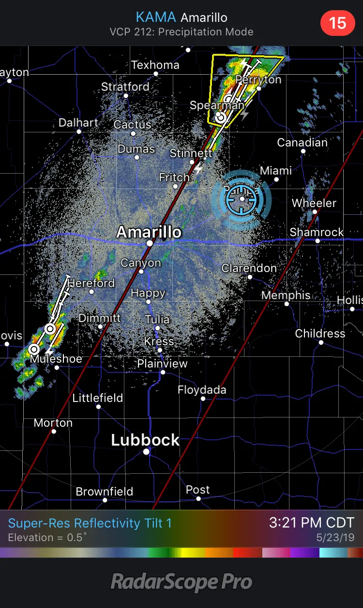
Myself and Paige are chasing in the Panhandle today. We’re sitting in Pampa awaiting thunderstorm development to our west/southeast. We’ll be streaming live video to YouTube and to our Mobile app. You can watch that live video here when we go live – or subscribe to our YouTube channel to get a notification when we go live.


0 Comments