
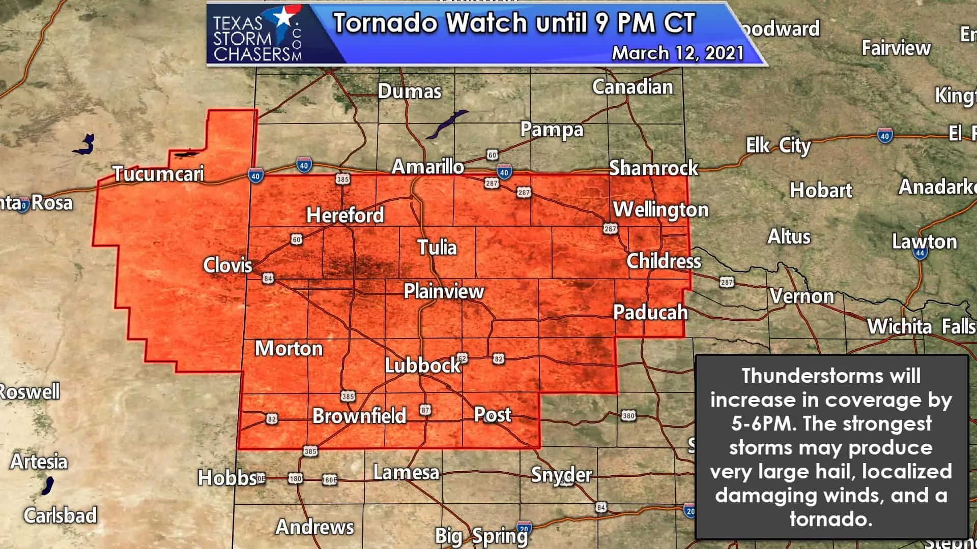
A tornado watch has been issued until 9 PM this evening for the southern Texas Panhandle and West Texas. The watch runs roughly along and south of Interstate 40 south to Brownfield, Post, and Childress. Hereford, Tulia, Plainview, Littlefield, Lubbock, Brownfield, Post, Turkey, and Childress are a few towns included. Cooler air remains entrenched north of Interstate 40 – limiting the threat of surface-based severe storms. A hailer or two is possible across the northern Panhandle this evening. South of the warm front, conditions are more favorable for severe thunderstorms. There is lower confidence that a surface-based supercell can develop later this afternoon and this evening. If storms remain elevated, they could be hailers with a risk for a few stronger wind gusts. Any surface-based supercells would pose the risk of producing a tornado along with very large hail.
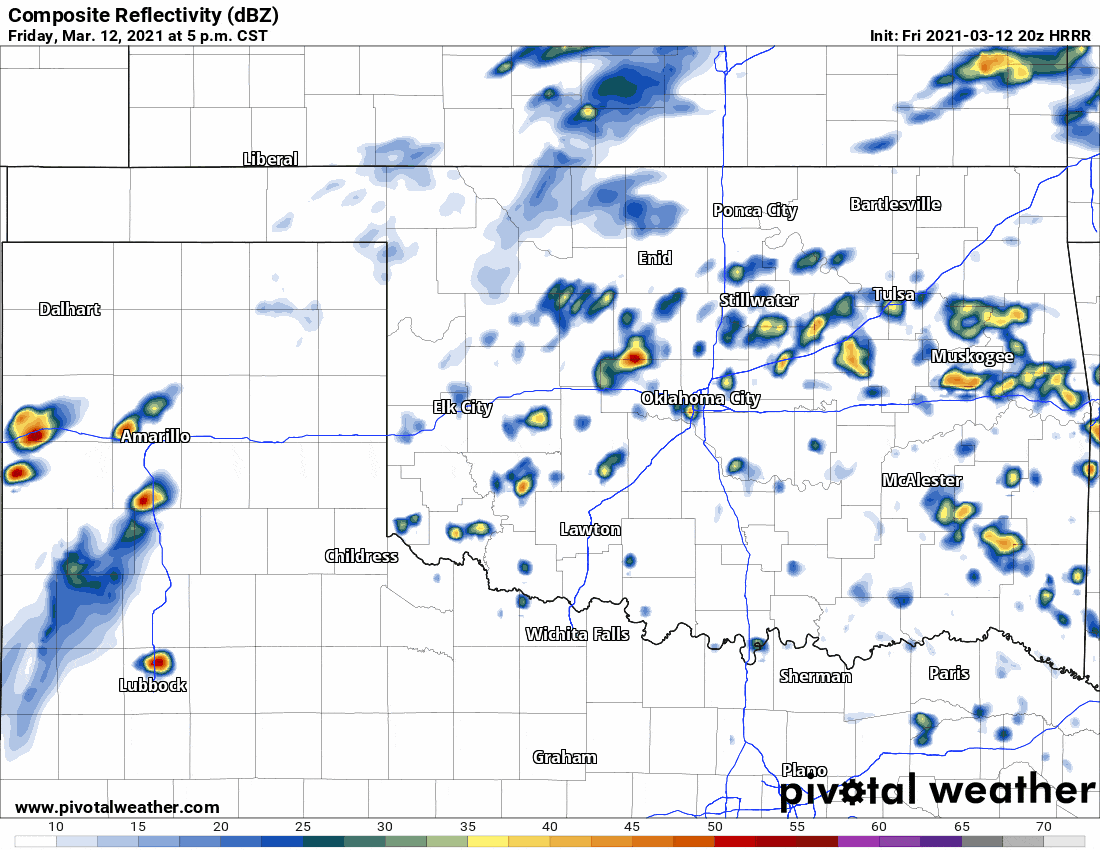
20Z HRRR: Simulated weather model radar through this afternoon and evening.
Scattered thunderstorms are expected to increase in coverage by dinner-time across the Panhandle and West Texas. Cloud cover has remained in place, but lift/ascent is increasing as stronger upper-level dynamics arrive from the west. Not all storms this evening will be severe, but I do expect we’ll be a bit busy in the hail department. We’ll also have to watch out for any supercells that interact with a warm front (near Interstate 40) or manage to deviate a bit to the right (right-turners). Mean storm motion will be east/northeast, with right-moving supercells tending to move more east. A sustained surface-based supercell is not guaranteed, but it’s something we’ll be watching for.
Saturday
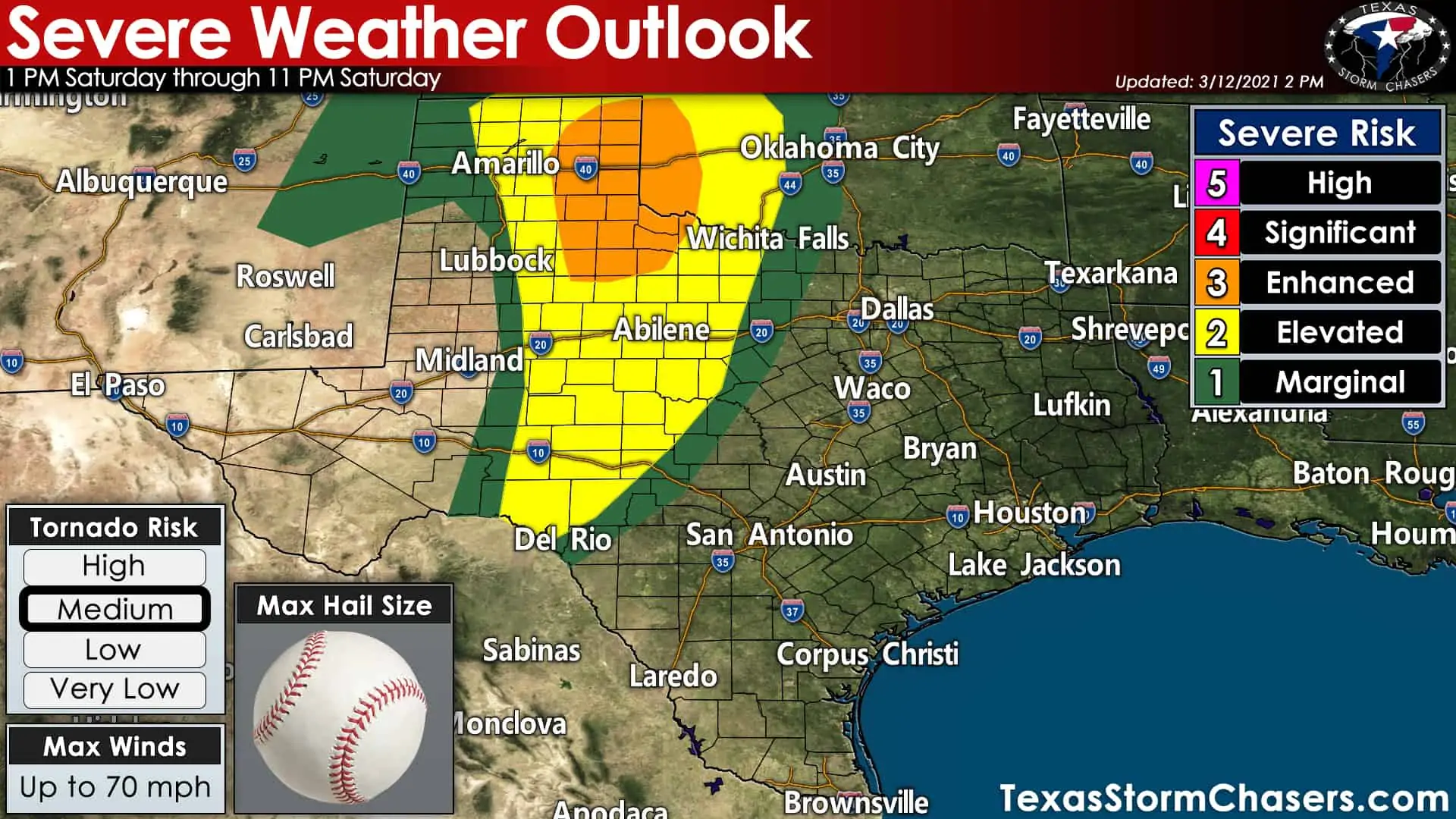
We’ll deal with tomorrow’s severe weather potential once we get past this evening. However, tomorrow’s risk is trending upward with an increased tornado threat. Today’s severe weather threat could be considered the ‘before the day event’ while tomorrow seems to be setting up as the ‘main event’. For tomorrow’s detailed forecast, you can check out my post from this morning here.


0 Comments