
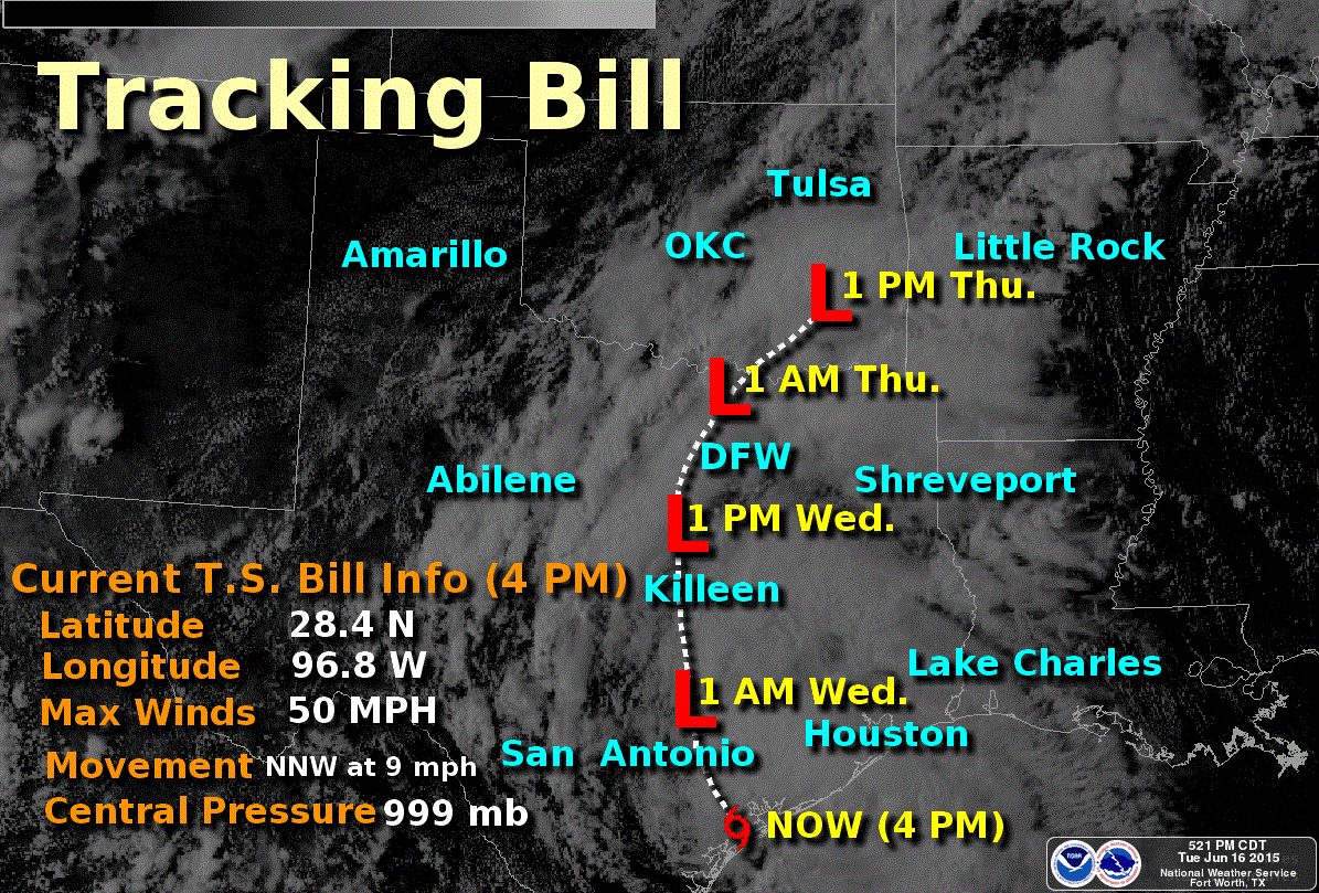
General forecast timeline and path of Bill. Remember the heaviest rains and tornado threat will be along and east of the track. Don’t focus on that line since impacts will occur well away from the center.
* We are aware that some cable networks and other entities have been creating a ridiculous amount of hype about this storm. We don’t do that and if you look back over our posts you’ll see that. However this is a serious situation. Not everyone will see heavy rain or flooding – but we certainly do have the potential for localized high-end/catastrophic flooding along with more widespread flooding.
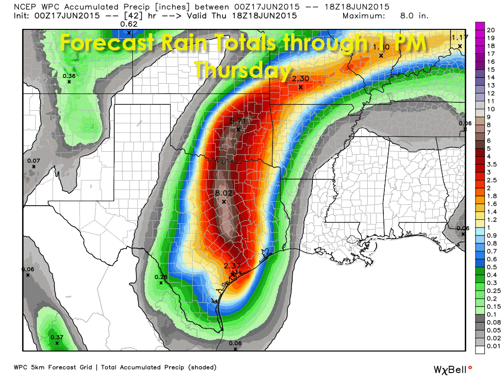
* Rain intensity will increase across portions of Central Texas and the Brazos Valley tonight resulting in a widespread flash flooding threat. Serious localized flash flooding is possible.
* More rain should begin moving into the D/FW Metroplex around 3 AM on Wednesday. I emphasis that this event has not begun yet for North Texas and will be a Wednesday-Wednesday Night event for North Texas We still expect 3 to 6 inches widespread rain accumulations along and just east of Bill’s track through Thursday morning. Localized rain accumulations of 6 to 12 inches are also expected which will cause a more serious flooding event. Don’t be lulled into a false sense of security just yet. It won’t be raining all the time everywhere.
Heavy rain & flooding from #Bill tonight into Wed morning. Turn Around Don't Drown! #txwx #okwx pic.twitter.com/knjECjcTGE
— NWS Southern Region (@NWS_Southern_US) June 17, 2015
* Bill slowed down earlier today and that’s why things have been relatively quiet so far. That will change tonight as the low pressure area becomes a bit more organized and we see rain intensity increase.
* The threat for flooding and heavy rain across portions of North Texas, Central Texas, East Texas, and Southwest Texas has not ended. Frankly we haven’t even gotten underway yet.
* Spinup tornadoes will be possible just east of the center of Bill overnight across East Texas. These tornadoes will likely be small, weak, and brief. However their nature means very little warning may occur.
* Extremely high moisture content is in the atmosphere. That’s how we’ll get very heavy rain rates tonight and on Wednesday. We may not see much lightning but rain rates of 2 to 4 inches per hour are probable in spots.


0 Comments