

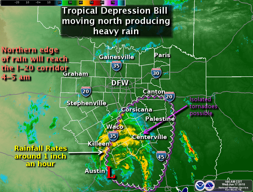
At 1:45 AM the area of low pressure known as Bill is located between Austin and College Station. THe low is moving north/northwest around 13 MPH.
* Most rain is located on the dirty side of the system located to the north and east of the circulation.
* A feeder band of stronger thunderstorms extends from El Campo north to College Station. A second feeder band is near Lufkin. Isolated tornadoes will be possible with this feeder band along with very heavy rain.
* The rain on the north side of Bill is producing around 1 to 2 inches of rain per hour.
* Rain will continue to move north and should reach Interstate 20 along with the D/FW Metroplex by 4-5 AM.
* Typical for tropical/warm-core lows we’ve seen the precipitation contract towards the low pressure along with an increase in rain intensity. Once the sun rises later this morning we’ll see precipitation expand back out away from the center. A tornado risk will continue with the feeder band and storms out east of the low.


0 Comments