
Accumulating winter precipitation will begin ending from west to east this afternoon. Some limited winter precipitation may continue tonight into Friday morning, but it will be much lighter. We do not anticipate improvement on road conditions today as melting will not occur. Gusty north winds will keep wind chills very cold and we do not anticipate much of a diurnal climb in temperatures this afternoon. The strong north winds and cold air advection will be too strong, so steady-state temperatures are expected through the afternoon – before we plummet tonight.

Simulated weather model radar from noon through midnight.
End times for accumulating winter precipitation
The Texas Panhandle: Early to mid-afternoon; although the snow will become more spotty soon.
D/FW Metroplex: 12:30 PM for the western portions of the D/FW Metroplex, 1:30 PM for the eastern parts of the D/FW Metroplex. A few snow showers are possible late this afternoon and early this evening.
Waco: Ending around 2 PM
Temple to Austin: Ending around 3 PM
San Antonio Metro: Should be concluding around 4 PM
Tyler to College Station: Concluding around 5 PM
Houston Metro: Can’t rule out a light winter mix during the evening rush hour into Friday morning. Some slick roads may occur.
Coastal Bend & Coastal Plains: Light winter precipitation is possible overnight into Friday morning. Light ice accumulations are possible – leading to slick roads.
Don’t expect melting Today
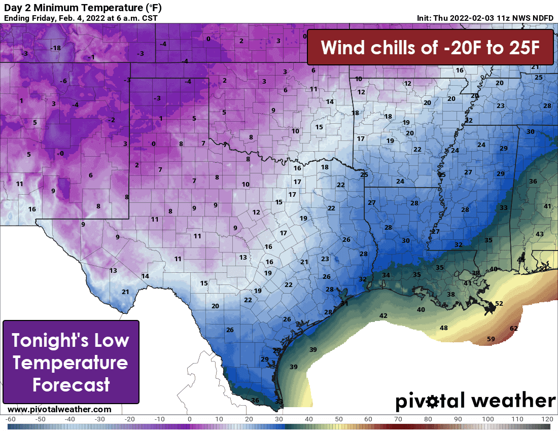
Frigid temperatures will result in dangerously low wind chill temperatures and a ‘hard freeze’ for the northern seventy-five percent of Texas tonight. Tomorrow’s afternoon temperatures will not get out of the 20s, with a snowpack and significant ice accumulations. Hopefully, we’ll rise above freezing on Saturday and start the melting process.


0 Comments