
If the end of February indicates our upcoming summer, we might as well surrender. La Nina’s return by the summer months certainly won’t help, as they favor below-average precipitation and above-average temperatures. Hopefully, we’re not in for our third summer of hell. I’m not particularly optimistic, but there are always anomalies to patterns. Let’s try to remember that when several Texas cities soar to August-level temperatures this afternoon.
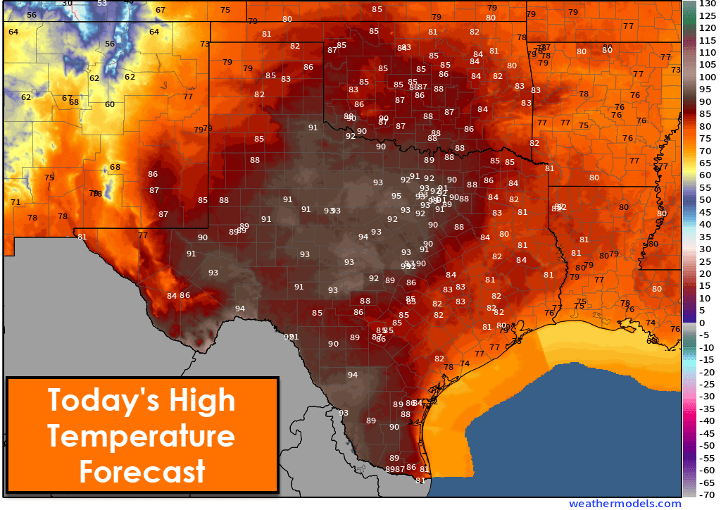
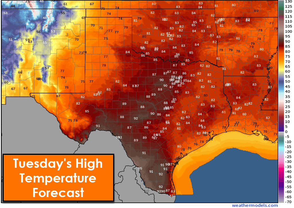
Near record-high to downright hot temperatures are expected across several regions of Texas over the following two afternoons. High temperatures will soar into the 91-96 degrees range, and I wouldn’t be surprised to see someone hit the century mark. For those interested, those temperatures are what we would expect to see in an average August (based on 1990-2020). The summers of 2022 and 2023 were not so kind. Overnight temperatures will also be quite warm.
Gusty winds and low humidities will create high wildfire danger across the western half of Texas most afternoons this week. Even when we cool down later this week, we’ll continue to see lower humidity values with a very dry airmass arriving.
Significant changes will arrive on Wednesday. A strong cold front will push south across Texas on Wednesday, dropping temperatures a good 25 to 45 degrees. That sounds impressive, and while it is, it won’t have the ‘scary cold front’ effect since we’ll be emulating August. Temperatures will at least get back down to comfortable levels. A freeze is expected across the northern third of Texas by Thursday morning.
Scattered showers are expected on Wednesday across the Trans-Pecos, Big Bend, Southwest Texas, Concho Valley, and the Big Country. That activity will move into the eastern half of Texas on Thursday, though some rain chances may continue across the Panhandle and West Texas. Lucky folks may pick up one-quarter to one-half inch of rain. Severe storms (spinny-spinny doom doom, big hail) are not expected. If the cold front arrives a bit quicker than expected, we may see a bit of snow mix in with rain in the Panhandle and West Texas on Thursday.
We’ll be comparatively colder on Wednesday and Thursday, with high temperatures in the 40s, 50s, and 60s. We’ll start climbing back up the temperature roller-coaster on Friday, with plenty of 70s and 80s statewide by Saturday. Another storm system and cool front may arrive Sunday night and Monday.
Scattered showers are expected on Wednesday across the Trans-Pecos, Big Bend, Southwest Texas, Concho Valley, and the Big Country. That activity will move into the eastern half of Texas on Thursday, though some rain chances may continue across the Panhandle and West Texas. Lucky folks may pick up one-quarter to one-half inch of rain. Severe storms (spinny-spinny doom doom, big hail) are not expected. If the cold front arrives a bit quicker than expected, we may see a bit of snow mix in with rain in the Panhandle and West Texas on Thursday.

0 Comments