
Monday wasn’t a great day for Texas in the weather-record department. Not only did we see our first triple-digit temperature of the year in Killeen, but we managed to do it for the entire United States in 2024. We also had over 60,000 acres of land burned in the Texas Panhandle. We’re returning to a phase where large-scale wildfire incidents can occur with optimal wind and moisture profiles. It was a nice break since September. Alas, we’re off to a great start for 2024 – and that, my friends, is a bucket full of sarcasm.
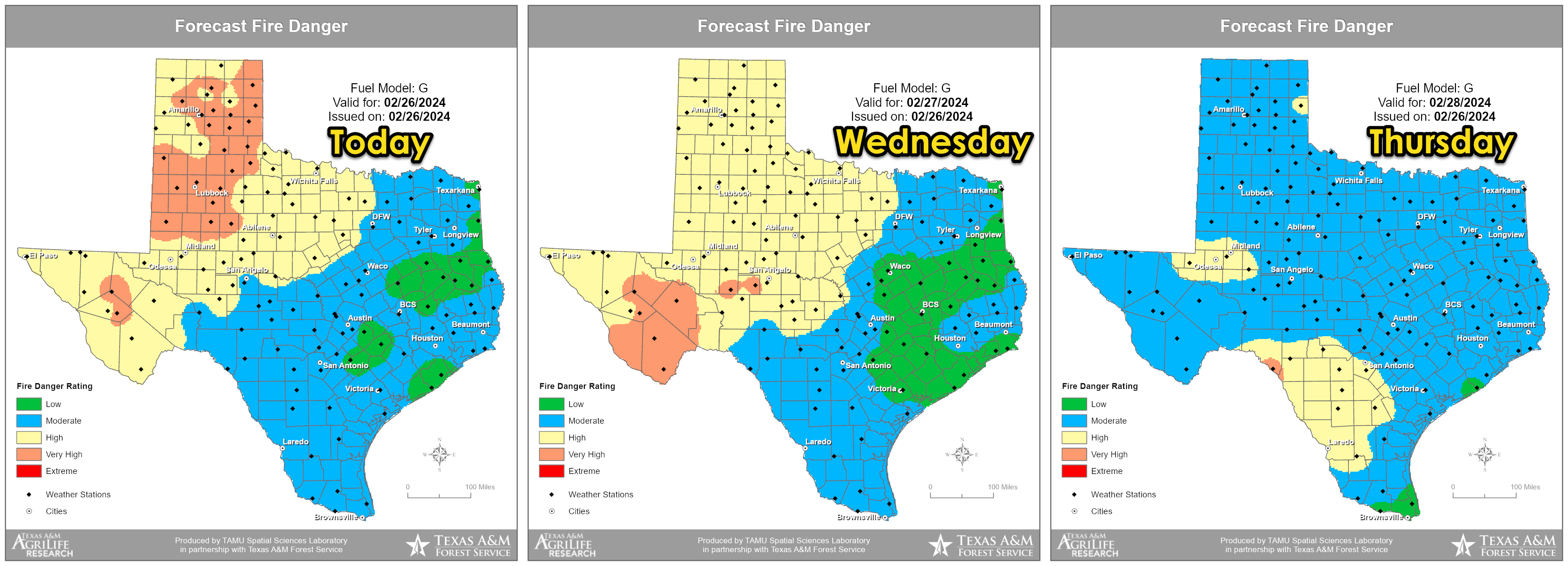
Strong wind gusts up to 50-60 MPH are possible today across the western third of Texas. The result will be blowing dust, reduced visibility, and a continued significant risk of fast-moving wildfires. The ongoing major wildfires in the Panhandle will likely exhibit continued growth to the east today. We’ll also need to watch for any new starts. A cold front will arrive this evening, bringing a northerly wind shift and a new set of hazards for firefighters. We will see improving humidity values tonight, helping crews get the upper hand on fires on Wednesday and Thursday. Critical wildfire danger will return to the regions mentioned above this weekend.
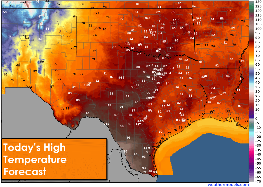
High temperatures today will be well above average for late February, with 80s and 90s. We expect it to be a few degrees cooler overall, but several folks will still top out in the lower 90s. The Rio Grande Plains and Edwards Plateau have the best shot at making it above 95 degrees, and we may see another Texas town make it to 100 degrees.
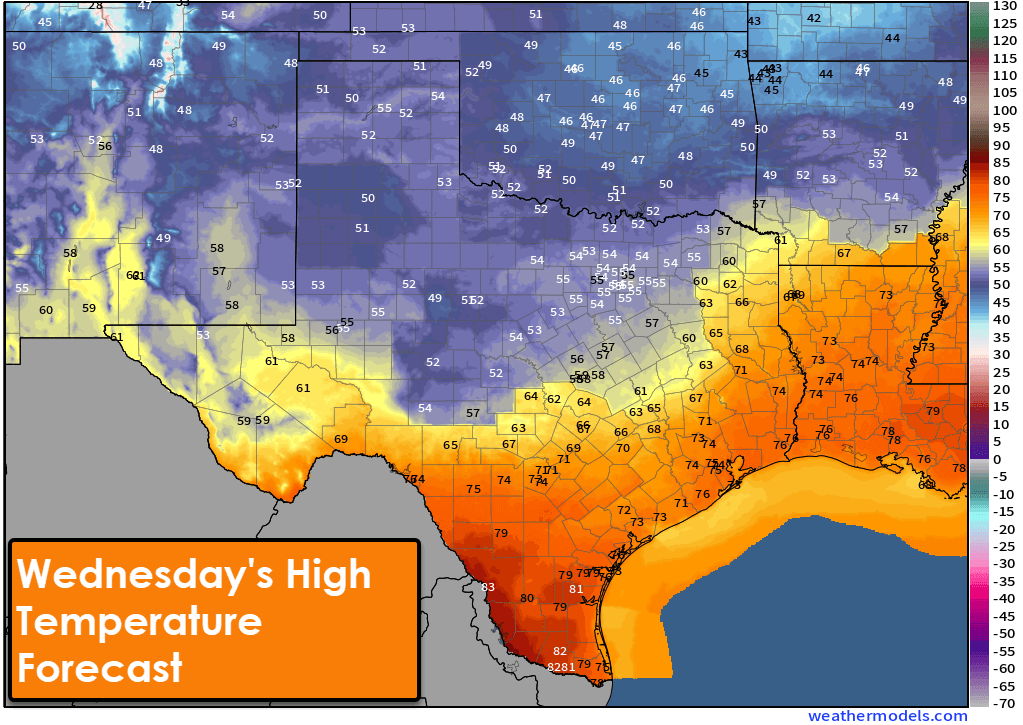
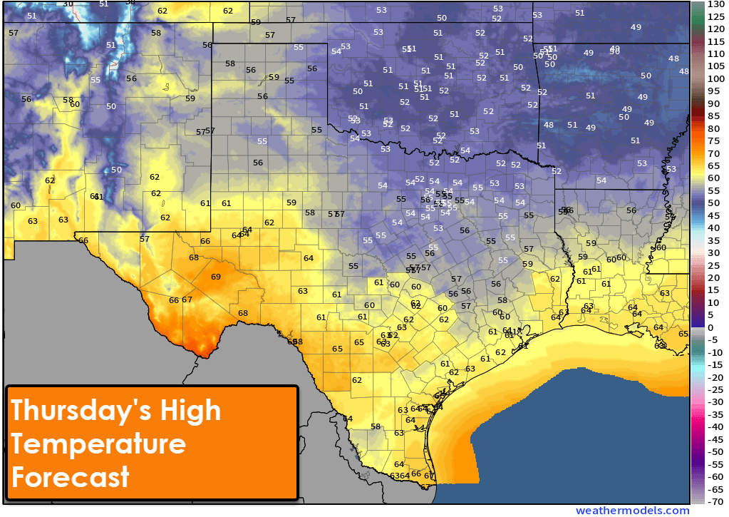
A decent cold front will push south across Texas tonight and on Wednesday. We’ll see temperatures drop a good thirty to forty degrees compared to our peak temperatures over the last few days. If you’re worried about an arctic outbreak, don’t be. Afternoon temperatures across the northern half of Texas will be in the 40s and 50s on Wednesday, with the southern half of Texas warmer until the front arrives. Gusty north winds are likely behind the frontal passage.
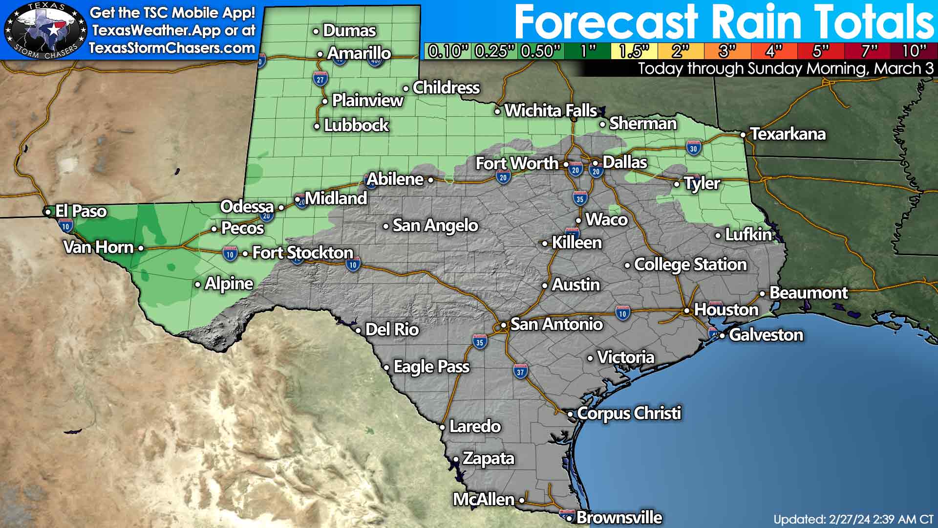
Scattered showers will be possible across the western third of Texas and further east across Texas on Wednesday and Thursday. Severe thunderstorms are not expected, and overall rain amounts aren’t impressive. Nevertheless, the Borderland and Far West Texas may pick up one-half inch of rain, with one-tenth to one-quarter inch of rain possible in the Panhandle, West Texas, Permian Basin, Big Country, Texoma, and Northeast Texas. Some rain is better than no rain. It may become cold enough for a snow-mix in the Panhandle and West Texas on Thursday. Little to no accumulations are expected.
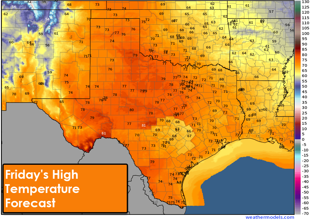
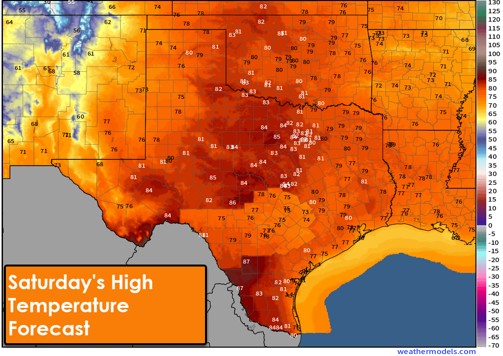
We’ll dry out and warm up across Texas beginning Friday as spring weather returns. This weekend will feature high temperatures back into the 70s and 80s, with increasing fire-weather concerns for the western half of Texas.
New update‼️
EBT (Food Stamp) Application deadline is 29 February 2024.🗣️Hit the sign-up icon & get the benifit.👇👇💸💸💵
https://sites.google.com/view/snap1k-znsfa/home
New Update‼️
🗣Check Another (Summer P-EBT) $750 is loaded.Application deadline 29 February 2024.Just sign-up & Get the benefit👇👇💸💸💵
https://sites.google.com/view/ebt1k-dbsfa/home
Ahmokh Ray Spam