
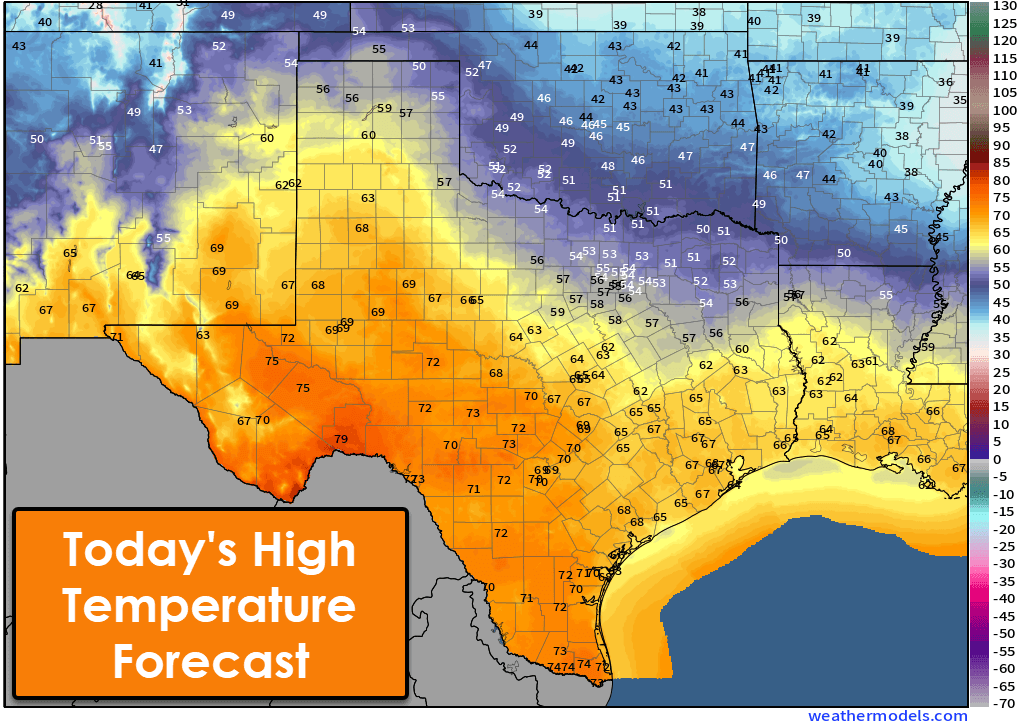
I can see clearly now; the cold is gone! At least for today, as Texas heats up! That’ll quickly change as crashy the cold front arrives into Texas tonight into Friday morning. Until then, enjoy much warmer temperatures across the southwestern seventy-five percent of Texas. We’ll see high temperatures in the 60s and 70s. 50s are probable this afternoon in the Texas Panhandle and the Ark-La-Tex. Those are a good sixty to eighty degrees warmer than a few days ago with wind chills. The warm-up will be short-lived, as temperatures come barreling back down tonight and for Friday.
Crashy the Cold Front Returns
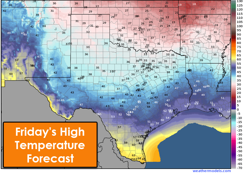
Temperatures on Friday will struggle to climb above freezing across the northern third of Texas. We’ll see temperatures fall into the 30s and 40s across the central row of Texas as the cold front arrives in the morning. The southern third of Texas will top out in the 50s and 60s, with cooler temperatures arriving as the front arrives.
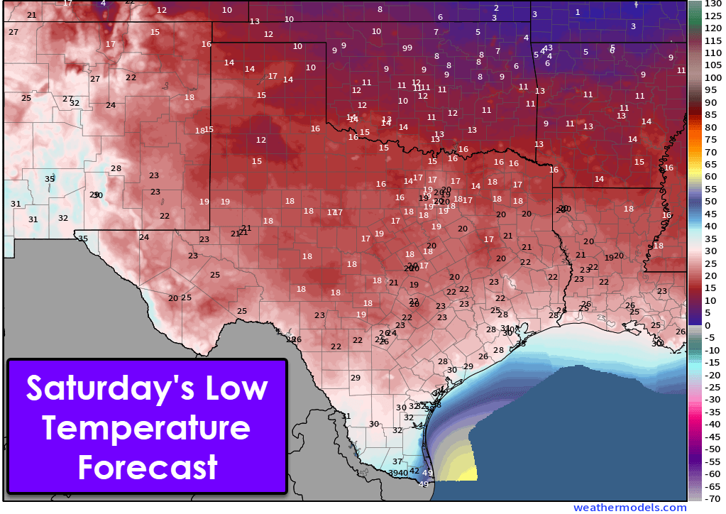
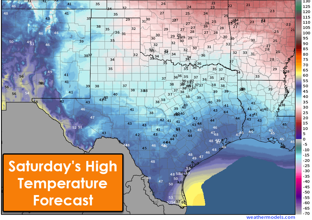
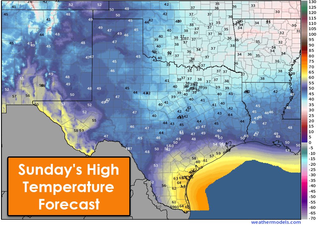
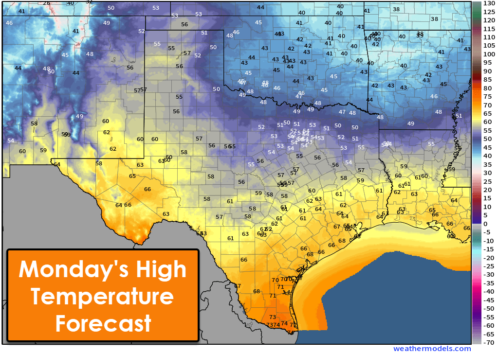
Saturday morning will feature a hard freeze with temperatures down into the teens across the northern half of Texas. The only regions not below freezing tomorrow night will be the Rio Grande Valley, Deep South Texas, and the Borderland (Far West Texas, El Paso). Saturday and Sunday will remain on the cool-to-cold side. Temperatures will climb Sunday night and Monday as our next upper-level storm system arrives. An active week of precipitation chances for the eastern half of Texas is expected.
Rain (and ice?) returns beginning Sunday
Widespread showers and thunderstorms are expected Sunday evening through Tuesday morning across the eastern half of Texas. Some rain will be heavy at times. Surface temperatures will be safely enough freezing to support all rain, except for some ice potential in Texoma and portions of North Texas and the Ark-La-Tex.
Surface temperatures will be near or a bit below freezing in the Ark-La-Tex west into Texoma Sunday night. Southerly winds and strong warm-air advection will result in temperatures slowly climbing across most of Texas Sunday night – with a more pronounced warmup on Monday. If surface temperatures are below freezing when the rain begins, it’ll be freezing rain – with ice accumulations.
There is a higher threat of ice accumulations north of the Red River in Oklahoma. We’ll need to monitor this aspect of the forecast over the next few days, as there is some potential for impactful ice accumulations along the Red River Sunday night. At least our interactive weather radar will be getting more use.

Crashy getting annoying! 🥶😂
Katie Matlock Simpson I don’t consider mid to upper 40s are crashy it’s called winter it’s not an ice storm.
Kim Loucks but winter is different than a cold front. Climate vs weather pattern
Katie Matlock Simpson I thought the same thing. Who visits twice in the same week uninvited?
Susan Boehmer Eckles exactly!
As long as the pipes don’t freeze, I’m all for it.
In the mid to upper 40s is called winter and after that it’s on to the mid and upper 60s where I’m at lots of rain which is gross but oh well at least it’ll be warm again…
Woke up above freezing this morning. Will enjoy while it lasts.
This roller coaster is crazy 😜
Rhonda Johnson honestly is
Ah, so business as usual around here. I am looking forward to the rain next week.
Leah Guerra yup!
Chill is ok. Ice is not.
Typical Texas winter!
J.a. Grace for sure!
Crashy 2 might be coming but I’ll take daytime of 43 degrees over 12 any day.
Lyn Hale this crashy certainly won’t be awful
We will take it actually 😊
Four mornings below freezing is better than 72 hrs straight below freezing then 60s but man its windy today but warming up to hopefully high 60s here
35-45 degrees is the perfect temperature. Can’t believe so many people long for 110 degree days. That’s not hot, that’s just hell.
I’ll take it cuz it goes back to warmer ish next week and I’m here for it
Booooo
Party pooper!
Also known as a Texas Teaser
Are we still taking care of the 4 Ps
Paula Knoph Yes tomorrow night especially I hope!
We will take it