
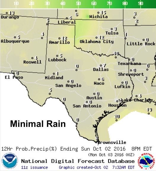
We have another gorgeous day on tap with mild highs and only minimal chances for a passing shower or two across the eastern panhandle/northwest Texas and possibly in the Big Bend region later this afternoon. Folks along the coastal bend are looking at a few showers offshore this morning, but those are expected to stay put and not impact inland areas. We’re also seeing some light radar returns moving east across deep south Texas, but those should begin to dissipate over the next couple of hours. Everywhere else, just dry with mostly clear skies perfect for a cup of coffee on the patio!
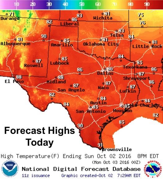
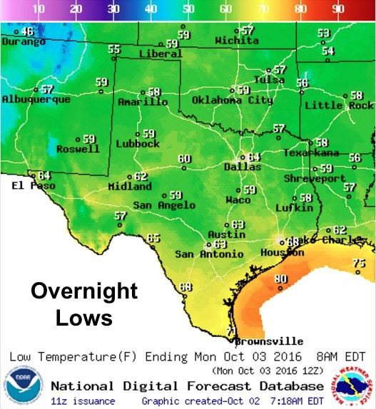
Highs today will once again be close to seasonal normals for this time of the year with plenty of sunshine and a light breeze. Moisture begins to return today which will bring slightly higher humidity values than we saw yesterday, but overall we won’t be feeling too “muggy” just yet. Lows tonight will be a bit warmer than we’ve seen the past couple of days, but will still be quite nice with upper 50s to mid 60s across most of the state. Rain chances will be quite low for the remainder of the day with the best chances up across the eastern panhandle with a bit of activity on the radar this morning.
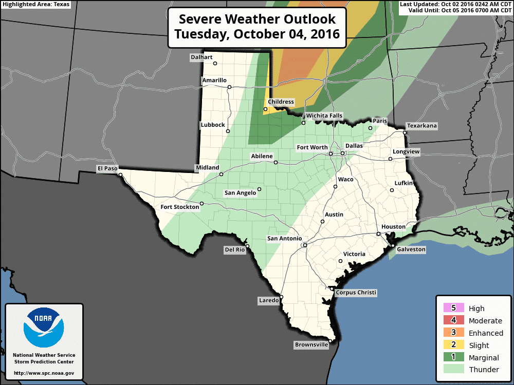
Long Term….still monitoring our next weather maker which will arrive Tuesday and bring chances for rain and possibly some severe weather into the forecast. At this point, most of the severe activity is expected to remain over Oklahoma and Kansas with a chance for isolated supercell thunderstorms and a low chance for tornadoes. For us, best chances for isolated storm development beginning next Tuesday will be across far western Texas along the dryline depending on whether or not the capping inversion can be breached. Wednesday and Thursday look mostly dry right now, but a cold front is expected to begin moving into the state late Thursday night into early Friday which will generate rain and storm chances out ahead of it. Details on that will be forthcoming this week as we continue to monitor the latest forecast model data.


0 Comments