
Crashy, the cold front came in yesterday with scattered storms and, for some, noticeable gusty north winds. Some of those thunderstorms are still in progress at the time of this writing across Southeast Texas, down the coast, into South Texas. Severe thunderstorms are not expected today, though any storm in the summer can produce bucketloads of lightning (and bucketloads of rain!).
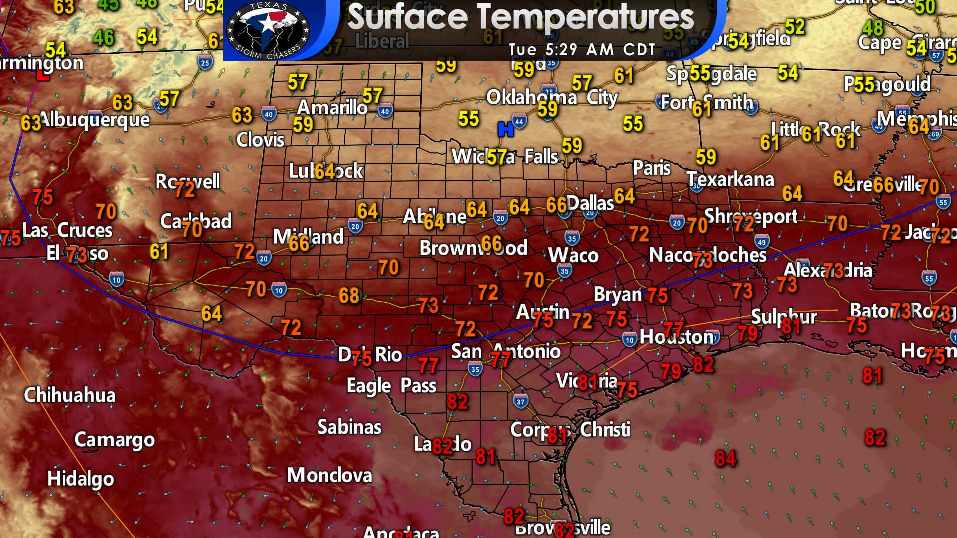
Hey, let’s start with the good news. Temperatures and humidity across the northern third of Texas are unseasonably pleasant to start your Tuesday. We’ve got temperatures down into the 50s across the Panhandle, Northwest Texas, and Texoma. Unfourtinietly for everyone else in Texas, it’s still air you can wear and on the warm side. Laredo, Corpus Christi, and Brownsville are still in the 80s as of 5 AM.
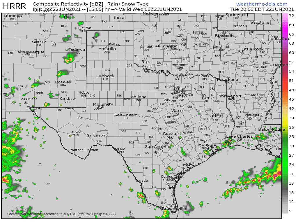
Simulated weather model radar at 7 PM today showing decreasing rain coverage.
Rain chances today will be confined to Southeast Texas, South Texas, and the Rio Grande Valley. The highest chance for rain will be this morning through the mid-afternoon hours. Precipitation coverage will decrease by dinner-time and should be down into the ‘isolated’ category thereafter.
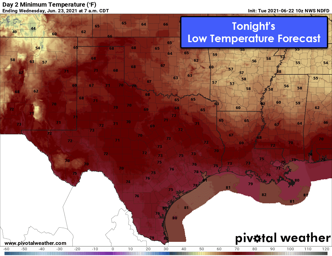
While the southern two-thirds of Texas may be wanting to pitchfork folks up north, they’ll get their revenge pretty quickly. The lack of humidity and cool temperatures will be shunned more quickly than a cute puppy getting pets. By tomorrow morning, the entire state will have low temperatures back in the ‘typical’ range (the upper 60s to lower 80s) – with the humidity we all love sooooo much.
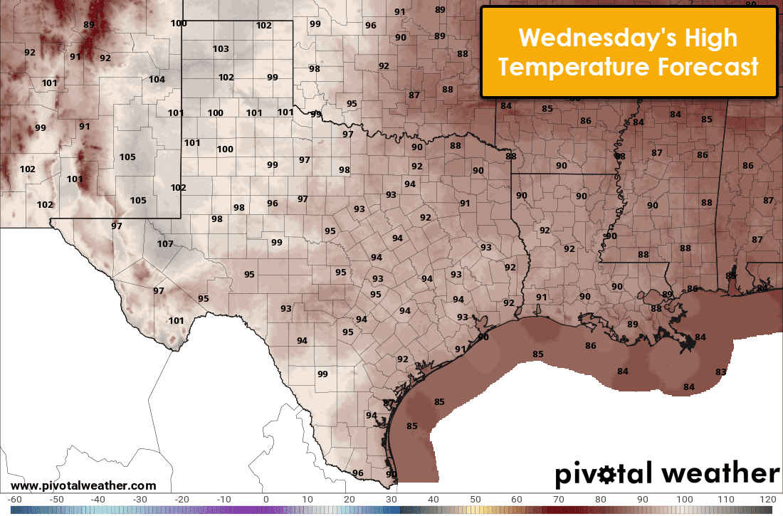
High temperatures? Yeah, those will be back into the ‘summer range’ for all of Texas by tomorrow too. Those triple digits will continue through the end of the work week. Don’t shoot the messenger with straw wrappers – I know it stinks.
But wait… there’s more!
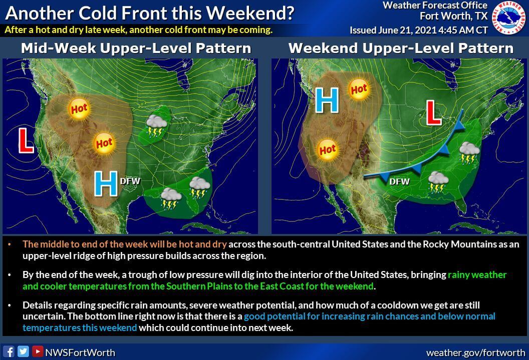
Mother Nature may throw us a bone by this weekend. Our upper-level heat dome of doom (yes, another ‘baldy-in-chief’ nickname) will shift into the Pacific Northwest. That upper-level pattern shift will bring a bit of a jetstream back into our neck of the woods. A cool front, or at least several days of unsettled weather, look to begin this weekend and continue through at least early next week. Precipitation chances, increased cloudiness, and ‘less hot’ temperatures look to be in our favor.


0 Comments