
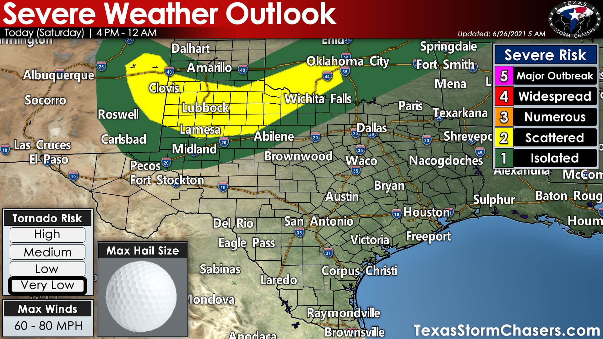
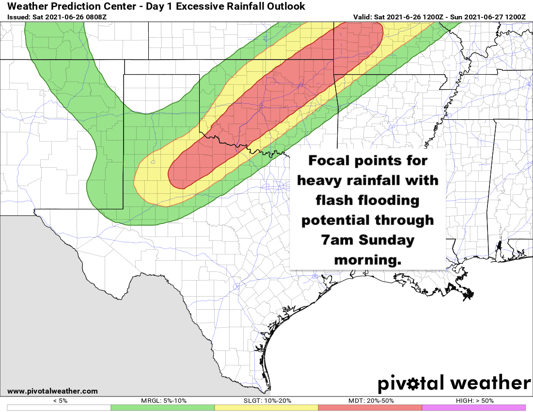
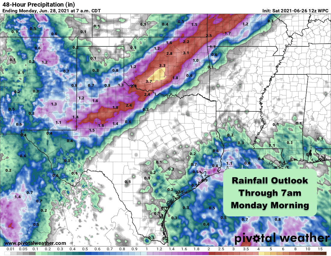
Another round of strong to severe storms will impact parts of the southern panhandle and rolling plains of western Texas later this afternoon. The Storm Prediction Center has outlined parts of these regions with a Slight Risk (Level 2) for severe weather with damaging winds and large hail up to the size of golf balls as the main threats. The tornado threat is very low, but non-zero, especially during the first couple of hours of storm development this afternoon when they are more isolated. The focus for these storms will be a slow moving cold front that is expected to drift south of Amarillo today and stall out somewhere in the vicinity of Lubbock up towards the Childress area. Where the front ends up stalling out, combined with remnant outflow boundaries from this morning’s storms across northwest Texas, will determine the focal point for storm initiation this afternoon after 4pm. Once they kick off, we’ll likely see a few hours of more isolated storms, but over time, we’ll see them congeal into a larger convective system that will continue to produce heavy rain and thunder through the late evening and overnight hours along and near the frontal boundary. Overnight, flash flooding is expected to take over as the main threat with upwards of 1-2 inches of rainfall, with some locally higher amounts, before tomorrow morning. That said, we’re looking at a Slight to Moderate risk of excessive rainfall for the southern panhandle, rolling plains and western north Texas over the next 24 hours.
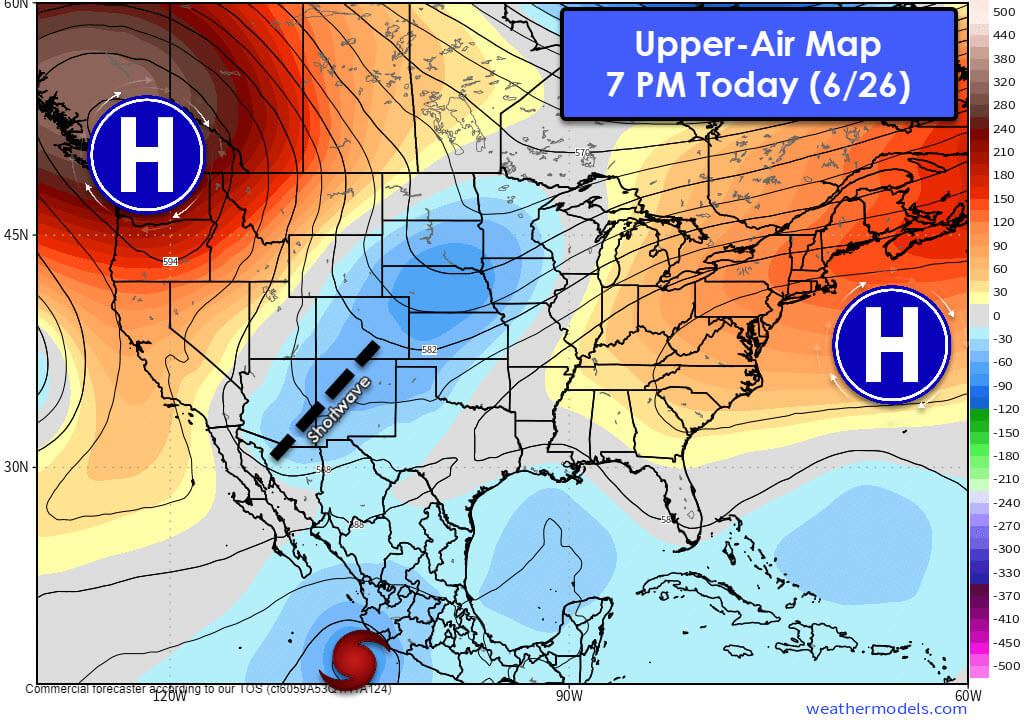
The overall upper level pattern which currently features a trough out west over New Mexico is expected to deepen today into tomorrow. Diffluent upper level flow from this feature combined with the stalled frontal boundary will lead to multiple chances for rain over the next several days across western Texas up through western north Texas. The potential for severe weather is likely to wane a bit over time as the lower atmosphere becomes more stabilized by the continuous cloud cover and lower temperatures, but several days of rainfall potential across the parched areas of western Texas up into southeastern New Mexico is certainly welcome!


0 Comments