
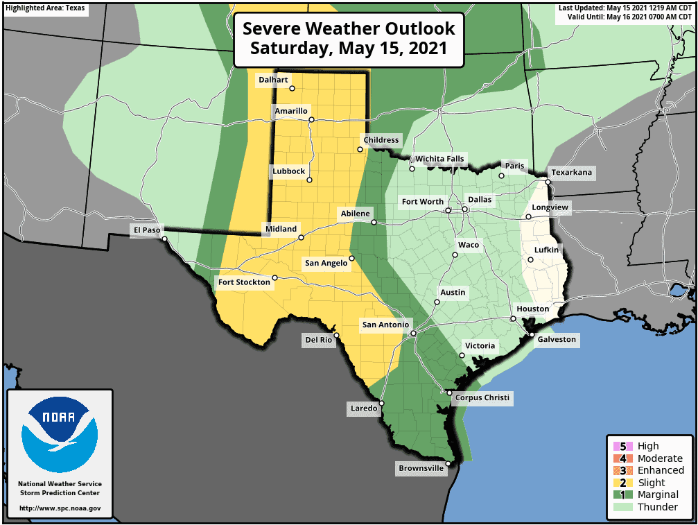
Looks like we’re heading into a very wet and soggy forecast for the next 7 days! A very slow moving upper level system out west will sit and spin over the desert southwest bringing a series of weak disturbances our way this weekend and into the next work week as well bringing multiple rounds of strong to severe storms and flooding rain. For today, severe weather chances will be most likely across west and southwest Texas this afternoon as peak daytime heating will kick off the development of storms along the dryline which will stretch from eastern New Mexico down into far western Texas and northern Mexico this afternoon. The Storm Prediction Center has placed a Slight Risk (Level 2) for severe weather across these regions today with the main risks being damaging wind gusts, torrential rainfall and large hail. The tornado threat today is very low with wind shear profiles looking quite meager.
The most likely time for initiation along the expanse of the dryline will be after 2pm. The storms that develop across the New Mexico front range are expected to drift into the western panhandle by around 5pm and will continue to impact the panhandle region throughout the late afternoon and slowly drift east into the rolling plains after nightfall. Further south along the dryline, expect storm development in far western Texas and across northern New Mexico at about the same time with storms drifting east out of the Trans Pecos into the Permian Basin Region by 5pm. The storms developing across northern Mexico later this afternoon will take a bit longer to cross the border into southwest Texas…most likely after 8pm…carrying the same risks of damaging wind, torrential rainfall and large hail. All of these areas of storms will begin to decrease in intensity after the sun sets and we lose daytime heating, but the rain chances will continue for at least several hours after dark and into the early hours Sunday morning.
In addition to storm development along the dryline, we have a chance to see development early this afternoon along the I-35 corridor in central Texas up into the western DFW metroplex region. Coverage of storms in this region out ahead of the dryline is not expected to be all that expansive, but we will see the same risks for damaging winds, large hail and periods of very heavy rainfall if you happen to be under one of these storms.
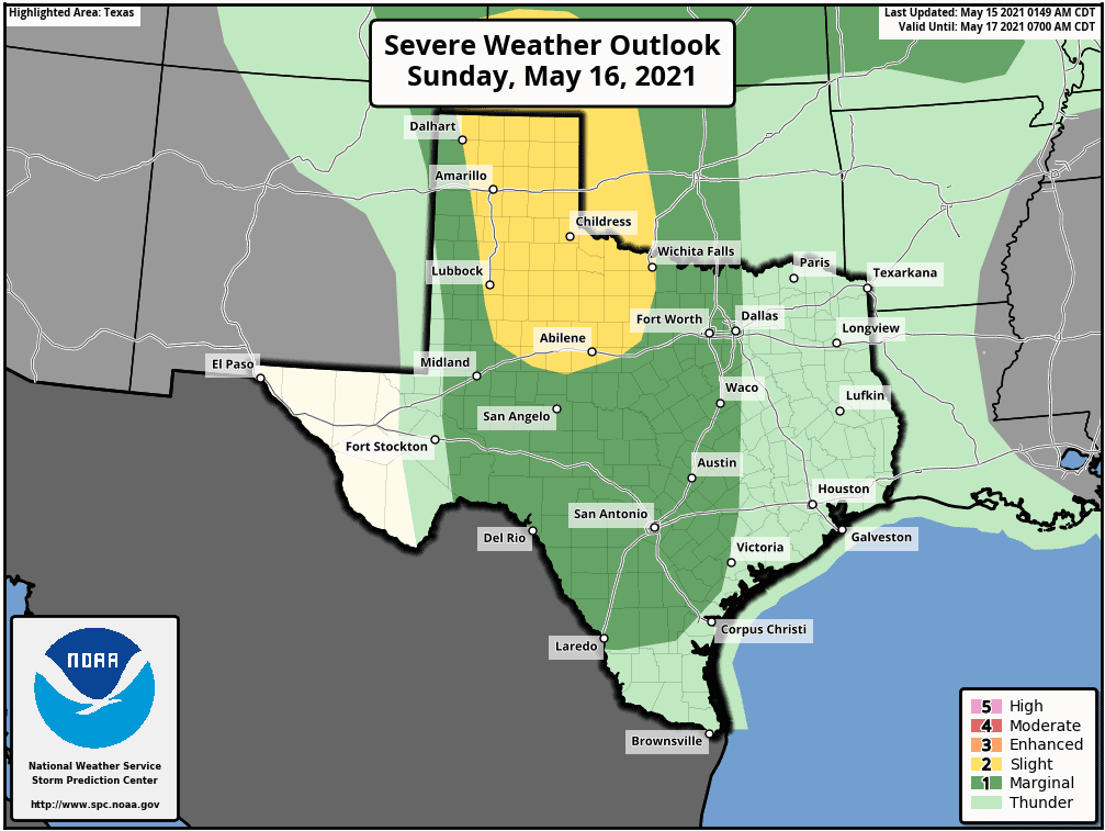
We will see a repeat of nearly the same scenario on Sunday with another round of storms likely across the dryline by Sunday afternoon. At this point, the dryline is expected to have pushed a bit further east…possibly as far east as the TX/NM border or even the I-27 corridor between Amarillo and Lubbock. Once again, daytime heating with slightly better upper level forcing will promote the development of isolated to scattered strong to severe storms from the panhandle down into west and southwest Texas and from North Central Texas down into Central Texas and our Hill Country region as well. On Sunday, the main threats will also be damaging wind, torrential rainfall and large hail. The tornado threat will increase slightly, but still very low. The current Severe Weather Outlook tomorrow places a Slight Risk (Level 2) across much of the panhandle and western north Texas with a Marginal Risk (Level 1) for the Permian Basin, Big Country, and Texas Hill Country regions.
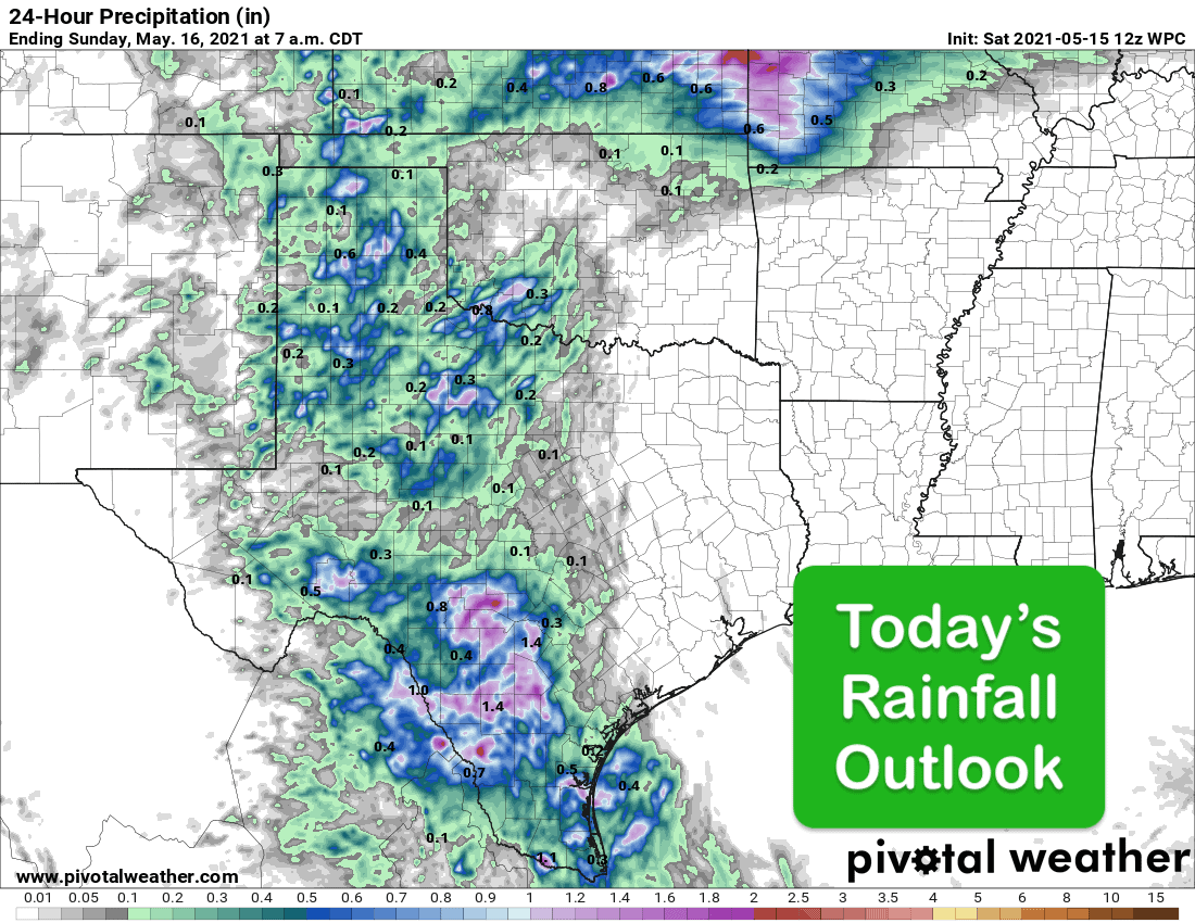
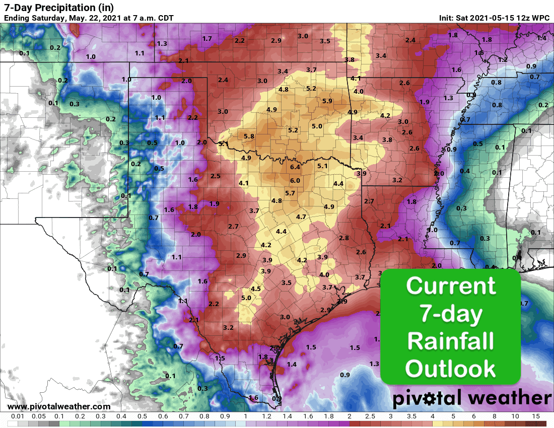
The current Rainfall Outlook for the week ahead is certainly impressive. The highest concentration of rainfall into next week will be across North, Central and Southeast Texas where rainfall accumulations are currently expected to range from nearly 4 inches to over 6 inches with the possibility of isolated higher amounts depending on where the strongest storms set up. Obviously, this will cause issues next week for any areas prone to flooding…especially for anyone living near creeks or rivers in areas that receive the highest concentration of rain next week. It won’t be raining the entire day each day next week…but when it does rain, the atmosphere will tend to be quite efficient about it and drop a lot in a short amount of time. As always, we’ll be keeping an eye on things and keep you up to date with any severe weather or flash flood guidance along with live storm coverage as the weather situation unfolds each day.


0 Comments