
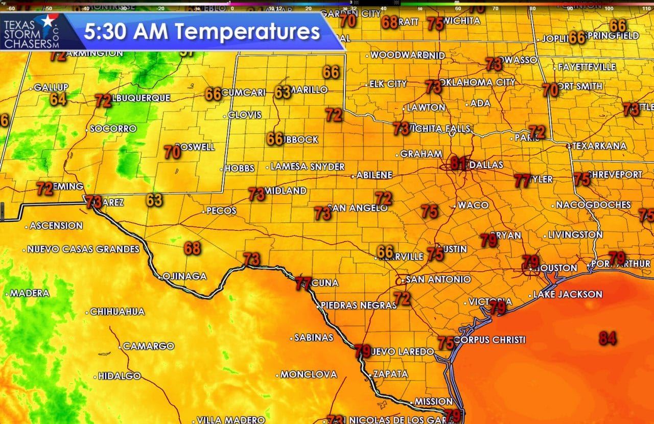
It is a unpleasantly warm and humid morning across the eastern half of Texas. Dewpoint values in the middle 70s have allowed fog to develop across South Texas, the Coastal Plains, Southeast Texas, and East Texas. It is pretty depressing when you have fog at 75 degrees in June. The morning fog is one indicator of a moisture-rich enviornment. Those of you wearing glasses will probably notice the moisture when stepping outside. Unlike Monday morning we don’t have any widespread thunderstorm complex underway this morning. Weather radar shows a few showers in progress across the Permian Basin into the Mountains in Far West Texas. Meanwhile folks in the Panhandle are enjoying a seasonably cool morning with temperatures in the low to mid 60s. Amarillo and Plainview are at 63° at the time of this writing. What I wouldn’t give to be out there this morning.
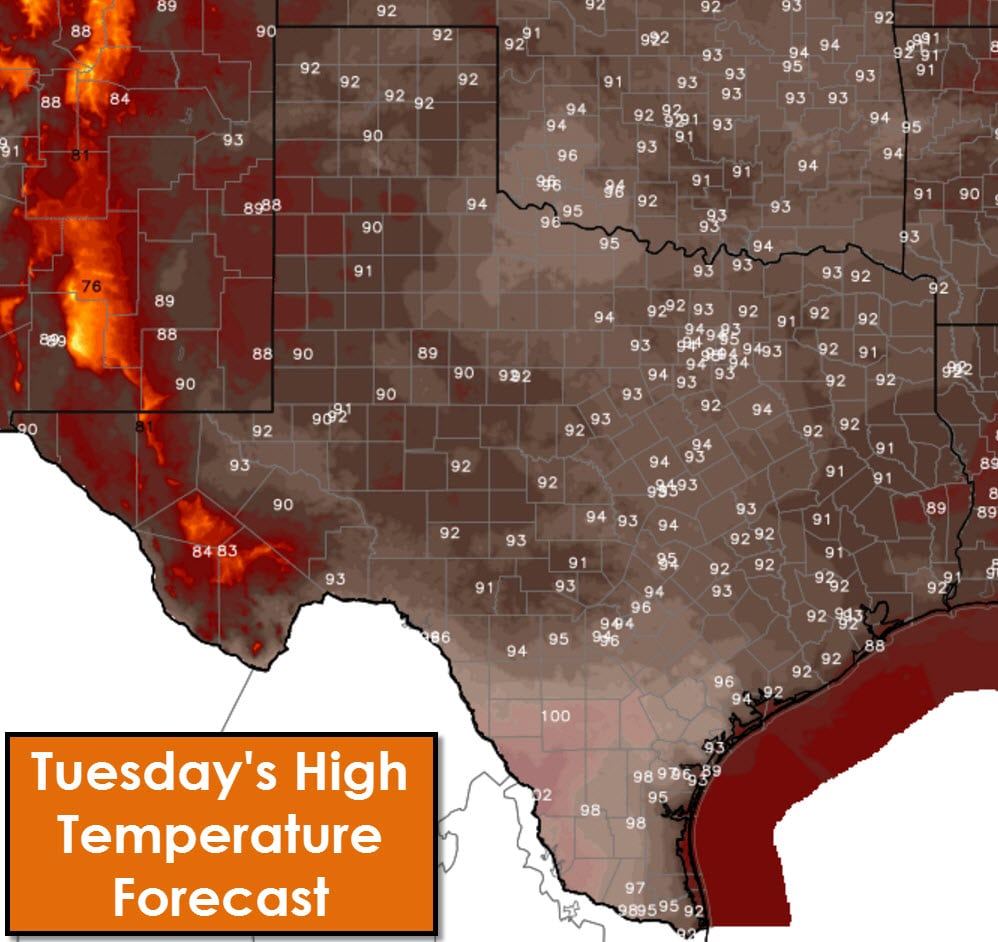
Afternoon high temperatures will be seasonably warm with 90s across the state. The exception will be Southwest Texas who will have the honor of being the warmest in the state with triple digit readings. For all those snickering you’ll be joining in with triple digit temperatures next week. The fourth of july is looking quite hot with triple digit heat and heat index values. The ridge of high pressure aloft is coming back with avengence next week. Another heatwave is approaching. However, we’ll get to deal with rain chances before then.
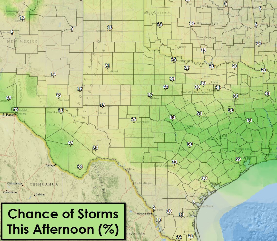
A slow-moving boundary will set up across Central and East Texas this afternoon. That boundary will be a focal point for numerous showers and thunderstorms beginning early this afternoon through early evening. Outflow boundaries produced by Monday’s storms will also be focal points for scattered thunderstorms this afternoon. Like Monday the strongest storms could be strong with very strong wind gusts, heavy rain, and nearly continuous cloud to ground lightning. Scattered thunderstorms are expected today across Far West Texas, North Texas, and Northwest Texas. Coverage should remain isolated in the Permian Basin, the Rio Grande Valley, West Texas, and the Panhandle. As the strongest storms collapse this afternoon they could produce localized wind gusts over 60 MPH. These strong winds will be very localized, but will be damaging. Collapsing storms will produce outflow boundaries which will help spark off new storms. This process will continue through the late afternoon. Storm coverage will start to diminish by early evening with isolated storms remaining possible through the late evening. Storms today will move very slowly or remain nearly stationary.
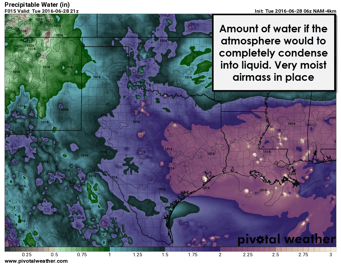
Precipitable water values across the state range from 1.25 inches all the way up to 2.25 inches. These values mean storms today will produce very heavy rains and thus localized flooding will be possible. We saw flooding issues in Fort Worth yesterday thanks to one of the stronger storms that sat for an hour. Welcome to summer in Texas folks!


0 Comments