
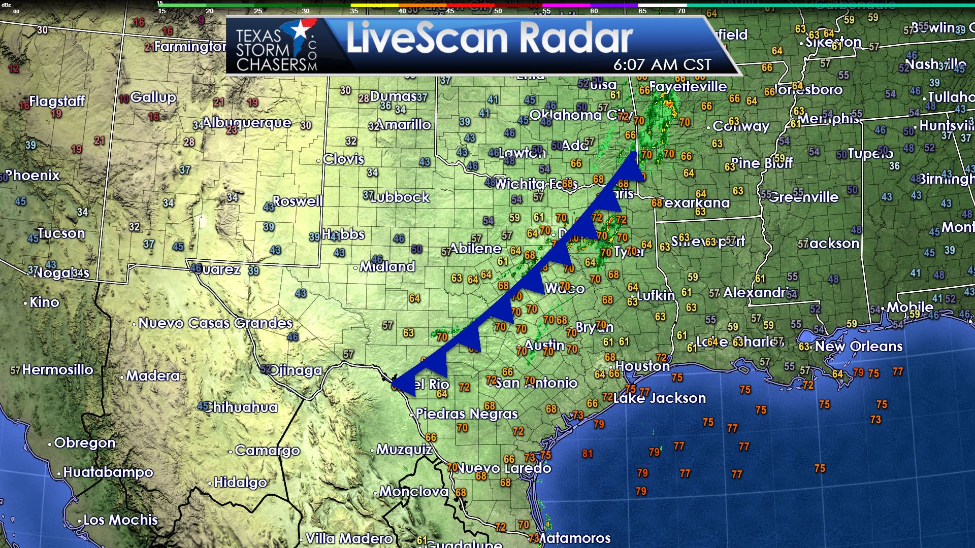
The leading edge of our strong cold front extends from Paris to Dallas to Evant to near Junction. Temperatures behind the front have fallen into the 60s – with the 40s and 50s lagging about 75 miles behind the front. The real cold air has filtered into the Texas Panhandle where temperatures are falling below freezing this morning. Winds are strong out of the northwest with gusts up to 30 MPH – creating wind chills about 10 degrees below the air temperature. It sure is nice to talk about wind chills instead of heat index values – at least for cool weather fans.
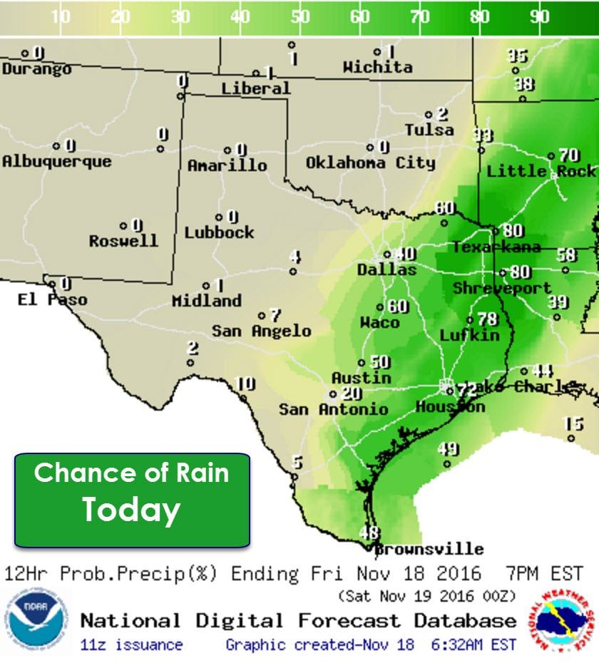
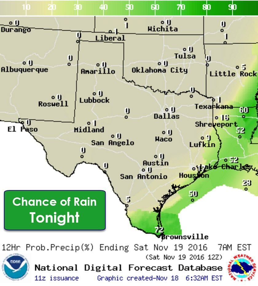
A broken line of showers has developed along the cold front this morning. These showers will continue and we’ll probably see storms develop as the front continues to move east/south through the day. A few storms may be strong with gusty winds and small hail, but severe weather is not anticipated. The best rain chances will be in East Texas and Southeast Texas later today where moisture levels are highest. A few lucky folks may pick up three quarters of an inch of rain, but widespread – beneficial rains aren’t likely. Rain chances quickly drop to zero behind the cold front as a much drier air mass filters in. By this evening rain chances will be confined to the Rio Grande Valley.
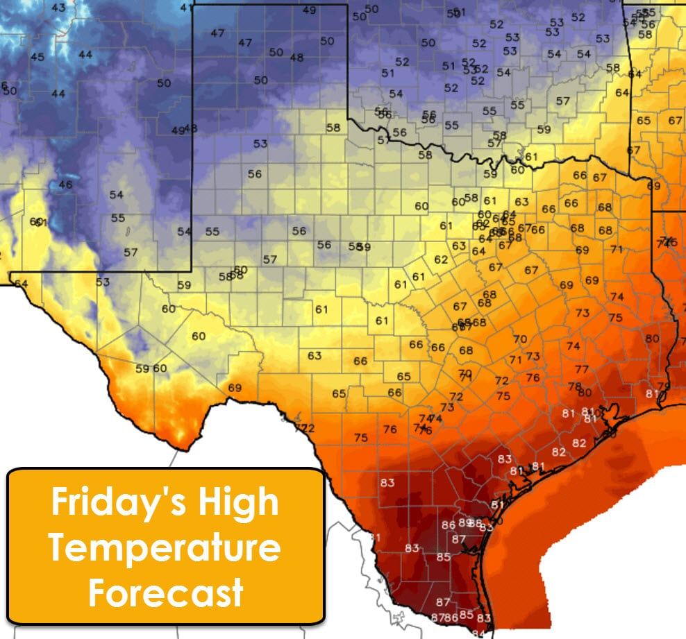
This will be the final day of well above-average temperatures for the next five days – at least. Highs will top out in the upper 80s in Deep South Texas and the Rio Grande Valley. Depending on your location this will be a day where high temperatures could be in the morning or early afternoon hours. Gusty north winds behind the cold front will cause temperatures to drop back into the 50s and 60s within an hour or two of the frontal passage. It should be approaching the Interstate 10 corridor from San Antonio to Houston by lunch – give or take a few hours. It’s been moving quickly this morning. The Texas Panhandle will struggle to get above the upper 40s for highs this afternoon, and that may not even happen as strong cold air advection continues.
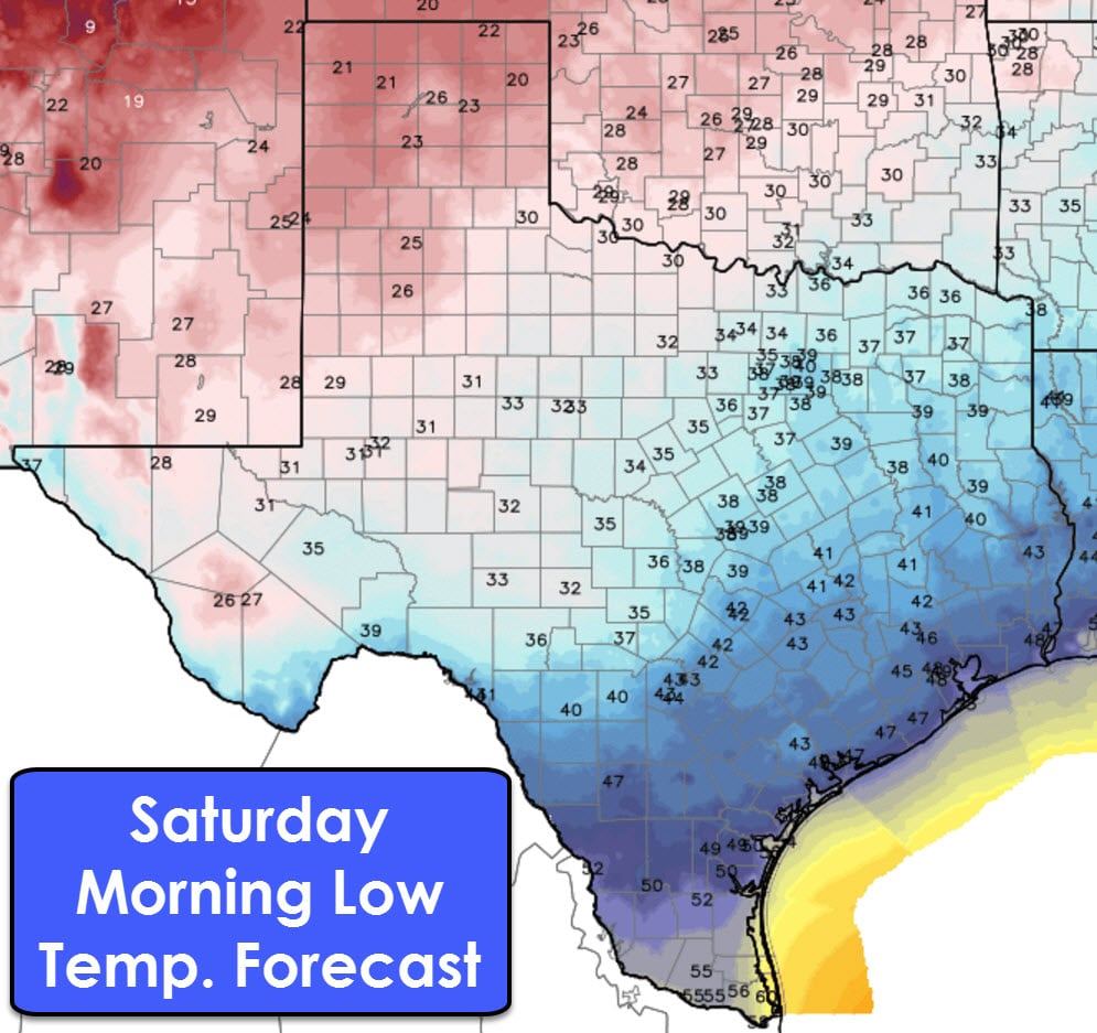
Tonight will be frigid in the Texas Panhandle with low temperatures dropping into the lower 20s. I would not be surprised to see a couple spots get into the 10s. 30s are expected south through the Hill Country, Central Texas, and into the piney woods of East Texas. The cold air advection will take a bit longer in South Texas so it’ll be in the 40s there tonight with north winds.
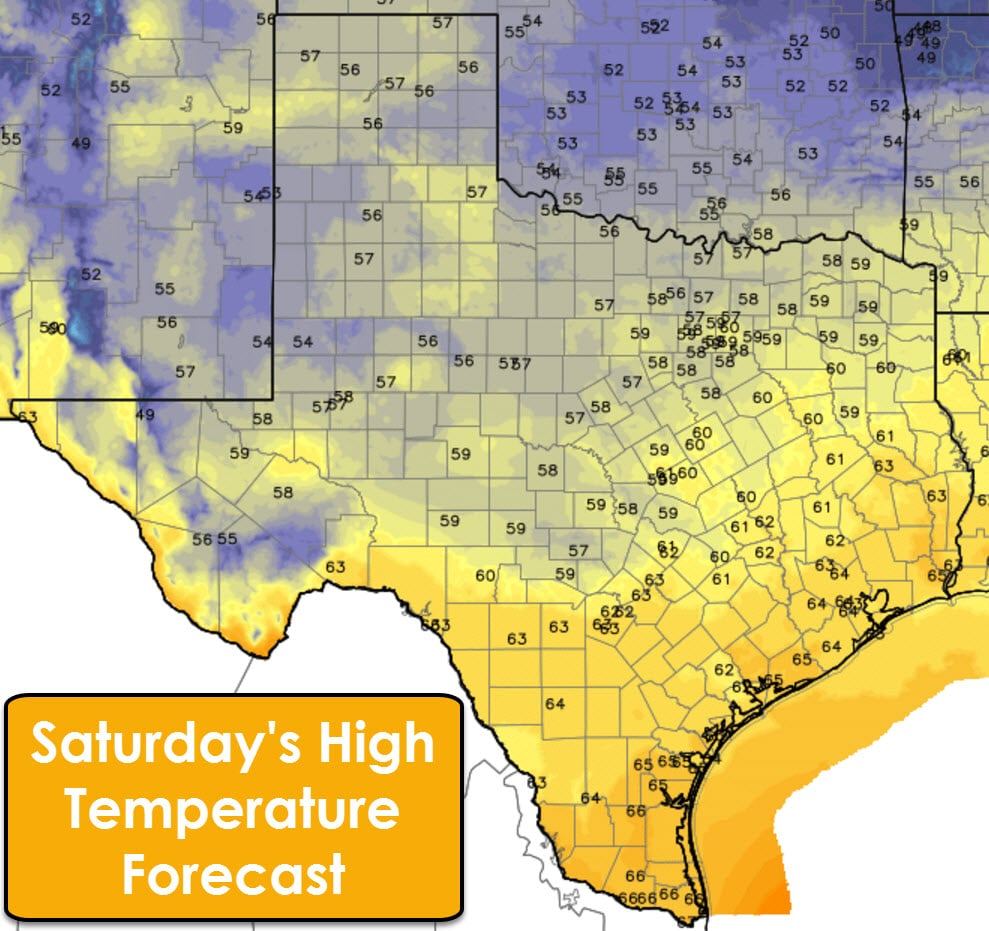
High temperatures on Saturday will struggle to make it into the upper 50s to middle 60s across Texas. North winds around 10 MPH are expected, but they’ll be much lower than what we’ll see today.
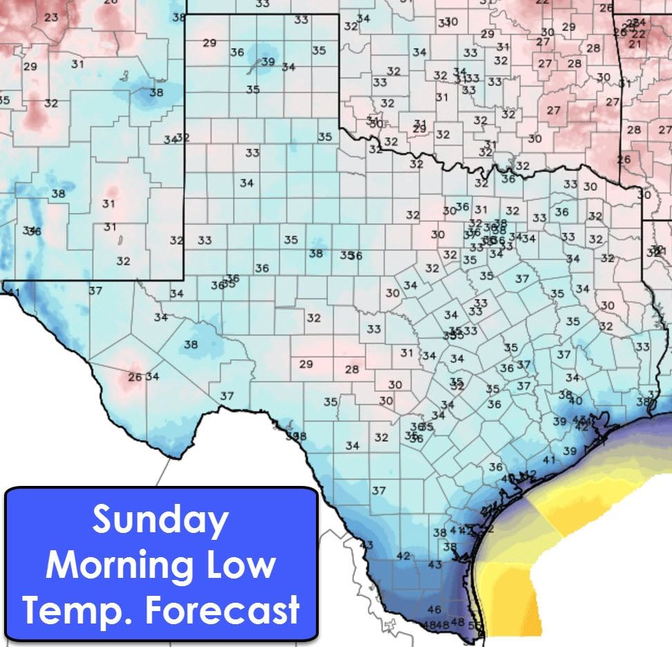
In terms of the most folks having the coldest readings so far this fall – Sunday morning will be that day. Low temperatures will drop into the 30s across all of Texas except Deep South Texas and the Rio Grande Valley. Be sure to protect your plants Saturday Night. While a widespread hard freeze isn’t forecast, several locations will have heavy frost and a light freeze.
Temperatures start to moderate on Sunday through Tuesday as a southerly flow returns ahead of our next storm system on Tuesday. High temperatures will range from the 60s to 70s. Lows will remain cool with 30s, 40s, and 50s. By Monday morning lows will start to increase as dewpoint values do the same. Rain chances increase on Monday in the Borderland and we could see those chances move east into more of Texas on Tuesday.


0 Comments