
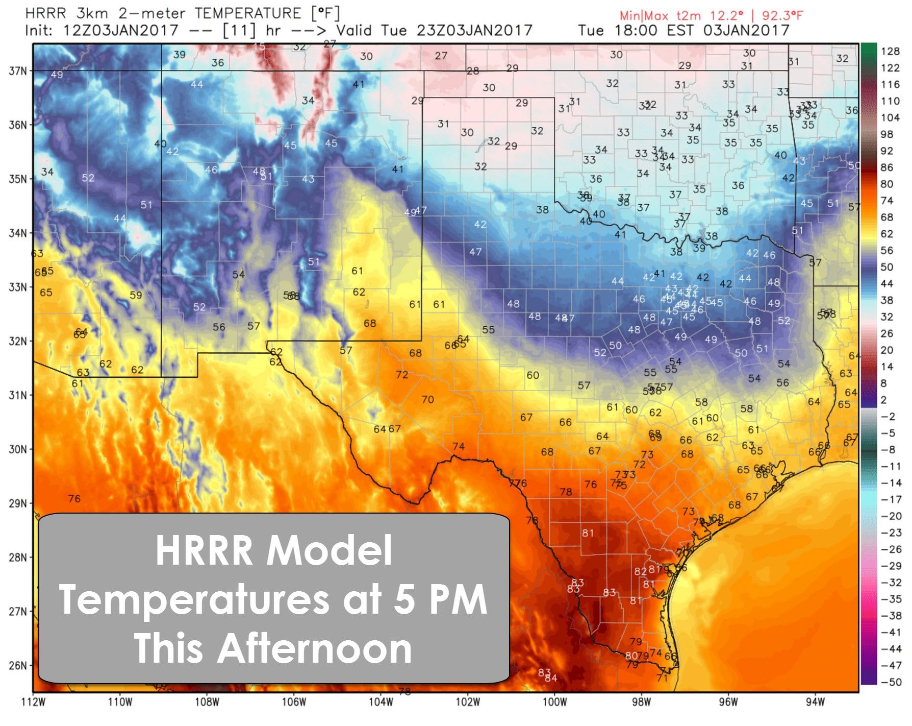
Let me start off by saying the next several days will be dry across Texas. Our next chances for precipitation will not arrive until late Thursday with a developing storm system. A strong cold front has pushed through the Texas Panhandle this morning where temperatures are in the 20s. The leading edge of the front is in West Texas to the northern ‘burbs of D/FW at the time of this writing. The front with its associated northerly wind shift should continue to make southward progress through the day. The colder temperatures will likely hang back until we get towards the second half of the day. By tonight the colder airmass will start to move south much more quickly.
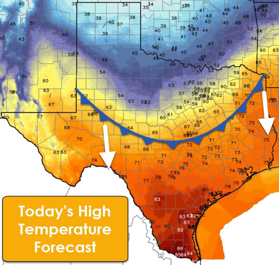
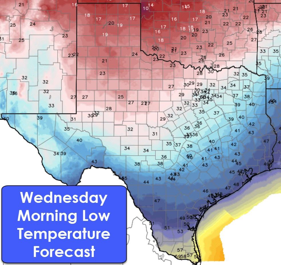
High temperatures this afternoon will be in the 60s, 70s, and 80s south of the cold front with temperatures in the 30s and 40s north of it. Enjoy the warmer weather because the next several days will feature a return of winter-like temperatures. Low temperatures by Wednesday morning will range from the upper teens in the Texas Panhandle up toward 60 degrees in the Rio Grande Valley. The freezing line should extend from near Kermit to San Angelo to Brady northeast up to D/FW and Paris.
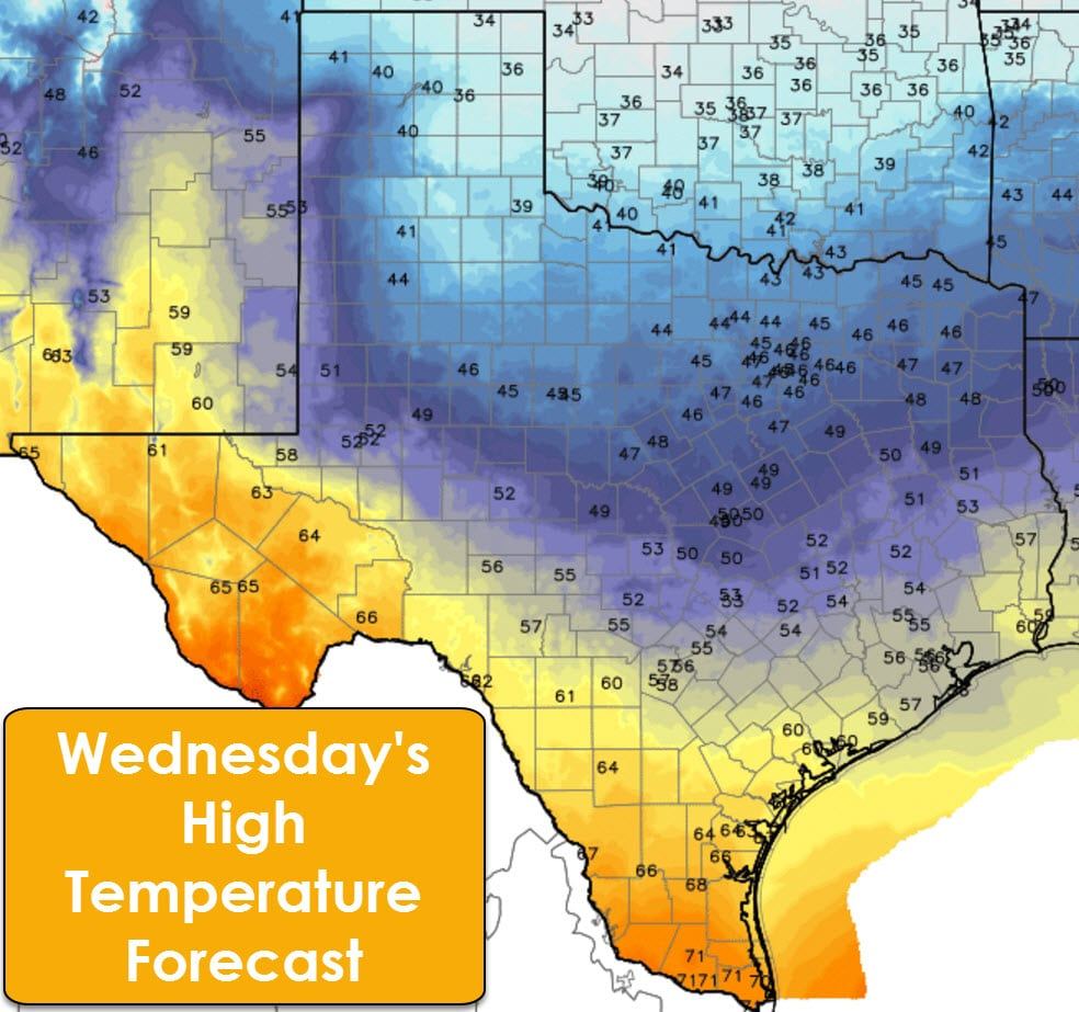
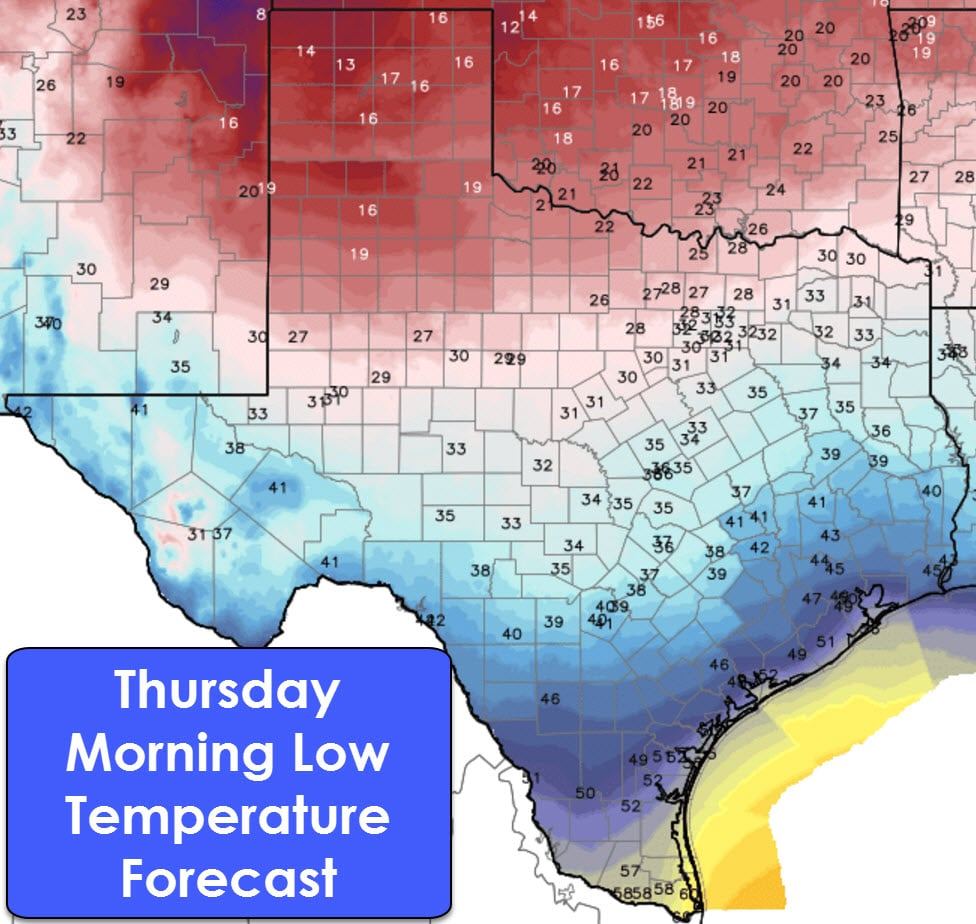
Wednesday’s temperature forecast will feature much cooler conditions across the northern two-thirds of Texas where highs will only be in the 30s and 40s. The Borderland, Southwest Texas, and Deep South Texas will still be holding onto their warmer airmass where conditions will be more pleasant with 60s and 70s. Thursday morning will be similarly cold as Wednesday morning.
A reinforcing blast of cold air will arrive on Thursday and Friday. That will help knock temperatures down another ten to fifteen degrees – resulting in high temperatures struggling to get out of the 30s and 40s across much of Texas. We do note the Borderland may be an exception with El Paso managing to hang on to the 50s and 60s for highs through the forecast period.
Now lets discuss the potential for precipitation for Thursday into Friday. We will have a reinforcing shot of arctic air in place, which means temperature profiles will be at least somewhat supportive of winter weather precipitation across the northern half of Texas – should precipitation fall at all. Weather models are in modest agreement that a storm system will begin to take shape and impact portions of the southern United States in that time period. We remain way too far out to even begin to speculate on specific precipitation types, intensities, or accumulation potential. There is the potential for light snow to fall on Thursday into Friday across the Texas Panhandle and West Texas with minor accumulation potential. Very light snow or flurries are also possible in Northwest Texas, Texoma, and Northeast Texas early on Friday with little accumulation expected at this time. Rain showers will be possible across the southern half of the state. All of the above is dependent on the intensity and track of our incoming storm system. Considering the upper level energy responsible for said potential is still in the Pacific, there will be changes to the forecast. At this time a high-impact winter storm is unlikely for Texas, but we’ll be watching trends closely. Hopefully we can squeeze out a few snow flakes!

0 Comments